mail_outline sales@mediastorehouse.com
Clearing Rievaulx a62_01706Rievaulx Abbey, North Yorkshire. Two workmen loading a wagon with rubble as part of restoration and clearance works carried out in the 1920s. Photographed by Marjory L Wight, 1924-29
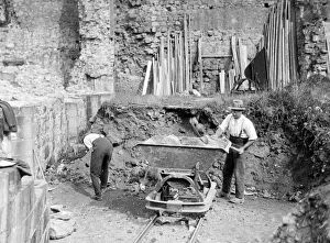
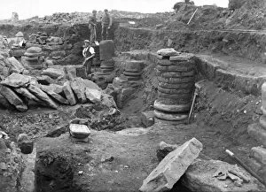
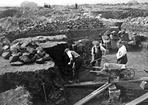
Corbridge Excavations FL00667_01_001Corbridge Roman Fort, Corbridge, Northumberland. Excavations in progress in 1909, showing workmen on the site
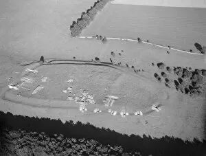
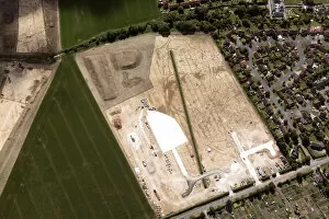
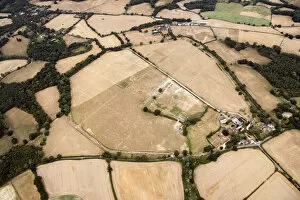
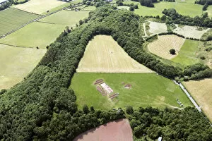
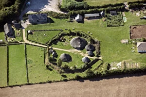
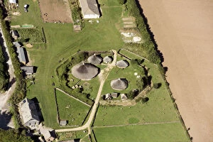
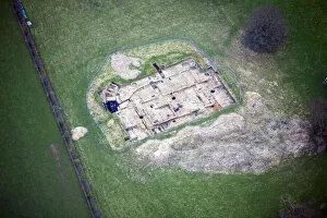
Conderton Camp HAW_9388_33Conderton Camp, Conderton, Worcestershire. Aerial view of the Nicholas Thomas excavations in progress in August 1958. Results were finally published in 2005
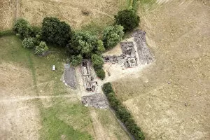
Eddisbury Hillfort entrance DP119403Eddisbury Hill, Delamere, Northwich, Cheshire. Excavation of the Eastern entrance of the hillfort in progress in August 2010
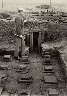
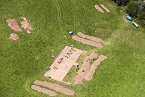
Netley Abbey excavations CC56_00907Netley Abbey, Netley, Hound, Hampshire. Excavations of the refectory in progress with excavators in trench. Probably 1922
Corbridge Excavations FL00667_02_002Corbridge Roman Fort, Corbridge, Northumberland. Excavations in progress in 1909 showing three men digging
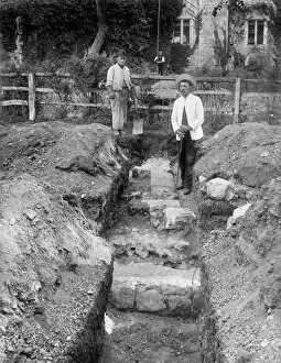
Darenth Court Villa AL2400_097_02Darenth Court Roman Villa, Darenth, Kent. The dig director George Payne standing amongst the archaeological excavations 1894-1895
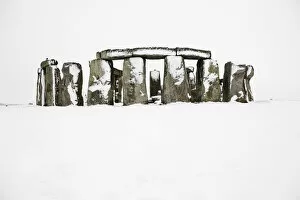
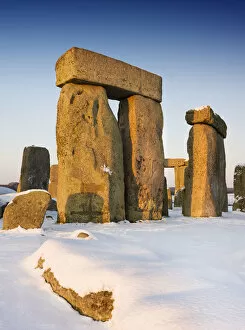
Stonehenge in the snow DP157903Stonehenge, Amesbury, Wiltshire. General view of snow covered Stonehenge
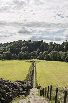
Hadrians Wall path DP217832Hadrians Wall, Willowford Bridge Abutment, Willowford, Upper Denton, Carlisle, Cumbria. General view looking west along Hadrians Wall towards the remains of the Roman bridge
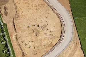
Pocklington excavations, 34003_014Pocklington, East Riding of Yorkshire, 2018. Site of an Iron Age cemetery excavated during spring/summer 2018 showing at least 12 burials as well as trackways and enclosure ditches. SE8049
Stonehenge in the snow DP157907Stonehenge, Amesbury, Wiltshire. General view of Stonehenge in the snow. Photographed in January 2010
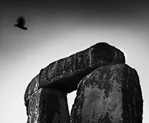
Stonehenge trilathon DP149798Stonehenge, Amesbury, Wiltshire. 2012, black and white image. Detail of trilathon with jackdaw
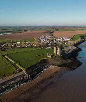
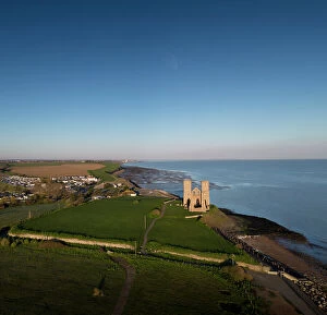
Reculver Towers and Roman Fort DP434420Reculver Towers and Roman Fort, Reculver Road, Reculver, Herne Bay, City of Canterbury, North Thanet, Kent. 12th-century towers of the former monastic church of St Mary that sit within a ruined Roman
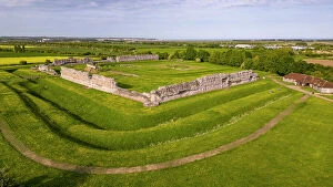
Richborough Roman Fort DP434388Richborough Roman Fort, Richborough Road, Sandwich, Dover, South Thanet, Kent. The Roman fort. Aerial drone view from south west
Reculver Towers and Roman Fort DP434410Reculver Towers and Roman Fort, Reculver Road, Reculver, Herne Bay, City of Canterbury, North Thanet, Kent. 12th-century towers of the former monastic church of St Mary that sit within a ruined Roman
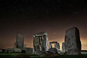
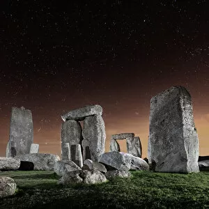
Stonehenge at night DP349839Stonehenge, Amesbury, Wiltshire. General view of stone circle lit at night with stars. View from east
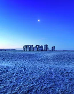
Stonehenge at dawn DP349794Stonehenge, Amesbury, Wiltshire. General view of Stonehenge at break of dawn with frost and moon. View from north
Stonehenge at night DP349838Stonehenge, Amesbury, Wiltshire. General view of stone circle lit at night with stars. View from east
Excavations 33963_033A soilmark and archaeological excavations at Mitchell Hill Common, Cambridgeshire, 2019
Excavations 35123_007Archaeogical excavations along new Southern Connector Road for New Eastern Villages Scheme, Swindon, Wiltshire, 2021
Silchester excavations 33723_036Excavations at Calleva Roman Town, Silchester, Hampshire, 2018
Silchester excavations 33723_034Excavations at Calleva Roman Town, Silchester, Hampshire, 2018
Dorstone Hill excavations 33675_014Archaeological excavation on Dorstone Hill, County of Herefordshire, 2018
Dorstone Hill excavations 33675_020Archaeological excavation on Dorstone Hill, County of Herefordshire, 2018
Butser Ancient Farm 29939_028Butser Ancient Farm, an archaeological open air museum, Petersfield, Hampshire, 2016
Butser Ancient Farm 29939_038Butser Ancient Farm, an archaeological open air museum, Petersfield, Hampshire, 2016
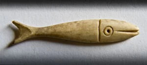
Fish counter DP077091Portchester Castle, Castle Street, Portchester, Fareham, Hampshire. Detail of a fish-shaped bone gaming piece from Portchester Castle, photographed at Fort Cumberland. Object no.88288132
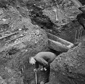
Pile cap trenches JLP01_08_043769COVENTRY CATHEDRAL, PRIORY STREET, COVENTRY. A man digging in the pile cap trench on the construction site of Coventry Cathedral, with a stone coffin behind him protruding into the trench
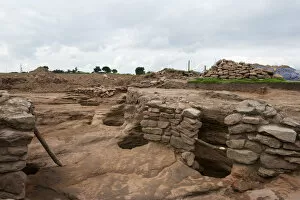
Binchester excavations 28860_048Binchester Roman fort (Vinovia), County Durham, 2016. NZ2031
Binchester excavations 28860_050Binchester Roman fort (Vinovia), County Durham, 2016. NZ2031
Pocklington excavations, 34003_009Pocklington, East Riding of Yorkshire, 2018. Site of an Iron Age cemetery excavated during spring/summer 2018 showing at least 12 burials as well as trackways and enclosure ditches. SE8049
Rescue excavation 33592_035Construction of the A14 Cambridge to Huntingdon Road Improvement Scheme, Cambridgeshire, near Offord Hill, 2018. Excavation work of probable henge monument. TL2168
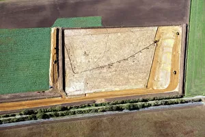
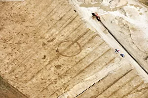
Siddington excavation 29616_038Siddington, Gloucestershire, 2015. Soilmark of a possible Bronze Age round barrow previously seen as a cropmark, the site has been stripped
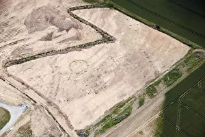
Excavations near Scarborough 28753_019Scarborough, North Yorkshire. A probable later prehistoric/Roman settlement visible as sub-surface deposits and earthworks exposed through excavation, 2015
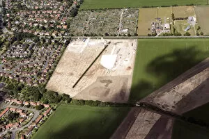
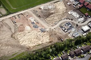
Pocklington excavations 28706_022Barmby Lane, Pocklington, East Riding of Yorkshire. The excavation of an extensive barrow cemetery prior to construction of housing, May 2015. SE8048
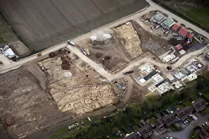
Pocklington excavations 28696_014Barmby Lane, Pocklington, East Riding of Yorkshire. Soilmarks of a square barrow cemetery revealed during excavation prior to housing development, April 2015. SE8048
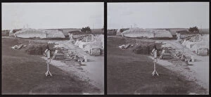
Old Sarum ZEH01_02_15OLD SARUM, SALISBURY, WILTSHIRE. Stereoscopic view of the Old Sarum site during excavation
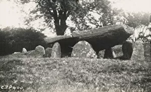
Arthurs Stone OP35390ARTHURs STONE, ARTHURs STONE LANE, DORSTONE, HEREFORDSHIRE. A view from the west of Arthurs Stone. This photograph was printed in the RCHME Inventory Volume for Herefordshire, Volume I, Plate 89
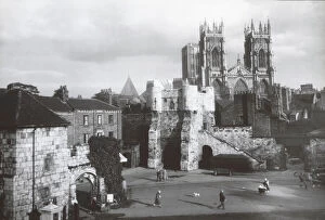
Bootham Bar DIX02_01_074BOOTHAM BAR, YORK. Bootham Bar and York Minster viewed from the City Art Gallery, Exhibition Square with the gateway of St Marys Abbey in the foreground. Photographed in the 1930s
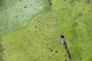
Maiden Castle Cumbria 28545_056Maiden Castle defended enclosure at the head of Eden Valley, Cumbria. Photographed in June 2014
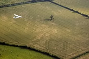
Aerial photography 24511_003Down Ampney, Gloucestershire. An aerial photography training flight over a rectangular double-ditched enclosure. Part of an aerial photography course to help spot
Barrow cemetery, Fittleworth 29744_033Bronze Age barrow cemetery in Fittleworth, West Sussex. This photograph taken in 2015 depicts the cropmarks of five, possibly six, circular buried ditches
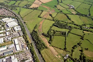
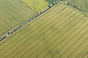
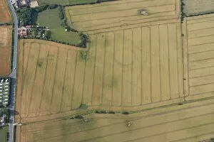
Settlement, Comberton 29365_001Iron Age/Roman settlement in Comberton, Cambridgeshire. The dry summer of 2015 proved an exciting year for cropmark discoveries on the Cambridgeshire claylands
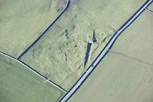
Earthworks, Shap 28376_051Medieval grange and post medieval lime kiln in Shap, Cumbria. This image shows the remains of a lime kiln in Cumbria which would have produced quick lime by burning limestone
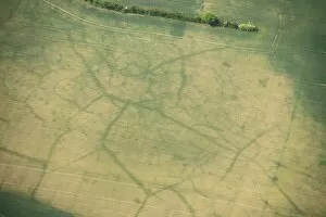
Settlement, Gillsmere 28366_033Iron Age Roman settlement at Gillsmere, Cumbria. The low winter sunlight in this aerial photograph reveals subtle details of this late Iron Age or Roman settlement
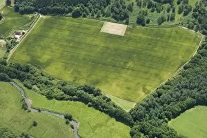
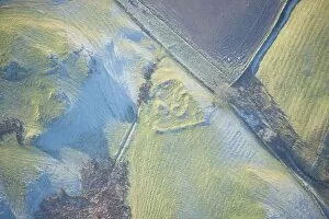
Henge and ringwork, Hornsea 28086_011Neolithic henge reused as a Bronze Age ringwork in Hornsea, East Yorkshire Historic Englands aerial reconnaissance team spotted the buried remains of this rare
Enclosures, Stoke Hammond 26957_027Neolithic long mortuary enclosures in Stoke Hammond, Buckinghamshire Features below the plough soil that cause cropmarks can be man-made or natural. In this case its both
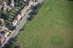
Earthworks, Coventry 26735_031Second World War air raid shelter in Coventry. In this photograph traces of a Second World War air raid shelter can still be seen in Radford Road recreation ground, Coventry