mail_outline sales@mediastorehouse.com
238 Jigsaw Puzzles
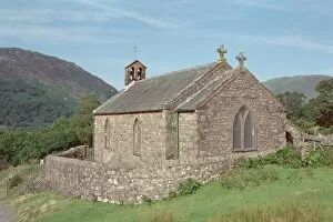
Church of St JamesParish Church in the picturesque setting of Buttermere, Cumbria. IoE 72162
Coalhouse Fort DP182466Coalhouse Fort, East Tilbury, Thurrock, Essex. The fort, looking north-west from the far bank of the water-filled ditch on its east side. Photographed in July 2016
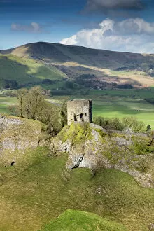
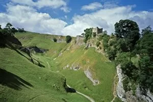
Peveril Castle DP175579Peveril Castle, Market Place, Castleton, Derbyshire. Keep and Cavedale with Iron Age hillfort, Mam Tor, beyond. View from east
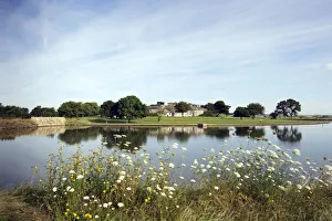
Riverbank FF002955Riverbank with daisies, West Berkshire. A stretch of unidentified river, with boats moored on the far bank and a lock gate in the distance. Photographed late 1960s or early 1970s by John Gay
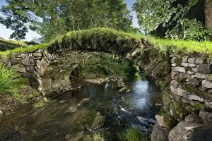
Packhorse Bridge DP169852Gaisgill Medieval Packhorse Bridge, Fawcett Mill Fields, Gaisgill, Tebay, Cumbria. View looking down stream from west
Peveril Castle N050075PEVERIL CASTLE, Derbyshire. View from the South East looking across Cavedale towards the castle
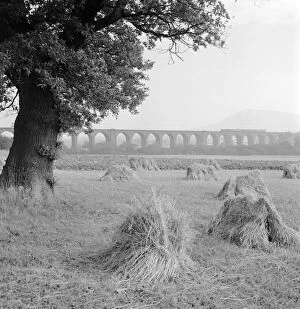
Congleton Viaduct a98_05397CONGLETON VIADUCT, Cheshire. General view of the Congleton Viaduct across agricultural land. There is a train crossing. Photographed by Eric de Mare (active 1945-80)
Battle Abbey battlefield K060304BATTLE ABBEY, East Sussex. Misty view of the battlefield at sunrise looking into the sun
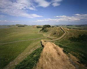
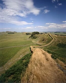
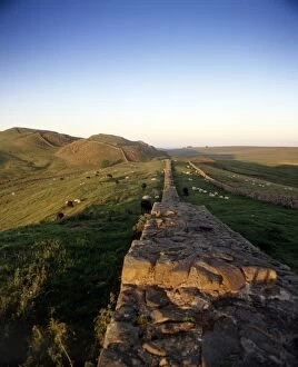
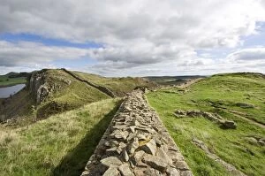
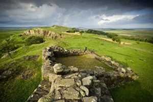
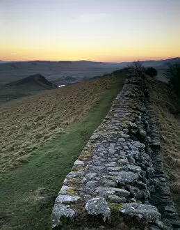
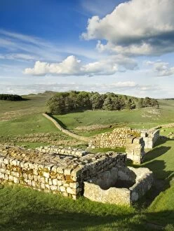
Hadrians Wall J060260HADRIANs WALL, Northumberland. Hadrians Wall winding over the rural landscape. hadrian
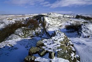
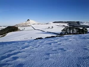
Hadrians Wall snow scene K060468HADRIANs WALL: WALLTOWN CRAGS, Northumberland. View from Walltown Crags showing the snow covered wall. hadrian
Hadrians Wall J060259HADRIANs WALL, Northumberland. Hadrians Wall winding over the rural landscape. hadrian
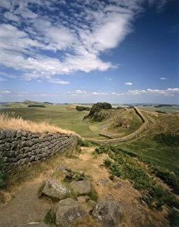
Hadrians Wall J060250HADRIANs WALL, Northumberland. View along the Wall, looking east, located half a mile west of Housesteads. hadrian
Field at sunset N090179The sun sets over a Lincolnshire landscape
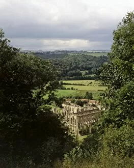
Rievaulx Abbey K050265RIEVAULX ABBEY, North Yorkshire. The Abbey seen from Rievaulx Terrace
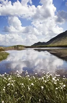
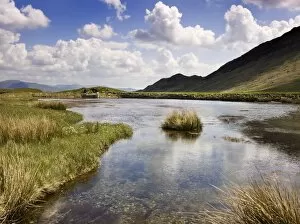
Cumbrian landscape N071925GREENBURN COPPER MINE, near Little Langdale, Lake District, Cumbria. View of the once natural waterbody which was dammed in the early 18th century to provide water for the mine
Cumbrian landscape N071924GREENBURN COPPER MINE, near Little Langdale, Lake District, Cumbria. View of the once natural waterbody which was dammed in the early 18th century to provide water for the mine
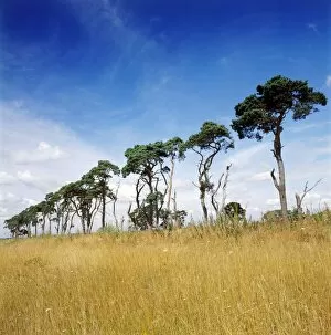
Trees K022124LANDSCAPE NEAR THETFORD, Norfolk. View of lines of trees on the horizon
Watendlath, Borrowdale, Cumbria a080406WATENDLATH, Borrowdale, Cumbria. The hamlet of Watendlath viewed across Watendlath Tarn. Photographed between December 1953 and January 1954 by John Gay
Egton Moor K021738EGTON MOOR, North Yorkshire. View of the moor between Goathland and Egton. Bridge
Hadrians Wall K970905HADRIANs WALL: CAWFIELDS, Northumberland. View along the wall. hadrian
Roseberry Topping K011548ROSEBERRY TOPPING, North Yorkshire. Snow view of hill on North Yorkshire moors
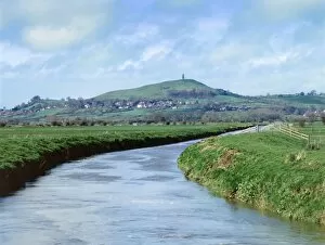
Glastonbury Tor K020304GLASTONBURY TOR, Somerset. View of the Tor from Butt Moor Bridge. Reputedly the Isle of Avalon
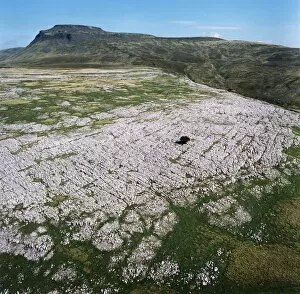
Ingleborough Common EAW603463Ingleborough Common, Yorkshire Dales. Aerial view of a limestone pavement - a natural karst landform consisting of a flat incised surface of exposed limestone. Aerofilms Collection (see Links)
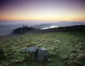
Hadrians Wall N060989HADRIANs WALL, Northumberland. General view of wall at Steel Rigg. hadrian
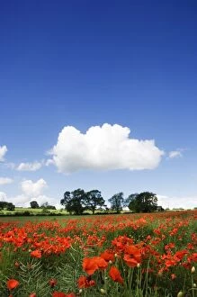
Poppy field N071386NORTHUMBERLAND COUNTRYSIDE. View of poppies in field with white cloud in the sky
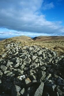
Monday Cleugh K040921MONDAY CLEUGH, Akeld, Northumberland. View from the West of the ramparts of the Iron Age hillfort
Hadrians Wall: Walltown Crags N070998HADRIANs WALL: WALLTOWN CRAGS, Northumberland. View of the wall and milecastle. hadrian
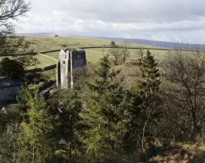
Shap Abbey K060279SHAP ABBEY, Cumbria. View of the 15th century west tower from a high vantage point
View from Little Trowlesworthy Tor K041102LITTLE TROWLESWORTHY TOR, Shaugh Prior, Devon. View looking towards quarry
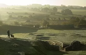
Castle Acre Castle N071221CASTLE ACRE CASTLE, Norfolk. Earthworks in the lower ward of the castle viewed from the north. A visitor pauses while walking his dog to look out over the early morning countryside
Hadrians Wall J080006HADRIANs WALL, Northumberland. Hotbank Crags, near turret 37B. The sun sets behind the wall showing Crag Lough and Highshields Crags in the distance. hadrian
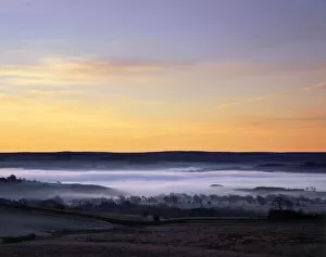
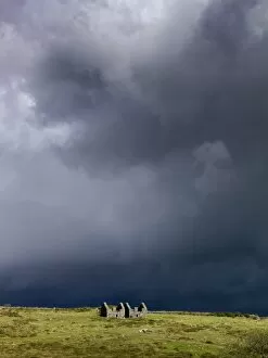
Hadrians Wall: Misty valley J080004HADRIANs WALL, Northumberland. View from Peel Crags, near turret 39A. Mist fills the valley south of the wall at day-break as the sky reflects the pre-dawn light. hadrian
Hadrians Wall J080001HADRIANs WALL, Northumberland. Cawfield Crags, west of turret 41B. View of the wall stretching towards Whin Sill and Cawfields Quarry as the sunsets, illuminating the sky. hadrian
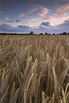
Barley at dusk N071213NORFOLK COUNTRYSIDE. View of a barleyfield, at dusk, near Ludham. Cereal grain
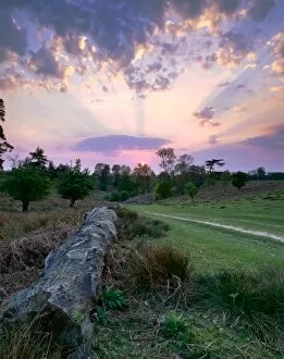
Sunset K070059KENT COUNTRYSIDE. View of felled tree trunk and sunset. Rays of sunlight against the evening clouds
Hadrians Wall: Housesteads Fort N071086HADRIANs WALL: HOUSESTEADS FORT, Northumberland. View along the wall away from Housesteads Fort. hadrian
Powder Mills, Dartmoor N071126DARTMOOR, Devon. Remains of the Powder Mills at Postbridge against an overcast sky
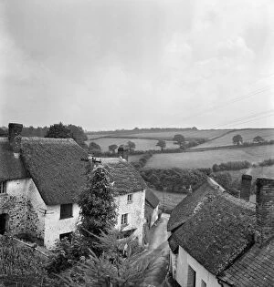
English village a079531A view from an elevated position over an unidentified village lane, showing foliage in the foreground, with thatched cottages and a rural landscape of fields beyond
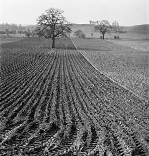
Ploughed field a079453A view along the furrows of a neatly ploughed field near Bridgnorth, Shropshire, with a lone tree in the centre of the field and rolling hills in the distance. Photographed by John Gay in 1953
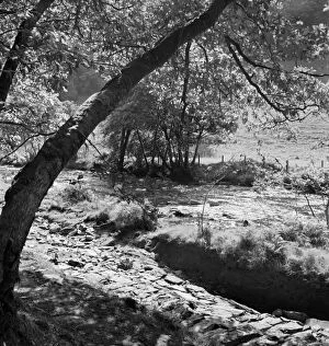
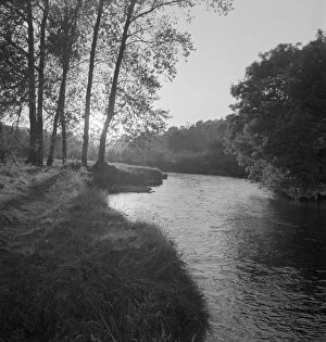
Wooded riverbank a074164A view from a wooded riverbank with tree trunks in the foreground, looking over a calm and sunny stretch of shallow river to a field beside woodland
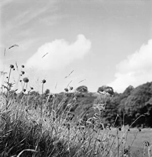
Wild flowers a074138A close-up of grasses and wildflowers growing on a bank in the Somerset countryside, with a rural landscape and woodland in the background. Photographed by John Gay. Date range: 1950-1965
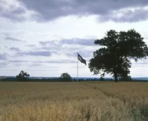
Bosworth Battlefield K940708BOSWORTH BATTLEFIELD, Leicestershire. Site of the battle of 1485
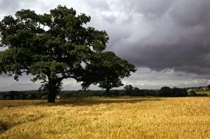
Blore Heath Battlefield K930399BLORE HEATH BATTLEFIELD, Staffordshire. Site of the battle of Blore Heath, 23rd September 1459 ( Wars of the Roses )
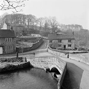
Alport, Derbyshire a069783ALPORT, Derbyshire. A single span stone bridge carries the road over the River Lathkill. Photographed by John Gay in 1959
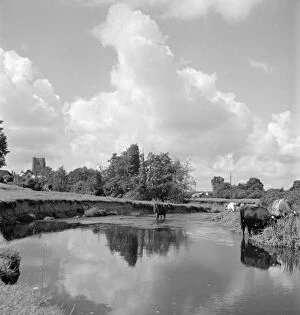
Rural river scene a079535A view along a calm stretch of river near an unidentified village, showing cows standing in the shallows, and the village church visible to the left of frame in the distance
Rural river scene a079524A view of a river running through a rural wooded area, with the low sun shining through tree foliage in the midground. Possibly photographed in the woodland gardens at Dartington Hall, South Hams
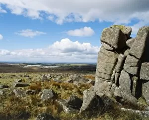
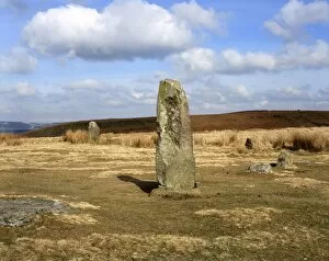
Mitchells Fold Stone Circle K060270MITCHELLs FOLD STONE CIRCLE, Shropshire. View of two of the remaining standing stones of the Bronze Age stone circle
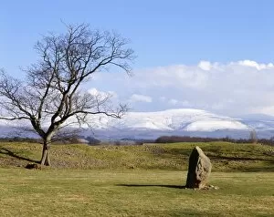
Mayburgh Henge K060246MAYBURGH HENGE, Cumbria. View towards the standing stone located in the middle of the henge showing snow fall on the fells behind