mail_outline sales@mediastorehouse.com
Choose a picture from our The Lake District Collection for your Wall Art and Photo Gifts
54 items
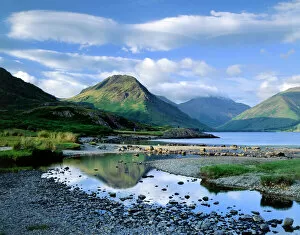
Wast Water, Lake District J060226WAST WATER, Lake District, Cumbria. A view over Wast Water showing the fell of Yew Barrow in the distance
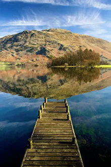
Ullswater, Lake District N100017ULLSWATER, Lake District, Cumbria. A landing stage jetty with reflection of Place Fell in the lake
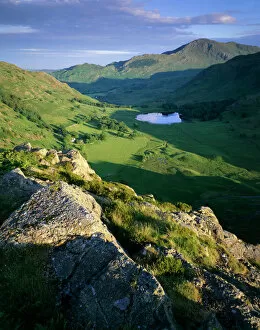
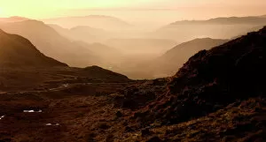
Side Pike, Lake District J060230SIDE PIKE, Lake District, Cumbria. View from Side Pike showing Blea Tarn and Tilberthwaite fells in the background
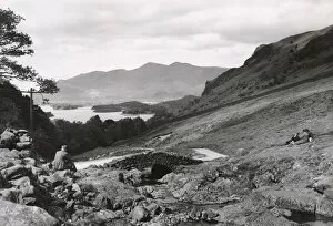
Derwent Water and Skiddaw DIX02_01_061Ashness Bridge, Borrowdale, Allerdale, Cumbria. The view towards Derwent Water and Skiddaw from Ashness Bridge, 1930s
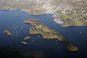
Belle Isle 28691_066Belle Isle, Windermere, Cumbria. The island is situated in the centre of Lake Windermere, the heart of a late C18 centre for aesthetic tourism. 2015, SD3996
Hardknott Roman Fort EAW589036HARDKNOTT, Cumbria. Aerial photograph showing the well-placed Roman fort on a promontory overlooking the Lake District (NGR: NY218015). Aerofilms Collection (see Links)
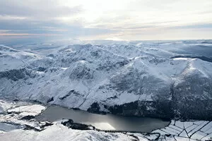
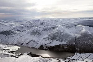
Buttermere 28980_007Buttermere, Cockermouth, Lake District, Cumbria. A view of the lake from the North with snow on the ground
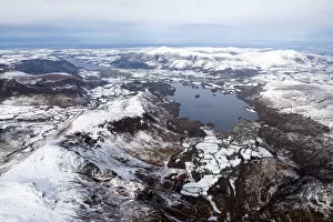
Derwent Water 28980_025Derwent Water and a snowy capped Maiden Moor, looking north, Lake District National Park, Cumbria, 2018
Buttermere 28980_007Buttermere Lake and Fell in the snow, Lake District National Park, Cumbria, 2018
Coniston Water 28695_045Coniston Water from the south-west, Cumbria, 2015. SD2890
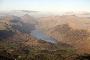
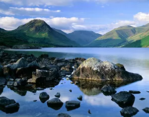
Wast Water 28694_035Wast Water, Kirk Fell and Sca Fell, Cumbria, 2015. NY1404
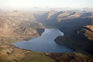
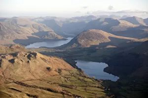
Ennerdale Water 28694_015Ennerdale Water, Cumbria, 2015. NY1015
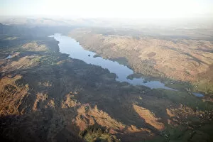
Loweswater and Crummock Water 28694_006Loweswater and Crummock Water, from the north-west, Cumbria, 2015. NY1221
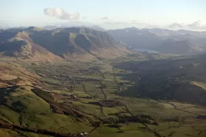
Lorton Vale 28694_002Lorton Vale, from the north-west, Cumbria, 2015. NY1526
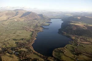
Bassenthwaite Lake 28693_060Bassenthwaite Lake and Skiddaw, Cumbria, from the north-west, 2015. NY2031
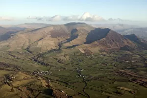
aerial landscapeSkiddaw, Cumbria. Skiddaw from the north-west, 2015. NY2331
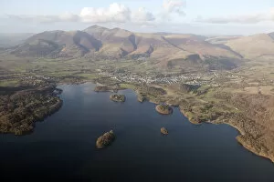
Derwent Water 28693_034Derwent Water, Keswick and Skiddaw, Cumbria, 2015. NY2622
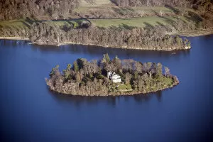
Derwent Isle 28593_023Derwent Isle, Cumbria, 2015 NY2622
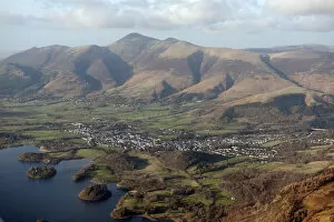
Keswick and Skiddaw 28693_001Keswick and Skiddaw, Cumbria, 2015. NY2623
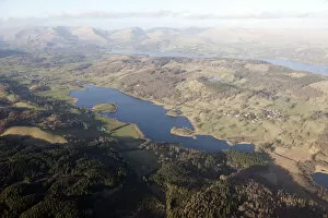
Esthwaite Water 28692_026Esthwaite Water, Cumbria, 2015. SD3695
Bowness-on-Windermere 28691_075Belle Isle and Bowness-on-Windermere, Cumbria, 2015. SD3996
Grasmere 28691_016Grasmere, Helm Crag, Seat Sandal and Fairfield, Cumbria, 2019. NY3306
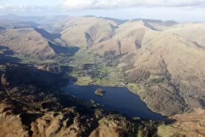
Haweswater Reservoir 28690_066Haweswater Reservoir, Cumbria, 2015. NY4711
Haweswater Reservoir 28690_065Haweswater Reservoir, Cumbria, 2015. NY4711
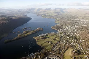
Ambleside 28691_026Ambleside, Cumbria, 2015. NY3703
Grasmere 28691_021Grasmere viewed from Loughrigg Fell, Cumbria, 2015. NY3406
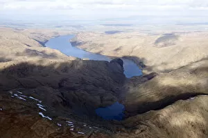
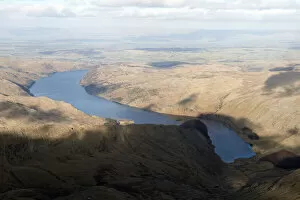
Thirlmere 28691_017Thirlmere viewed from Grasmere, Cumbria, 2015. NY3308
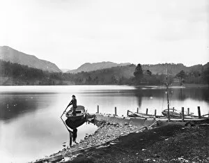
Coniston Water DD004389CONISTON WATER, SOUTH LAKELAND, CUMBRIA. A man launching a rowing boat from a small jetty at the edge of Coniston Lake. Photographed in 1996 for the London Midland and Scottish Railway
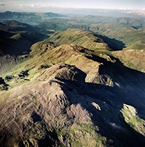
Scafell Pikes AFL03_aerofilms_ac587428SCAFELL, Cumbria. Aerial photograph showing Scafell Pikes and the Lake District. Aerofilms Collection (see Links)
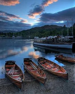
Rowing boats at Ambleside N060978LAKE WINDERMERE, Lake District National Park, Ambleside, Cumbria. Rowing boats at sunset
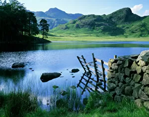
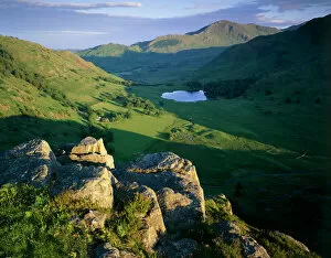
Blea Tarn, Lake District J060231BLEA TARN, Lake District, Cumbria. View across the tarn showing the Langdale Pikes and Side Pikes beyond
Wast Water, Lake District J060228WAST WATER, Lake District, Cumbria. Showing the fell of Yew Barrow in the distance
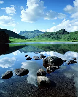
Blea Tarn, Lake District J060236BLEA TARN, Lake District, Cumbria. A view across Blea Tarn showing reflections of the clouds on the waters surface
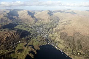
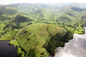
Hallin Fell 28546_008Lake District, Cumbria. View from Ullswater over Hallin Fell towards Martindale Common. Photographed in June 2014
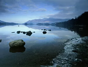
Derwentwater K100004DERWENTWATER, Lake District National Park, Cumbria. View across the water showing an ice formation on the right. derwent
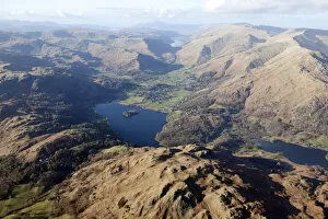
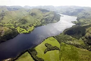
Ullswater EAW587876ULLSWATER, Lake District, Cumbria. Aerial view of Ullswater and Patterdale. Aerofilms Collection (see Links)
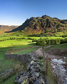
Early light on the Langdale Pikes, Cumbria N060979LANGDALE PIKES, Lake District National Park, Langdale, Cumbria. Mountain in the morning sunlight with footpath and wall
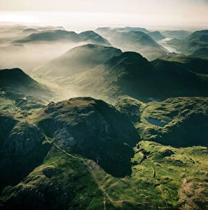
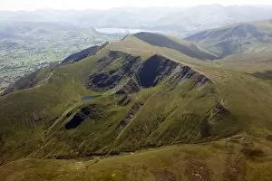
Scafell EAW587429SCAFELL, Cumbria. Aerial view of Great End, 910 metres (2984 ft), the most northerly mountain in the Scafell chain, in the Lake District National Park. Aerofilms Collection (see Links)
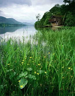
Ullswater Boat House, Lake District J060232ULLSWATER BOAT HOUSE, Lake District, Cumbria. General view of the lake and boathouse
Side Pike, Lake District J060227SIDE PIKE, Lake District, Cumbria. View of Blea Tarn, Blea Moss and the Tilberthwaite Fells
Striding Edge 28546_015Lake District, Cumbria. View east along Striding Edge. Photographed in June 2014
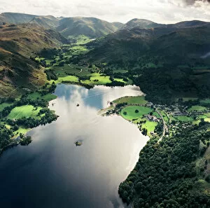
Ullswater 28546_012Lake District, Cumbria. View south west along Ullswater. Photographed in June 2014
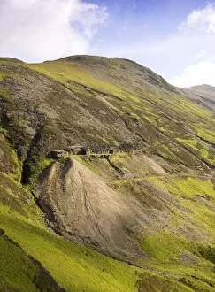
Force Crag Mine DP054906FORCE CRAG MINE, Coledale Valley, Braithwaite, Keswick, Cumbria. Hillside location of High Force Cross Cut, viewed from the south. Lake District landscape
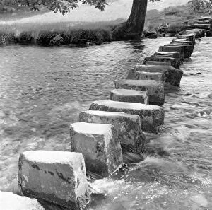
Stepping Stones a98_05078AMBLESIDE, Lake District, Cumbria. General view of stepping stones in Ambleside. Photographed by Eric de Mare (active 1945-80)
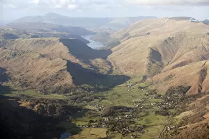
Hardknott Pass, Cumbria N081057HARDKNOTT PASS, Lake District, Cumbria. Landscape views with Roman fort in far distance
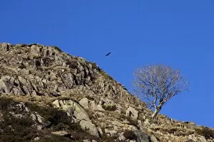
Cumbrian landscape N080905KIRKSTONE SLATE QUARRY, Lake District, Cumbria. View of an isolated tree found close to the quarry
Cumbrian landscape N071925GREENBURN COPPER MINE, near Little Langdale, Lake District, Cumbria. View of the once natural waterbody which was dammed in the early 18th century to provide water for the mine
Cumbrian landscape N071924GREENBURN COPPER MINE, near Little Langdale, Lake District, Cumbria. View of the once natural waterbody which was dammed in the early 18th century to provide water for the mine