mail_outline sales@mediastorehouse.com
64 items
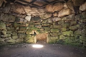
Carn Euny Ancient Village N160027CARN EUNY ANCIENT VILLAGE, Cornwall. Interior of round chamber to fogou, viewed from the south
Carn Euny Ancient Village N160026CARN EUNY ANCIENT VILLAGE, Cornwall. General view of house A, viewed from the north west
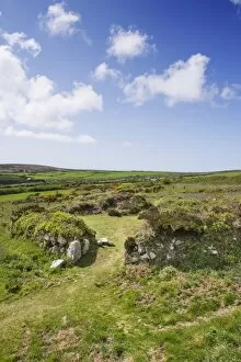
Chysauster Ancient Village N160023CHYSAUSTER ANCIENT VILLAGE, Cornwall. General view of hut 1, viewed from the east
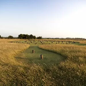
Durrington Walls N130013DURRINGTON WALLS Wiltshire. General view of Durrington Walls landscape
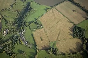
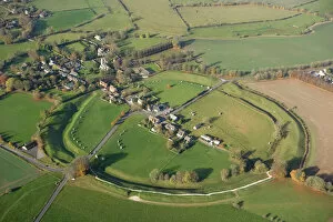
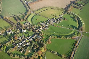
Hatfield Earthworks, Marden Henge N081101HATFIELD EARTHWORKS, Wiltshire. Aerial view of Marden Henge prior to 2010 excavations
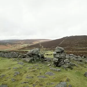
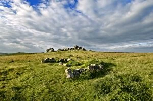
Grimspound K930028GRIMSPOUND, Dartmoor, Devon. General view of the remains of a Bronze Age settlement
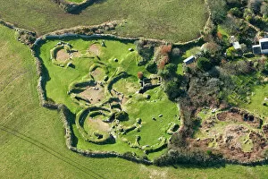
Carn Euny Ancient Village N070045CARN EUNY ANCIENT VILLAGE, Cornwall. Aerial view
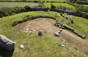
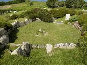
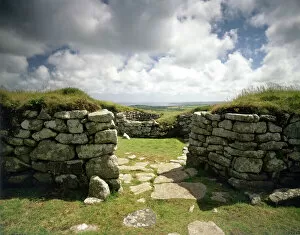
Halangy Down Ancient Village, Isles of Scilly N090273HALANGY DOWN ANCIENT VILLAGE, St Mary s, Isles of Scilly. Remains of the Iron Age village. View of circular house with stone walls and hearth
Hound Tor, Cist and Cairn Circle N090115HOUND TOR, Devon. View towards Hound Tor showing the Cist and Cairn Circle
Chysauster Ancient Village J910198CHYSAUSTER ANCIENT VILLAGE, Cornwall. Entrance to a courtyard house
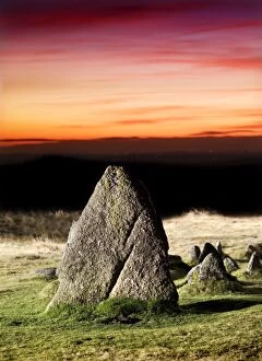
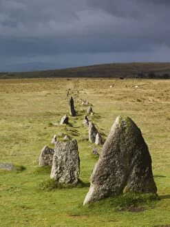
Merrivale Prehistoric Settlement N080731MERRIVALE PREHISTORIC SETTLEMENT, Dartmoor, Devon. Illuminated view of the stones at sunset
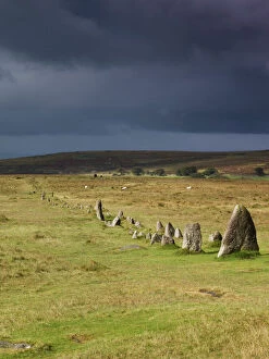
Merrivale Prehistoric Settlement N071133MERRIVALE PREHISTORIC SETTLEMENT, Dartmoor, Devon. General view of stone row avenue against an overcast sky
Merrivale Prehistoric Settlement N071132MERRIVALE PREHISTORIC SETTLEMENT, Dartmoor, Devon. General view of stone row avenue against an overcast sky
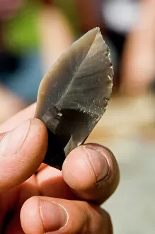
Flint knapping N071000GRIMES GRAVES, Norfolk. Flint knapping demonstration. Detailed view of a flint arrow head during the knapping process
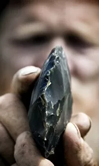
Flint knapping N070999GRIMES GRAVES, Norfolk. Flint knapping demonstration. Detailed view of a flint during knapping
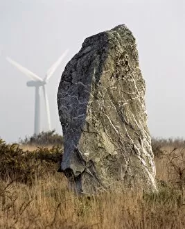
St. Breock Downs Monolith K021457ST BREOCK DOWNS MONOLITH, Cornwall. General view of the standing stone with wind turbine in the background. wind farm
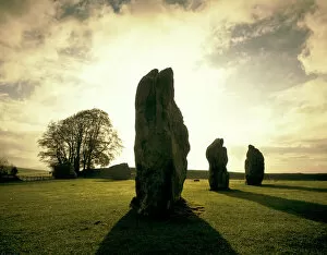
Avebury Stone Circle J900435AVEBURY STONE CIRCLE, Wiltshire. Sunrise over the stones
Stonehenge ahead FL01500_02_003STONEHENGE, Amesbury, Wiltshire. A car drives past an a box towards Stonehenge. Photograph 1930, from the Ministry of Works Blue Album
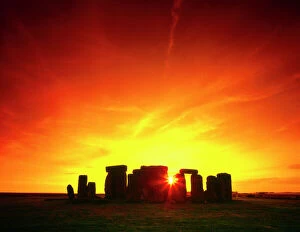
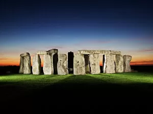
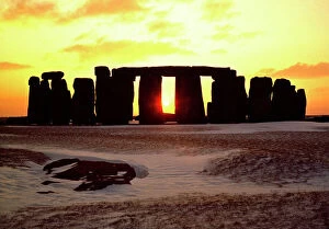
Stonehenge sunset J870232STONEHENGE, Wiltshire. Mid-Summer sunset
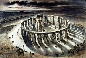
Stonehenge J940486STONEHENGE, Wiltshire. Reconstruction drawing of Stonehenge as it might have appeared in 1000 BC by Alan Sorrell
Maiden Castle J870379MAIDEN CASTLE, Dorset. Aerial view reconstruction drawing by Paul Birkbeck
Stonehenge J850008STONEHENGE, Wiltshire. Stones at sunset with snow in the foreground
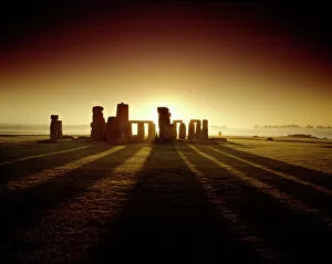
Stonehenge K021103STONEHENGE, Wiltshire. View from the North East at sunrise
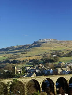
Ingleborough Iron Age Hill Fort K100007INGLEBOROUGH IRON AGE HILL FORT, Yorkshire Dales. View across to the village of Ingleton, showing the Viaduct and Ingleborough Hill Fort behind
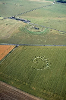
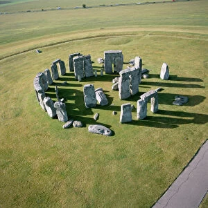
Stonehenge and crop circle N960002STONEHENGE, Wiltshire. Aerial view of Stonehenge with crop circle in the foreground
Stonehenge N071215STONEHENGE, Wiltshire. A floodlit view of Stonehenge. Late evening / dusk
Stonehenge from the air K040315STONEHENGE, Wiltshire. Aerial view of the site looking south east
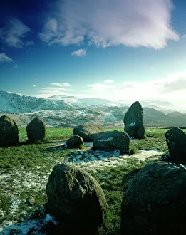
Castlerigg Stone Circle J850518CASTLERIGG STONE CIRCLE, Cumbria. View to South West of part of the stone circle with snow covered hills beyond
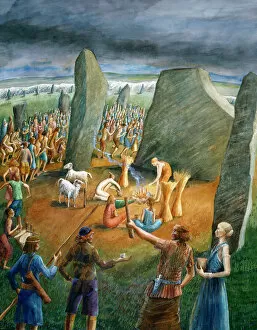
Avebury Stone Circle J880248AVEBURY STONE CIRCLE, Wiltshire. Reconstruction drawing " Harvest Ceremony at the Cove in Northern Inner Circle " by Judith Dobie, English Heritage Graphics Team
Avebury Stone Circle N071124AVEBURY STONE CIRCLE, Wiltshire. Aerial view
Stonehenge K030912STONEHENGE, Wiltshire. View of the circle from the west at sunrise
Stonehenge sunset M890091STONEHENGE, Wiltshire. View of the stone circle looking south west along axis. Mid-winter sunset with snow
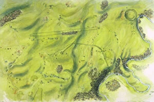
Stonehenge landscape c. 1600 J050045STONEHENGE, Wiltshire. Aerial view reconstruction drawing by Peter Dunn of the Stonehenge landscape in c.1600 BC. Date of photograph: February 2005
Waylands Smithy K040655WAYLANDs SMITHY, Oxfordshire. The line of sarsen stones flanking the entrance chamber of the long barrow
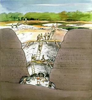
Grimes Graves J940184GRIMES GRAVES, Norfolk. 1994 cutaway reconstruction drawing of Prehistoric flint mining by Terry Ball (English Heritage Graphics Team). Recent evidence suggests that ladders may not have been used
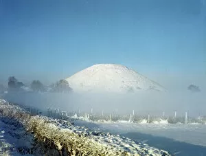
Silbury Hill N060151SILBURY HILL, Avebury, Wiltshire. View from the east looking towards the snow covered mound. Part of the Avebury World Heritage Site
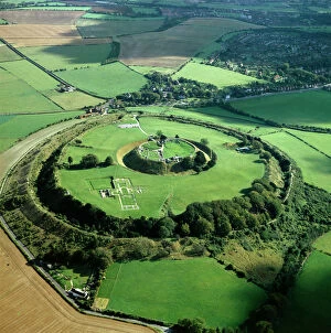
Old Sarum K000139OLD SARUM, Wiltshire. Aerial view
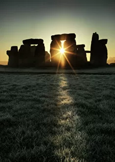
Stonehenge at sunrise N120064STONEHENGE, Wiltshire. General view of Stonehenge at sunrise
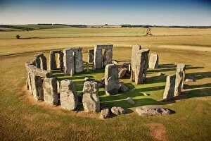
Stonehenge N130045STONEHENGE, Wiltshire. Aerial view
Bronze Age barrow types J050104STONEHENGE, Wiltshire. Reconstruction drawing by Peter Dunn (English Heritage Graphics Team) showing Bronze Age barrow types
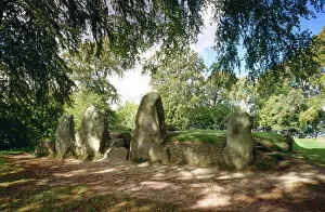
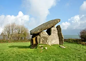
Trethevy Quoit N061057TRETHEVY QUOIT, St Cleer, Cornwall. View of the Neolithic dolmen burial chamber containing five standing stones, and a large capstone
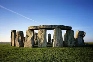
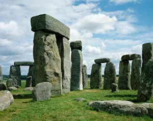
Stonehenge J870257STONEHENGE, Wiltshire. View of the stones against a cloudy summer sky
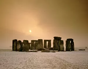
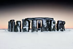
Stonehenge in snow N100786STONEHENGE, Wiltshire. General view of Stonehenge in the snow
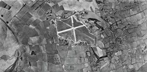
Wroughton, Wiltshire US_7PH_GP_LOC209_V_5004WROUGHTON, Wiltshire. This vertical photograph (taken in 1944 by the US Army Air Force) shows Barbury Castle hillfort, RAF Wroughton (centre), and the village of Wroughton
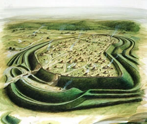
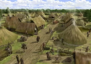
Iron Age Silchester N080916SILCHESTER ROMAN CITY WALLS, Hampshire. The Iron Age town at Silchester, seen from the north looking towards the southern entrance. Reconstruction drawing by Peter Urmston
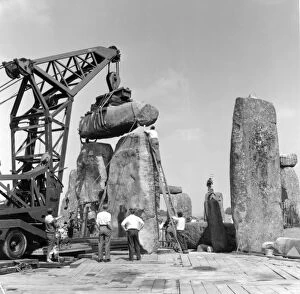
Stonehenge. Re-erection of Trilithon lintel in 1958 P50217STONEHENGE, Wiltshire. Re-erection of Trilithon lintel 158 by the 60 ton Brabazon Crane, the larger of two cranes used to lift stones
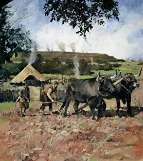
Iron Age farming N080555OLD OSWESTRY HILL FORT, Shropshire. Reconstruction drawing by Ivan Lapper showing Iron Age arable cultivation
Avebury Stone Circle N071125AVEBURY STONE CIRCLE, Wiltshire. Aerial view