mail_outline sales@mediastorehouse.com
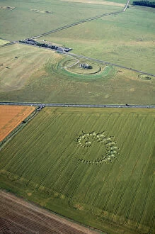
Stonehenge and crop circle N960002STONEHENGE, Wiltshire. Aerial view of Stonehenge with crop circle in the foreground
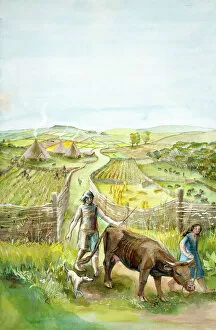
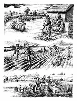
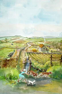
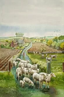
Rural landscape J910032Reconstruction drawing of imaginary rural landscape, 2000 BC by Judith Dobie, English Heritage Graphics Team. Farming
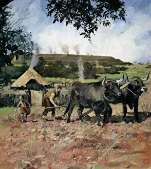
Iron Age farming N080555OLD OSWESTRY HILL FORT, Shropshire. Reconstruction drawing by Ivan Lapper showing Iron Age arable cultivation
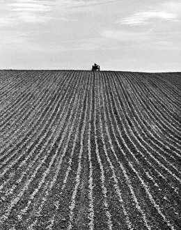
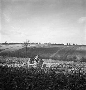
Ploughing OP04506A newly ploughed field near Aylesbury, Buckinghamshire. The farmer on his tractor is sillouhetted on the horizon. Photographed by John Gay during 1950s 1960s
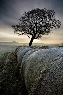
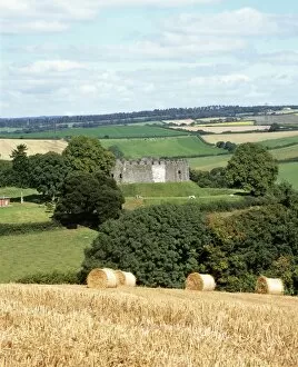
Roseberry Topping from Morton Carr N100025ROSEBERRY TOPPING, North Yorkshire / Cleveland. View across Morton Carr towards Roseberry Topping on the horizon with hay bales and tree on a frosty, misty winter morning. Sunrise
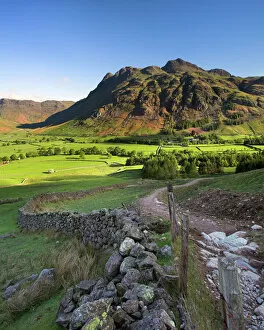
Early light on the Langdale Pikes, Cumbria N060979LANGDALE PIKES, Lake District National Park, Langdale, Cumbria. Mountain in the morning sunlight with footpath and wall
Ploughing J910039Reconstruction drawing of ploughing in Victorian times by Judith Dobie, English Heritage Graphics Team. Farming
Ploughing a076208A field in Hertfordshire, being ploughed by a man on a tractor. Photographed by John Gay. Date range: 1950-1959
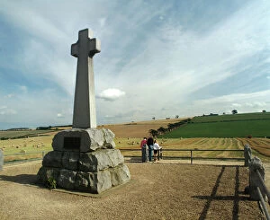
Flodden Field K940715FLODDEN FIELD, Northumberland. Site of battle of 1513. Memorial cross
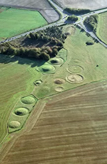
Winterbourne Stoke Barrows N930001WINTERBOURNE STOKE BARROWS, Wiltshire. Aerial view of the Winterbourne Stoke cemetery showing Bronze Age round barrows with the Neolithic Long Barrow top right, next to the roundabout
Medieval farming N070208WHARRAM PERCY MEDIEVAL VILLAGE, North Yorkshire. Reconstruction drawing by Peter Dunn (English Heritage Graphics Team) showing villagers shearing sheep and planting and harvesting crops
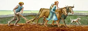
Ploughing J910038Reconstruction drawing of family ploughing during the Iron Age by Judith Dobie, English Heritage Graphics Team. Farming
Rural landscape J910033Reconstruction drawing of imaginary rural landscape, AD 200 Romano-British by Judith Dobie, English Heritage Graphics Team. Farming
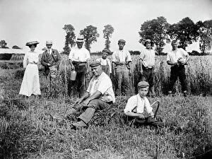
Harvest time, Lower Cadsden, Buckinghamshire a97_05316LOWER CADSDEN, Princes Risborough, Buckinghamshire. View of people in a field, including farm workers taking a break from harvesting, with a smart lady and gentleman
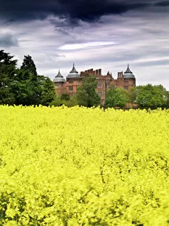
Westwood House N080957WESTWOOD HOUSE, Droitwich, Worcestershire. Beyond a field of yellow flowering crops
Farm wagons, Norfolk a98_15161Freethorpe, Norfolk. These two traditional horse-drawn farm wagons would still have been in regular use when this photograph was taken. Behind, a portable elevator was used to build the haystacks
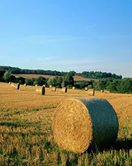
Haywheels J070054KENT COUNTRYSIDE, View of hay bails / haywheels in a field near Farningham
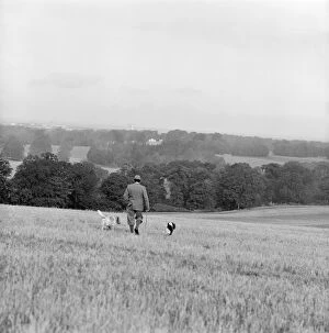
Gamekeeper a067099A rural landscape near Basingstoke, Hampshire. A gamekeeper and his dogs walk away from the camera with the skyline of Basingstoke just visible on the horizon. Date range 1960-1980. John Gay
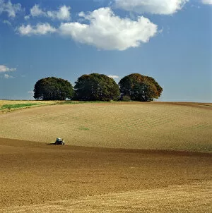
The Ridgeway K930754THE RIDGEWAY, Wiltshire. The Downs south of Avebury. Rural landscape with tractor in field and copse of trees on the horizon
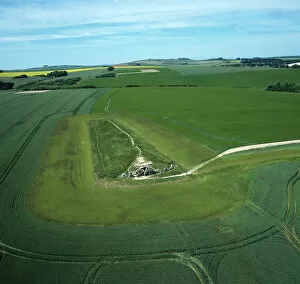
West Kennet Long Barrow from the air K040320WEST KENNET LONG BARROW, Avebury, Wiltshire. Aerial view of the site looking West. Part of the Avebury World Heritage Site
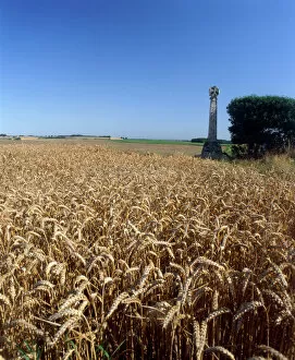
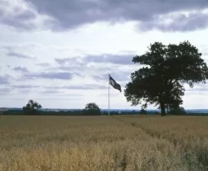
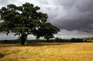
Towton Battlefield K940712TOWTON BATTLEFIELD, North Yorkshire. Site of battle of 1461. Stone cross and wheat field. Cereal grain
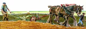
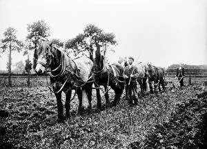
Ploughing, Buckinghamshire BB98_10630A view showing a horse and plough team at work possibly in Ilmer, Whiteleaf or Monks Risborough, Buckinghamshire. Photographed by Alfred Newton and Son. Date range: 1896-1920
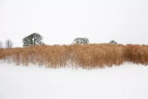
Elephant grass in snow N100016Snowfall covers a biocrop in Somerset. Elephant grass is used for biofuel and thatching
Bosworth Battlefield K940708BOSWORTH BATTLEFIELD, Leicestershire. Site of the battle of 1485
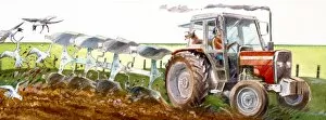
Ploughing J910040Reconstruction drawing of present day view of tractor ploughing field by Judith Dobie, English Heritage Graphics Team. Farming
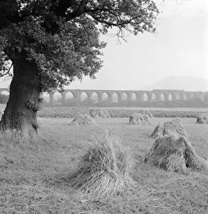
Congleton Viaduct a98_05397CONGLETON VIADUCT, Cheshire. General view of the Congleton Viaduct across agricultural land. There is a train crossing. Photographed by Eric de Mare (active 1945-80)
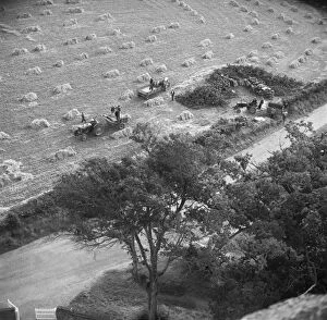
Harvest, Norfolk a98_14729Ranworth, Norfolk. The harvest is seen from the church tower. Despite mechanisation, it is still a labour-intensive task with at least 14 men visible. Photographed by Hallam Ashley September 1954
Blore Heath Battlefield K930399BLORE HEATH BATTLEFIELD, Staffordshire. Site of the battle of Blore Heath, 23rd September 1459 ( Wars of the Roses )
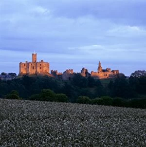
Warkworth Castle K961402WARKWORTH CASTLE, Northumberland. A distant view from the West at sunset
Rural landscape J910035Reconstruction drawing of present day imaginary rural landscape by Judith Dobie, English Heritage Graphics Team. Farming
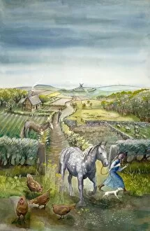
Rural landscape J910034Reconstruction drawing of imaginary rural landscape, c1600 Tudor by Judith Dobie, English Heritage Graphics Team. Farming
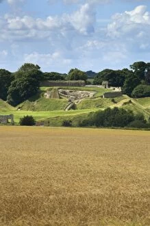
Castle Acre Castle N071728CASTLE ACRE CASTLE, Norfolk. General view from the south east across a field of cereal crops
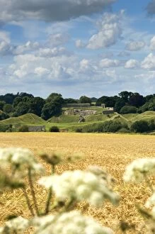
Castle Acre Castle N071727CASTLE ACRE CASTLE, Norfolk. Distant view from the south east across a field of cereal crops
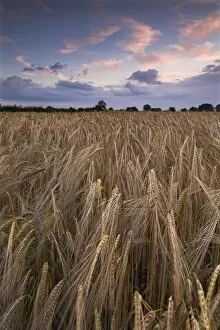
Barley at dusk N071213NORFOLK COUNTRYSIDE. View of a barleyfield, at dusk, near Ludham. Cereal grain
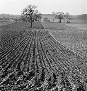
Ploughed field a079453A view along the furrows of a neatly ploughed field near Bridgnorth, Shropshire, with a lone tree in the centre of the field and rolling hills in the distance. Photographed by John Gay in 1953
Restormel Castle K010871RESTORMEL CASTLE, Cornwall. View from the South West