mail_outline sales@mediastorehouse.com
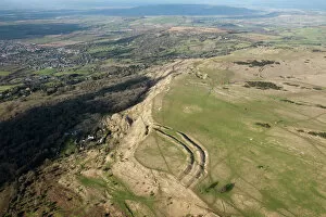
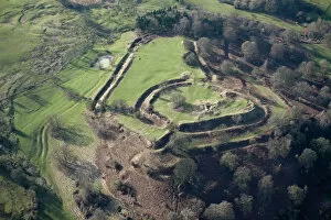
Cleeve Hill 27646_030Cleeve Hill camp, Gloucestershire. Iron Age hillfort on the edge of the Cotswold scarp. SO9825/75
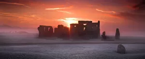
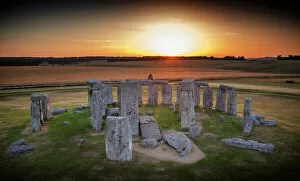
Stonehenge K021103STONEHENGE, Wiltshire. View from the North East at sunrise
Stonehenge at sunrise N120064STONEHENGE, Wiltshire. General view of Stonehenge at sunrise
Stonehenge N071215STONEHENGE, Wiltshire. A floodlit view of Stonehenge. Late evening / dusk
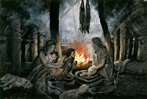
Yeavering J910320YEAVERING, Northumberland (also know as Ad Gefrin). Reconstruction drawing of Saxon Yeavering AD 627, by Peter Dunn (English Heritage Graphics Team)
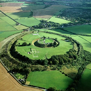
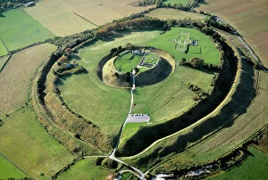
Old Sarum K000139OLD SARUM, Wiltshire. Aerial view
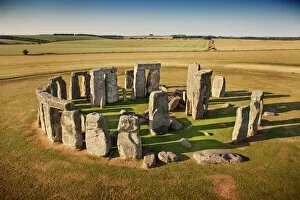
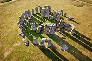
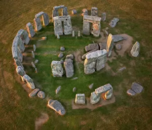
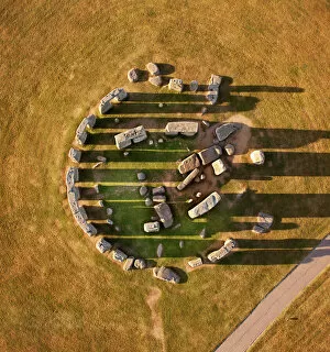
Stonehenge N130045STONEHENGE, Wiltshire. Aerial view
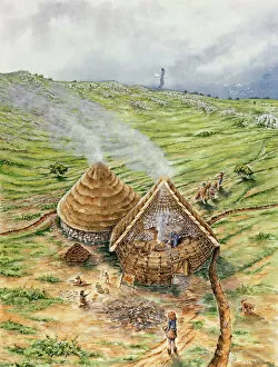
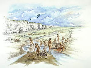
Brean Down J890031BREAN DOWN, Somerset. Reconstruction drawing of Bronze Age huts, by Peter Dunn (English Heritage Graphics Team)
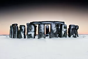
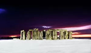
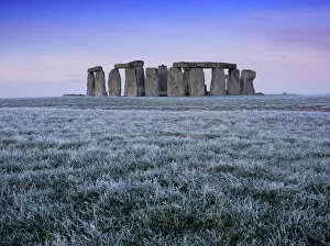
Stonehenge in snow N100786STONEHENGE, Wiltshire. General view of Stonehenge in the snow
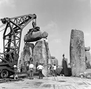
Stonehenge. Re-erection of Trilithon lintel in 1958 P50217STONEHENGE, Wiltshire. Re-erection of Trilithon lintel 158 by the 60 ton Brabazon Crane, the larger of two cranes used to lift stones
Fotheringhay Castle 27869_030Fotheringhay Castle, Northamptonshire. TL0692/37
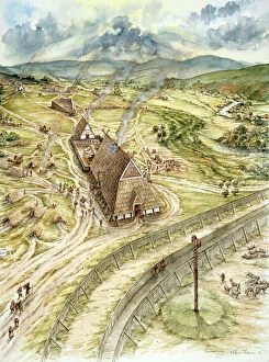
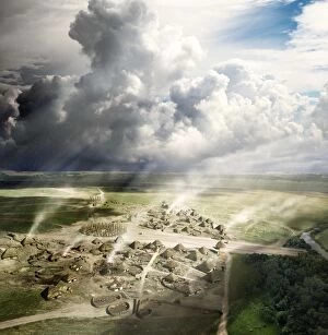
Durrington Walls N130053DURRINGTON WALLS, Wiltshire. Reconstruction showing the settlement at Durrington Walls near Stonehenge in about 2500BC, this view looking north, in summer
Stonehenge N130044STONEHENGE, Wiltshire. Aerial view
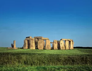
Stonehenge K030970STONEHENGE, Wiltshire. Detailed view of the stones from the south
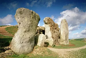
West Kennet Long Barrow K910277WEST KENNET LONG BARROW, Wiltshire. Stones at the entrance
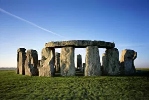
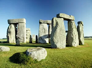
Stonehenge J040120STONEHENGE, Wiltshire. General view against a blue sky
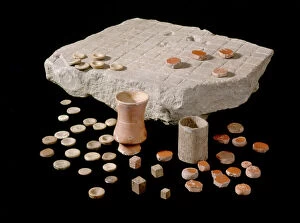
Roman gaming board J970223CORBRIDGE ROMAN TOWN, Northumberland. A gaming board with dice and counters. hadrian
Durrington Walls N130055DURRINGTON WALLS, Wiltshire. Reconstruction showing the settlement at Durrington Walls near Stonehenge in about 2500BC. The site is shown in midwinter
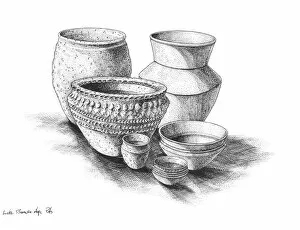
Bronze Age pottery N980006BRONZE AGE BRITAIN. Group of Late Bronze Age pots. Reconstruction drawing by Peter Dunn (English Heritage Graphics Team)
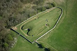
West Kennet Long Barrow N072012WEST KENNET LONG BARROW, Avebury, Wiltshire. Aerial view
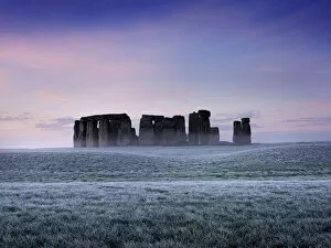
Stonehenge at twilight N090035STONEHENGE, Wiltshire. General view of Stonehenge at twilight showing recent snowfall
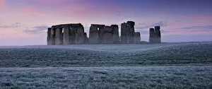
Stonehenge N071258STONEHENGE, Wiltshire. View of the stone circle at early dawn
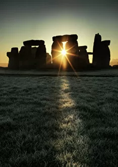
Stonehenge N071216STONEHENGE, Wiltshire. View of Stonehenge at sunrise
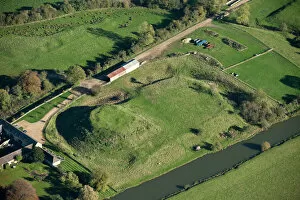
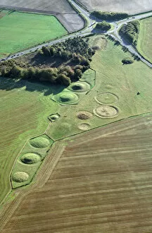
Winterbourne Stoke Barrows N930001WINTERBOURNE STOKE BARROWS, Wiltshire. Aerial view of the Winterbourne Stoke cemetery showing Bronze Age round barrows with the Neolithic Long Barrow top right, next to the roundabout
Old Sarum N070651OLD SARUM, Wiltshire. Aerial view
Boxgrove J940321BOXGROVE QUARRY, West Sussex. A panorama reconstruction drawing of Boxgrove by Peter Dunn (English Heritage Graphics Team)
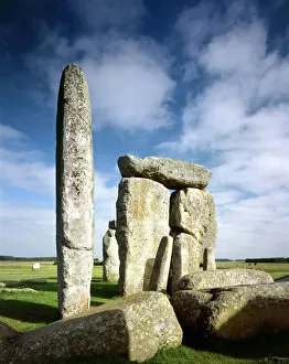
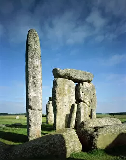
Stonehenge J060030STONEHENGE, Wiltshire. Detail of the sarsen trilithons showing tallest upright and station stone against a cloudy sky
Stonehenge J060031STONEHENGE, Wiltshire. Detail of sarsen trilithons showing tallest upright and station stone
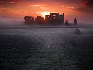
Stonehenge N071262STONEHENGE, Wiltshire. View of the stone circle at sunrise
Stonehenge N130038STONEHENGE, Wiltshire. Aerial view
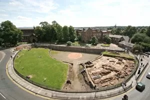
Chester Roman Amphitheatre N071454CHESTER ROMAN AMPHITHEATRE, Cheshire. Elevated view with excavation in progress
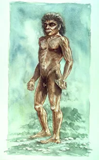
Boxgrove Man J940257BOXGROVE QUARRY, West Sussex. Reconstruction drawing of the Boxgrove Man by Peter Dunn (English Heritage Graphics Team)
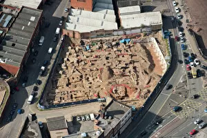
Leicester excavations 33128_032Great Central Street and Highcross Street, Leicester. The largest archaeological excavation in the city for 10 years, which found 2 Roman streets and the largest mosaic ever found in Leicester
Elmley Castle 27640_002Elmley Castle, Worcestershire. The earthwork remains of the Norman castle on Bredon Hill. SO9740/15
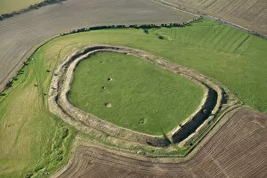
Liddington Castle 27618_002Liddington Castle, Swindon. Iron Age hillfort near the Ridgeway. SU2079/136
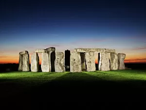
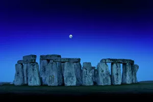
Stonehenge at dusk with moon N110366STONEHENGE, Wiltshire. General view at dusk with moon
Stonehenge N130043STONEHENGE, Wiltshire. Aerial view
Stonehenge at sunrise N130035STONEHENGE, Wiltshire. Sunrise
Grimspound J940469GRIMSPOUND, Dartmoor, Devon. A reconstruction drawing of a Bronze Age cottage interior by Ivan Lapper
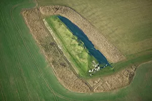
Belas Knapp Long Barrow N071890BELAS KNAPP LONG BARROW, Gloucestershire. Aerial view
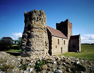
Roman Pharos and St Marys Church J960160DOVER CASTLE, Kent. The Roman pharos lighthouse and St Mary in Castro church (St Mary in the Castle)
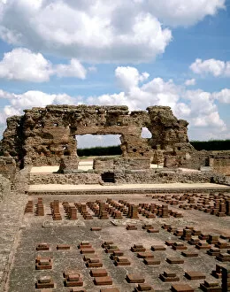
Wroxeter Roman City J900276WROXETER ROMAN CITY, Shrophire. Tepidarium and Caldarium and the Frigidarium from the south showing the hypocaust heating system
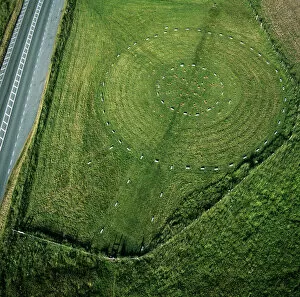
The Sanctuary from the air K040340THE SANCTUARY, Avebury. Wiltshire. Aerial view of the site looking East. Part of the Avebury World Heritage Site
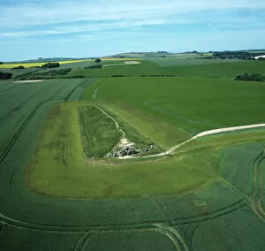
West Kennet Long Barrow from the air K040320WEST KENNET LONG BARROW, Avebury, Wiltshire. Aerial view of the site looking West. Part of the Avebury World Heritage Site
Stonehenge DP180673STONHENGE, Amesbury, Wiltshire. View of Stonehenge with a single beam of light for the centenary to mark the outbreak of the First World War. Shot after twilight
Stonehenge N071260STONEHENGE, Wiltshire. View of the stone cirlce at early dawn
Stonehenge N071259STONEHENGE, Wiltshire. View of the stone circle at early dawn
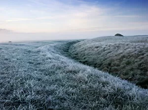
Stonehenge, outer ditch N071266STONEHENGE, Wiltshire. View of the outer ditch. Frosty early morning view