mail_outline sales@mediastorehouse.com
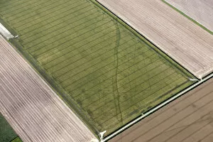
Cropmarks of a trackway 28779_043Tog Dale, near Langtoft, East Riding of Yorkshire. Iron Age and Roman linear settlement and trackway crop marks, 2015. TA0268
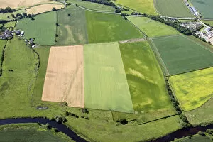
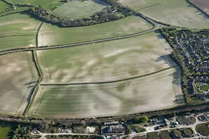
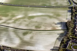
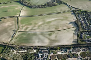
Newton Kyme Roman fort 28740_041Newton Kyme, North Yorkshire. Roman fort and Neolithic henge monument west of Newton Kyme, 2015. SE4545
Burgh Le Marsh cropmarks 28712_042Double ditched enclosure crop mark (possible roman villa), near Burgh Le Marsh, Lincolnshire, 2015
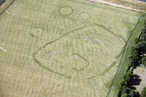
Bradford Roman Villa 35166_017Roman villa crop mark showing under sports pitches at St Laurence School, Bradford on Avon, Wiltshire, 2022
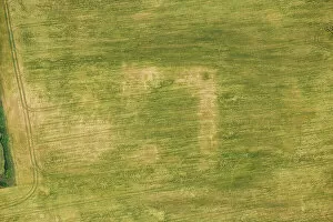
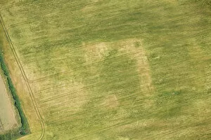
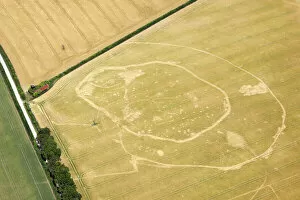
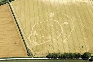
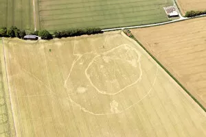
Broughton Roman Villa 35164_022Broughton Roman Villa showing as a crop mark, Tadmarton, Oxfordshire, 2022
Broughton Roman Villa 35164_006Broughton Roman Villa showing as a crop mark, Tadmarton, Oxfordshire, 2022
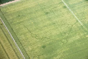
Banjo enclosure 33689_003Crop mark of a possible Iron Age settlement in the form of a banjo enclosure near Coombefield Plantation, West Berkshire, 2018
Linwood moat cropmarks 34118_060Linwood, Lincolnshire, 2019. Crop marks of a moat and garden. TF1185
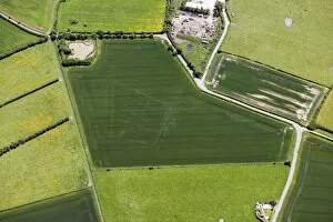
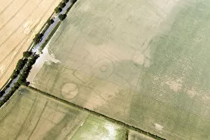
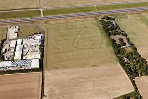
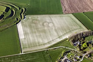
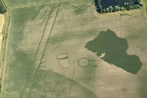
Iron Age settlement 34030_023Settringham, North Yorkshire, 2018. Iron Age settlement crop mark on the Yorkshire Wolds. SE8269
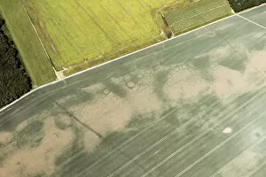
Haisthorpe Moor 34032_019Haisthorpe Moor, East Riding of Yorkshire, 2018. Iron Age square barrow cemetery crop mark
Haisthorpe Moor 34032_007Haisthorpe Moor, East Riding of Yorkshire, 2018. Iron Age square barrow cemetery crop mark
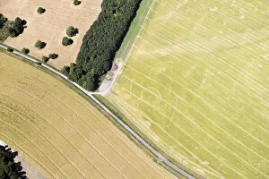
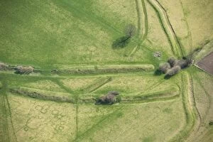
Wansdyke at North Down 29622_035North Down, Willtshire, 2015. The Wansdyke and a medieval or later sheep enclosure
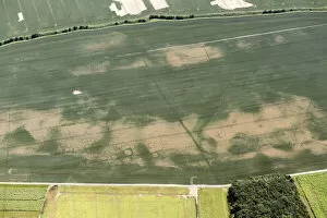
South Wonston cropmark 29800_026South Wonston, Hampshire, 2015. Iron Age double ditched enclosure crop mark
South Wonston cropmark 29800_022South Wonston, Hampshire, 2015. Iron Age double ditched enclosure crop mark
South Wonston cropmark 29800_018South Wonston, Hampshire, 2015. Iron Age double ditched enclosure crop mark
Cropmarks, Minster, Kent 29752_015Minster, Kent, 2015. Enclosure and ring ditch crop marks. TR3165
Cropmarks, Minster, Kent 29752_014Minster, Kent, 2015. Enclosure and ring ditch crop marks. TR3165
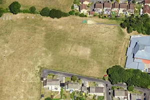
Practice trenches 29753_018Birchington, Kent, 2015. World War Two practice trench showing as a crop mark. TR2868
Mount Pleasant 29551_013Mount Pleasant, near Dorchester, Dorset, 2015. A henge enclosure crop mark, with associated round barrow earthwork, known as the Conquer Barrow, and nearby round barrows also showing as crop marks
Mount Pleasant 29551_016Mount Pleasant, near Dorchester, Dorset, 2015. A henge enclosure crop mark, with associated round barrow earthwork, known as the Conquer Barrow
Mount Pleasant 29551_014Mount Pleasant, near Dorchester, Dorset, 2015. A henge enclosure crop mark, with associated round barrow earthwork, known as the Conquer Barrow, and nearby round barrows also showing as crop marks
Winterborne Monkton barrow cemetery 29548_003Winterborne Monkton, near Dorchester, Dorset, 2015. A round barrow cemetery crop mark immediately south east of Maiden Castle
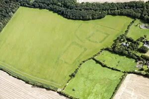
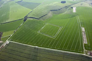
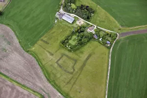
Woodhall Hall 28713_028Woodhall Hall Moated Site, Lincolnshire, 2015
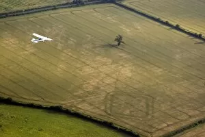
Aerial photography 24511_003Down Ampney, Gloucestershire. An aerial photography training flight over a rectangular double-ditched enclosure. Part of an aerial photography course to help spot
Warborough Cursus 27803_025Warborough cursus, Oxfordshire. aerial view showing a range of cropmarks, including the parallel lines indicative of the cursus ditches, ring-ditches, enclosures and other features. SU5994/64
Roman settlement 27422_018March, Cambridgeshire. Soilmarks showing part of a Roman settlement comprising rectangular buildings and enclosures lining a road in a recently cultivated field
Stonea Camp 27422_009Stonea Camp, Cambridgeshire. Lying in the Fens near March, this is the lowest Iron Age hillfort in Britain. Detail of the earthwork remains of banks