mail_outline sales@mediastorehouse.com
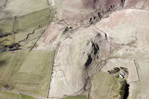
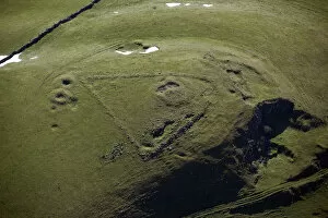
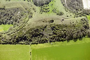
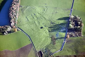
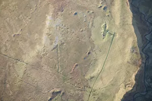
Gallow Law 28680_003Iron Age defended settlement and later Romano-British settlement on Gallow Law, Northumberland, 2015. NT9207
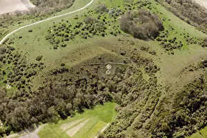
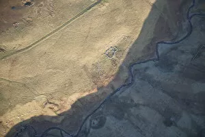
Jennys Lantern 28686_056Romano British enclosed settlement earthwork, Jennys Lantern, Northumberland, 2015. NU1215
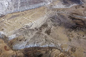
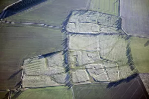
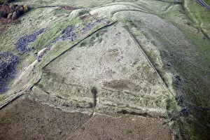
Chew Green earthworks 28677_047Earthwork remains of a Roman fort, fortlets, camps and a medieval settlement and chapel at Chew Green, Northumberland, 2015. NT7808
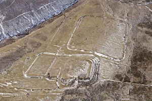
Chew Green earthworks 28677_044Earthwork remains of a Roman fort, fortlets, camps and a medieval settlement and chapel at Chew Green, Northumberland, 2015. NT7808
Construction works 28676_020Construction works for the Bedale, Aiskew and Leeming Bar bypass, North Yorkshire, 2015. SE2789
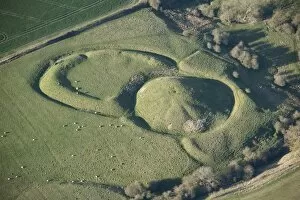
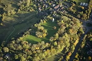
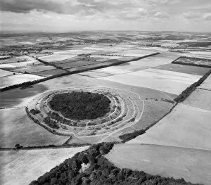
Thornborough henges 26876_010Thornborough henges and Centre Hill round barrow, North Yorkshire, 2015. SE2879
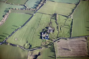
Medieval and Roman Car Colston 28669_007Car Colston, Nottinghamshire. Minor Romano-British villa, moat and associated medieval manorial and village earthworks, including six fishponds, 2015. SK7142
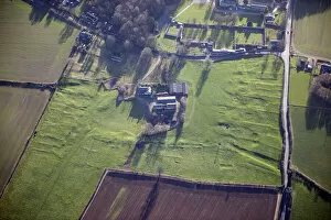
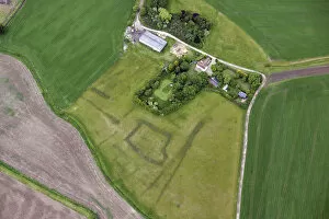
Bingham medieval settlement 28669_002Bingham, Nottinghamshire. Bingham medieval settlement, 2015. SK7139
Southorpe medieval settlement 28671_068Southorpe medieval settlement and cultivation remains, Lincolnshire, 2015. SK8995
Willoughby DMV 28671_011Willoughby deserted medieval village, Nottinghamshire, 2015. SK7863
Hawton moated site 28670_033Hawton moated site and ridge and furrow earthworks, Nottinghamshire, 2015. SK7851
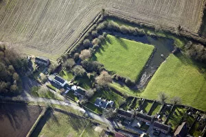
Coddington moat 28670_040Water filled moat, Coddington, Nottinghamshire, 2015. SK8354
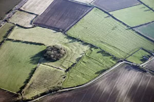
Bole Hill 28658_052Bowl barrow and lead mining, Bole Hill, Derbyshire, 2015. SK1075
Mining, Staffordshire 28661_035Mining, Staffordshire, 2015. SK0359
Ulnaby DMV 28655_021Ulnaby, Darlington. Earthwork remains of the deserted medieval village of Ulnaby, Darlington, 2015. NZ2217
Walworth DMV 28655_027Walworth, Darlington. Earthwork remains ofr the deserted medieval village at Walworth, Darlington, 2015. NZ2319
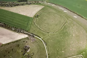
Chiselbury Camp 29526_013Chiselbury Camp Univallate Hillfort, Wiltshire, 2015
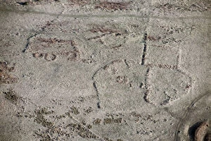
Sutton badges 29526_005Chalk Military Badges of the 7th (City of London) Battalion and the Royal Warwickshire Regiment, Near Sutton Down, Wiltshire, 2015
Sutton badges 29526_003Chalk Military Badge of the 7th (City Of London) Battalion (Shiny Seventh), Near Sutton Down, Wiltshire, 2015
Sutton Badges 33233_021Chalk Military Badges of the Royal Warwickshire Regiment and the 7th (City of London) Battalion, Near Sutton Down, Wiltshire, 2016
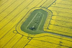
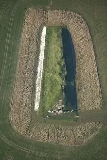
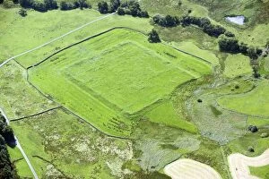
Woodhall Hall 28713_028Woodhall Hall Moated Site, Lincolnshire, 2015
Dolphenby 28498_037The Deserted Medieval Settlement earthwork of Dolphenby, ridge and furrow earthwork, Cumbria, 2013
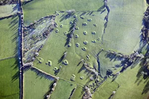
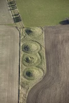
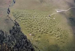
Mine shafts 28498_032Earthwork remains of Medieval or Post Medieval Mining, at least 30 circular spoil heaps with a central shaft, Near Sleagill, Cumbria, 2013
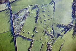
Mine shafts 28498_031Earthwork remains of Medieval or Post Medieval Mining, at least 30 circular spoil heaps with a central shaft, Near Sleagill, Cumbria, 2013
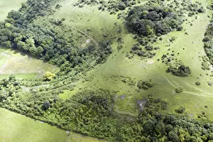
Bank Moor settlement 28497_018Romano British Settlement Earthwork, Bank Moor, Cumbria, 2013
Haresceugh Fell 28500_047Former Busk lime kiln and limestone quarry and Haresceugh Fell Medieval dispersed settlement comprising a stone-walled enclosure containing a stone-walled enclosure interpreted as a dwelling
Haresceugh Fell 28500_049Haresceugh Fell Medieval dispersed settlement comprising a stone-walled enclosure containing a stone-walled enclosure interpreted as a dwelling and a stock enclosure, Haresceugh Fell, Cumbria, 2013
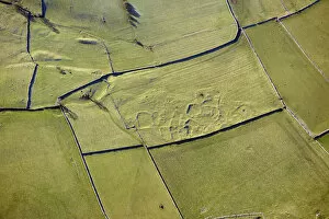
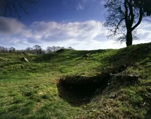
Combs Edge 28491_029Promontory Fort on Combs Edge, Derbyshire, 2013
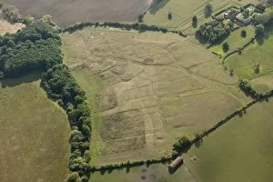
Burston 29183_027Burston Deserted Settlement, Buckinghamshire. The street pattern and building plots of the village are clearly visible. The residents are believed to have been evicted in 1488
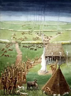
Windmill Hill, Avebury J860364WINDMILL HILL, AVEBURY, Wiltshire. Reconstuction drawing of the Neolithic site by Judith DOBIE
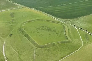
Uffington Castle 29701_028UFFINGTON CASTLE, Oxfordshire. Aerial view of the Iron Age hillfort
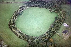
Cadbury Camp JEH_22046_038Cadbury Camp, Tickenham, Somerset. This Iron Age hillfort is thought by some to be the location of King Arthurs Camelot, although Cadbury Castle (South Cadbury) arguably has a stronger claim
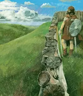
Iron Age man IC063_001Reconstruction drawing by Ivan Lapper depicting an Iron Age man standing beside a wooden palisade fence atop Liddington Castle Hillfort, Swindon
Hallaton Castle 27445_003Hallaton Castle, Leicestershire. Earthwork remains of a Norman motte and bailey accentuated by evening shadows
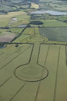
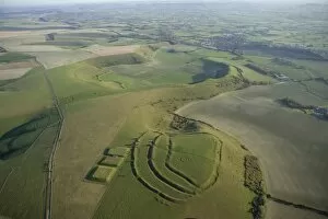
Thornborough Henges 28175_020Thornborough Henges, North Yorkshire. Three henges on the north bank of the River Ure, which form part of a wider ritual landscape including a cursus, mortuary enclosures and Bronze Age barrows
Four barrows 27611_030Four Barrows, near Aldbourne, Wilts. Prehistoric round barrows. Photographed in February 2013. SU2477/27
West Kennet 29570_019West Kennet Long Barrow, Avebury, Wiltshire. The neolithic burial mound surrounded by a field of yellow flowering crops. Aerial photograph taken in April 2015
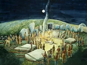
West Kennet Long Barrow J880279WEST KENNET LONG BARROW, AVEBURY, Wiltshire. Neolithic ceremony reconstruction drawing by Judith Dobie (English Heritage Graphics Team)
Bramber Castle N072005BRAMBER CASTLE, West Sussex. Aerial view
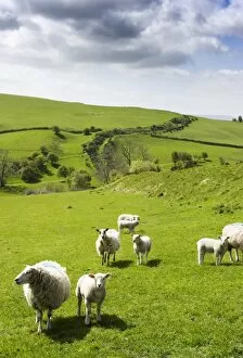
Offas Dyke, Herefordshire N090410OFFAs DYKE, Llanfair Hill, Herefordshire. General view, with sheep
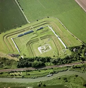
Richborough Roman Fort N070696RICHBOROUGH ROMAN FORT, Sandwich, Kent. Aerial view. Richborough, or Rutupiae was known to be a major naval base This shows the triple ditch defences of the early 3rd century fort surrounding
Windmill Tump Long Barrow K040090WINDMILL TUMP LONG BARROW, Rodmorton, Gloucestershire. General view
White Sheet Castle 24826_003WHITE SHEET CASTLE, White Sheet Hill, near Mere, Wiltshire ST804346. Aerial view of the countryside. Iron Age hill fort with one rampart overlooking the escarpment
West Kennet Long Barrow N071891WEST KENNET LONG BARROW, AVEBURY, Wiltshire. Aerial view showing the standing stones outside the entrance
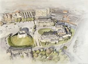
Cliffords Tower, York J970191CLIFFORDs TOWER, York, North Yorkshire. Reconstruction drawing. Contemporary aerial view by Peter Dunn (English Heritage Graphics Team). clifford
Grimes Graves N070076GRIMES GRAVES, Norfolk. Neolithic flint mine. An aerial view of pock-marked landscape
Badbury Rings EAW010546Badbury Rings and surrounding landscape from the north-east. Hillfort, East Dorset. 30th August 1947
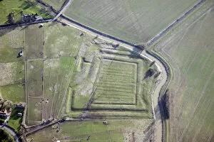
Habitancum 28796_008Habitancum Roman Fort, Risingham, Northumberland. Earthworks show the remains of the defensive ditches and the outlines of many of the buildings of the Roman fort