mail_outline sales@mediastorehouse.com
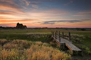
Fairfield Church, Romney Marsh N060981FAIRFIELD CHURCH, Romney Marsh, Kent. View of the footbridge looking across the meadow towards Fairfield Church at sunset
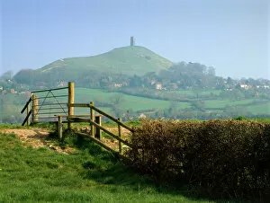
Glastonbury Tor K020561GLASTONBURY TOR, Somerset. Looking north from east across stile towards distant tor
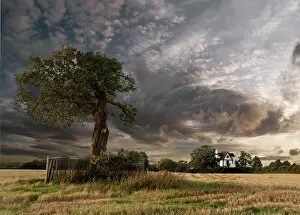
The Royal Oak and Boscobel House N090358BOSCOBEL HOUSE, Brewood, Staffordshire. The Royal Oak and Boscobel House with dramatic sky
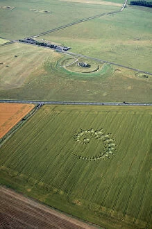
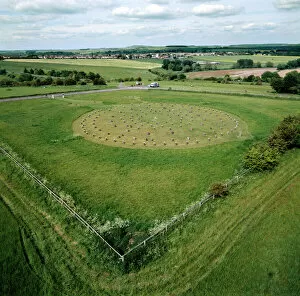
Stonehenge and crop circle N960002STONEHENGE, Wiltshire. Aerial view of Stonehenge with crop circle in the foreground
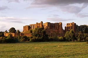
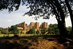
Kenilworth Castle K981291KENILWORTH CASTLE, Warwickshire. General view from the South West at sunset
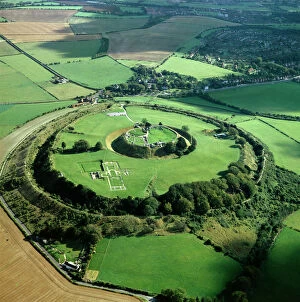
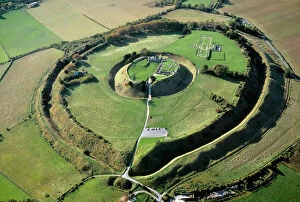
Old Sarum K000139OLD SARUM, Wiltshire. Aerial view
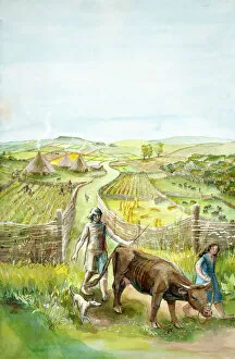
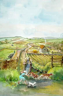
Rural landscape J910032Reconstruction drawing of imaginary rural landscape, 2000 BC by Judith Dobie, English Heritage Graphics Team. Farming
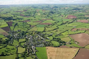
North Yorkshire landscape N100504KETTLEWELL, North Yorkshire. Panoramic view of field barns in the landscape
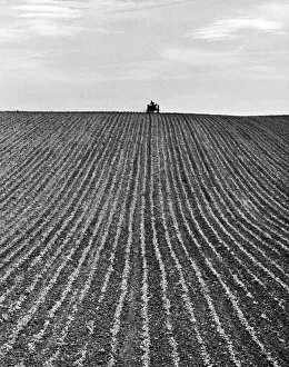
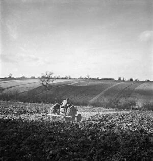
Ploughing OP04506A newly ploughed field near Aylesbury, Buckinghamshire. The farmer on his tractor is sillouhetted on the horizon. Photographed by John Gay during 1950s 1960s
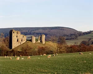
Clun Castle K060184CLUN CASTLE, near Ludlow, Shropshire. General view of the castle showing its picturesque surroundings and extensive earthworks
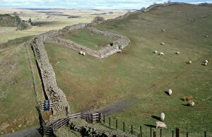
Hadrians Wall, Cawfields, Milecastle 42 K960046HADRIANs WALL: CAWFIELDS, Northumberland. Milecastle 42. General view
Avebury Stone Circle N070083AVEBURY STONE CIRCLE, Wiltshire. Aerial view
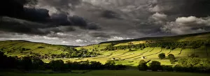
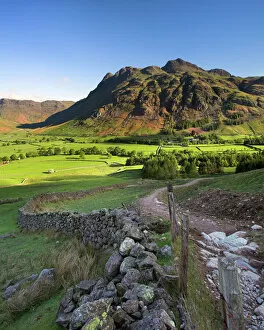
Early light on the Langdale Pikes, Cumbria N060979LANGDALE PIKES, Lake District National Park, Langdale, Cumbria. Mountain in the morning sunlight with footpath and wall
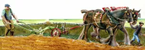
Ploughing J910039Reconstruction drawing of ploughing in Victorian times by Judith Dobie, English Heritage Graphics Team. Farming
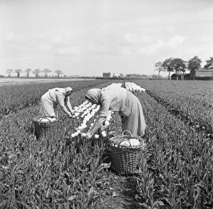
Tulip picking, Lincolnshire a98_09310Fulney, Spalding, Lincolnshire. The tulip was introduced into Europe in the 16th century from Turkey and takes its name from the French word for turban. It became an important cash crop
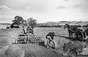
Disc harrowing, Lincolnshire a98_09683Disc harrowing near Honington, Lincolnshire. The mechanisation of agricultural practices made farming more intensive and productive
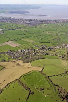
Brent Knoll 24572_017BRENT KNOLL HILLFORT, Somerset, ST340509 (RSM 24001). Aerial view. An Iron Age fort with multiple ramparts on a hill overlooking the Somerset Levels
Stonehenge and The Avenue N070631STONEHENGE, Wiltshire. Oblique aerial view including Stonehenge and The Avenue
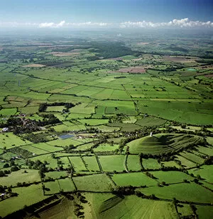
Glastonbury Tor and surrounding countryside 23697_05GLASTONBURY TOR, Somerset. Aerial view of the tor and surrounding countryside, reputedly the Isle of Avalon
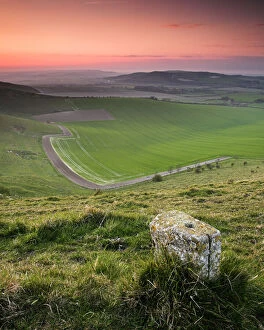
South Downs waymarker N071744SOUTH DOWNS, East Sussex. Waymarker along downland path
Ploughing a076208A field in Hertfordshire, being ploughed by a man on a tractor. Photographed by John Gay. Date range: 1950-1959
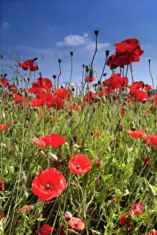
Poppies N060980Low-level view of poppies in full bloom against blue-sky backdrop. Near Lullingstone, Shoreham, Kent. Poppy flower
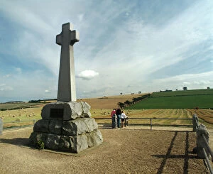
Flodden Field K940715FLODDEN FIELD, Northumberland. Site of battle of 1513. Memorial cross
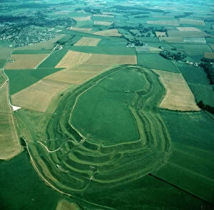
Maiden Castle K940060MAIDEN CASTLE, Dorset. Aerial view
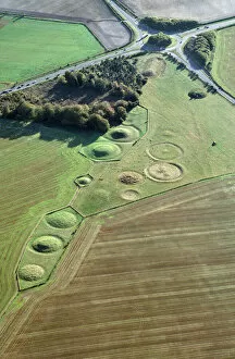
Winterbourne Stoke Barrows N930001WINTERBOURNE STOKE BARROWS, Wiltshire. Aerial view of the Winterbourne Stoke cemetery showing Bronze Age round barrows with the Neolithic Long Barrow top right, next to the roundabout
Old Sarum N070651OLD SARUM, Wiltshire. Aerial view
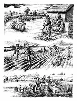
Medieval farming N070208WHARRAM PERCY MEDIEVAL VILLAGE, North Yorkshire. Reconstruction drawing by Peter Dunn (English Heritage Graphics Team) showing villagers shearing sheep and planting and harvesting crops
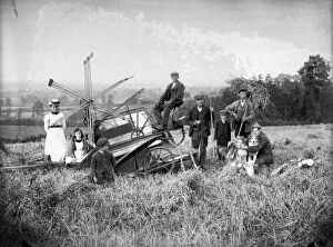
Harvest a97_05926Harvesting with a mechanical harvester near Hellidon, Northamptonshire. Alfred Newton and Son July 1902
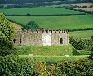
Restormel Castle K010870RESTORMEL CASTLE, Cornwall. View from the South West
Kenilworth Castle K900477KENILWORTH CASTLE, Warwickshire. The Castle from across the mere
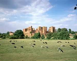
Kenilworth Castle J900445KENILWORTH CASTLE, Warwickshire. A view from the south with cattle / cows grazing in the foreground
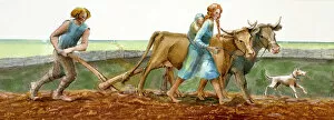
Ploughing J910038Reconstruction drawing of family ploughing during the Iron Age by Judith Dobie, English Heritage Graphics Team. Farming
Rural landscape J910033Reconstruction drawing of imaginary rural landscape, AD 200 Romano-British by Judith Dobie, English Heritage Graphics Team. Farming
Country road a081285A long straight country road near Stamfordham, Northumberland. Photographed by John Gay during the 1950s
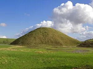
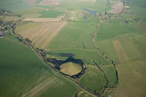
Silbury Hill N070124SILBURY HILL, Avebury, Wiltshire. View taken from the information board to the west
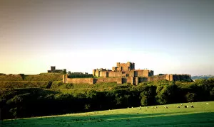
Dover Castle J960158DOVER CASTLE, Kent. View from the North East
Watling Street 27371_006Hockliffe, Bedfordshire. The Roman road of Watling Street provides the principle axis, with roads to Woburn (to the left) and Leighton Buzzard (to the right)
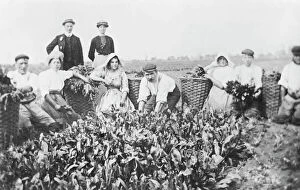
Woad production, Algarkirk, Lincolnshire NMR02_01_00009Algarkirk, Lincolnshire. A group of man and women cropping woad and collecting it in large wicker baskets. The earliest woad production in Britain dates from the Iron Age
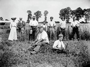
Harvest time, Lower Cadsden, Buckinghamshire a97_05316LOWER CADSDEN, Princes Risborough, Buckinghamshire. View of people in a field, including farm workers taking a break from harvesting, with a smart lady and gentleman
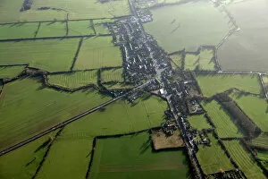
Clun 24753_041CLUN, Shropshire. Aerial view of the countryside. A small town nestling in the Shropshire Hills Area of Outstanding Natural Beauty. The remains of Clun Castle can be made out to the right of the town
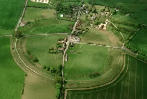
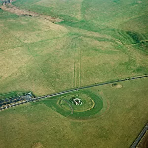
Woodhenge K040326WOODHENGE, Amesbury, Wiltshire. Aerial view of the site looking North East. Part of the Stonehenge World Heritage Site
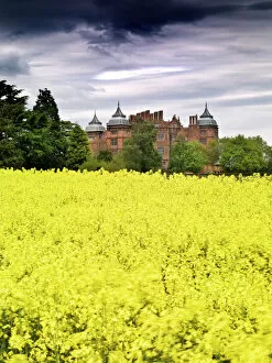
Westwood House N080957WESTWOOD HOUSE, Droitwich, Worcestershire. Beyond a field of yellow flowering crops
Farm wagons, Norfolk a98_15161Freethorpe, Norfolk. These two traditional horse-drawn farm wagons would still have been in regular use when this photograph was taken. Behind, a portable elevator was used to build the haystacks
Silbury Hill and Avebury N071892SILBURY HILL, AVEBURY, Wiltshire. Aerial view with the henge and stone circle at Avebury top right
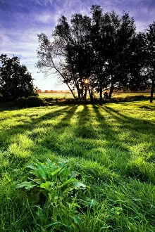
Backlit tree and meadow at sunrise N061020English countryside. Backlit trees and meadow at sunrise
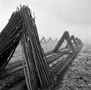
Hop poles a079959Hop poles, stacked in tent shapes, arranged in lines. Taken in Kent. Photographed by John Gay during the 1950s
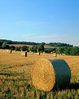
Haywheels J070054KENT COUNTRYSIDE, View of hay bails / haywheels in a field near Farningham
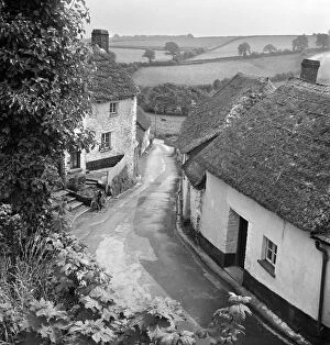
English village a079532A view from an elevated position over an unidentified village lane, showing small whitewashed and thatched cottages either side of the road and a rural landscape of fields beyond