mail_outline sales@mediastorehouse.com
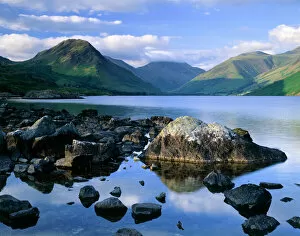
Wast Water, Lake District J060228WAST WATER, Lake District, Cumbria. Showing the fell of Yew Barrow in the distance
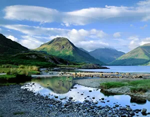
Wast Water, Lake District J060226WAST WATER, Lake District, Cumbria. A view over Wast Water showing the fell of Yew Barrow in the distance
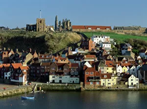
Whitby K011127WHITBY, North Yorkshire. View looking across the harbour to Old Town from West Cliff Abbey hill
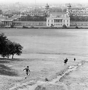
The Old Royal Naval College a065204OLD ROYAL NAVAL COLLEGE, Greenwich, London. View from a hill in Greenwich Park, looking north-west across the park towards the Queens House and the Old Royal Naval College
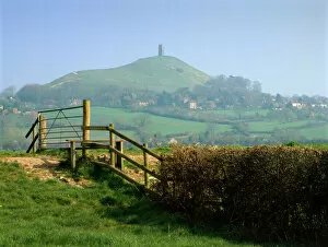
Glastonbury Tor K020561GLASTONBURY TOR, Somerset. Looking north from east across stile towards distant tor
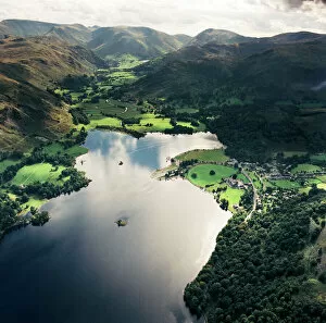
Ullswater EAW587876ULLSWATER, Lake District, Cumbria. Aerial view of Ullswater and Patterdale. Aerofilms Collection (see Links)
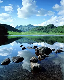
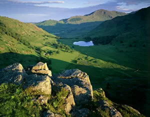
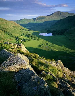
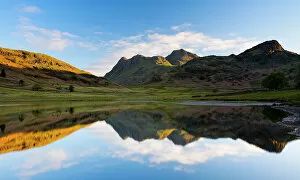
Blea Tarn, Lake District J060231BLEA TARN, Lake District, Cumbria. View across the tarn showing the Langdale Pikes and Side Pikes beyond
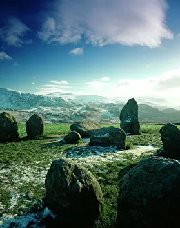
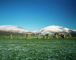
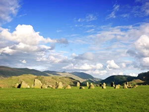
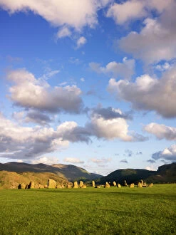
Castlerigg Stone Circle J850518CASTLERIGG STONE CIRCLE, Cumbria. View to South West of part of the stone circle with snow covered hills beyond
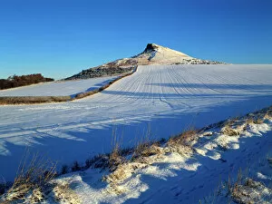
Roseberry Topping K011542ROSEBERRY TOPPING, North Yorkshire. Snow view of hill on North Yorkshire moors
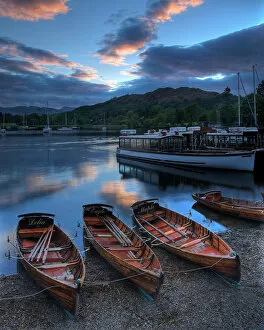
Rowing boats at Ambleside N060978LAKE WINDERMERE, Lake District National Park, Ambleside, Cumbria. Rowing boats at sunset
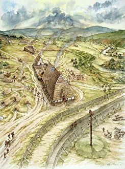
Yeavering J910320YEAVERING, Northumberland (also know as Ad Gefrin). Reconstruction drawing of Saxon Yeavering AD 627, by Peter Dunn (English Heritage Graphics Team)
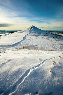
Roseberry Topping N100024ROSEBERRY TOPPING, North Yorkshire. Snow view of hill on North Yorkshire moors with animal tracks
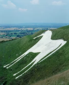
Westbury White Horse K022100BRATTON CAMP & WHITE HORSE, Westbury Hill, Wiltshire. View of the Westbury White Horse from the south west. Cut into the hillside in 1778, this replaced an older horse
Cissbury Ring DP147648Cissbury Ring, Findon, South Downs, West Sussex. View towards the Iron Age hill fort. List entry Number: 1015817
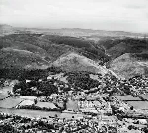
Church Stretton EAW017336The Long Mynd and the town, Church Stretton, Shropshire, from the south-east. Photographed by Aerofilms Ltd in July 1948
Great Malvern HAW_9424_12GREAT MALVERN, Malvern, Worcestershire. Aerial view taken by Harold Wingham, 26th November 1951
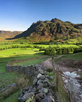
Early light on the Langdale Pikes, Cumbria N060979LANGDALE PIKES, Lake District National Park, Langdale, Cumbria. Mountain in the morning sunlight with footpath and wall
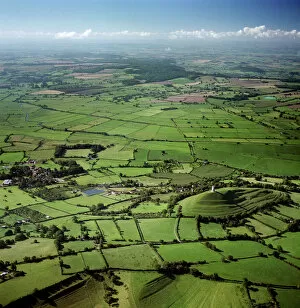
Glastonbury Tor and surrounding countryside 23697_05GLASTONBURY TOR, Somerset. Aerial view of the tor and surrounding countryside, reputedly the Isle of Avalon
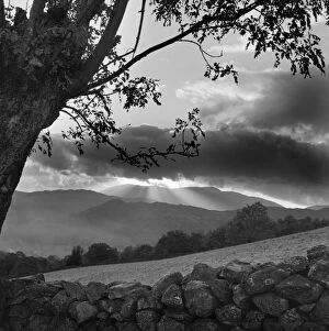
Cumbrian view a080561Lake district landscape, Cumbria. Sun behind dark cloud with tree and stone wall in the foreground. Photographed by John Gay c.1956
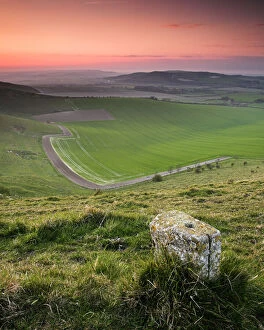
South Downs waymarker N071744SOUTH DOWNS, East Sussex. Waymarker along downland path
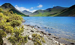
Wast Water, Lake District N061018WAST WATER, Lake District National Park, Cumbria. Shoreline of the lake with gorse bushes and mountains in the distance. View towards Scafell
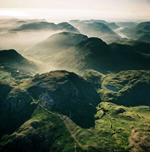
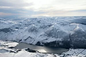
Scafell EAW587429SCAFELL, Cumbria. Aerial view of Great End, 910 metres (2984 ft), the most northerly mountain in the Scafell chain, in the Lake District National Park. Aerofilms Collection (see Links)
Castlerigg Stone Circle J850519CASTLERIGG STONE CIRCLE, Cumbria. General view from the south west
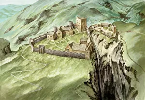
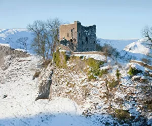
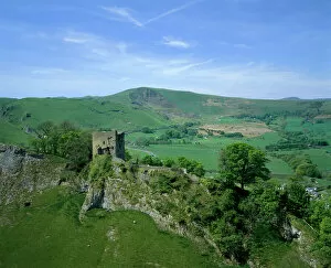
Peveril Castle J980125PEVERIL CASTLE, Derbyshire. Aerial view reconstruction drawing of the castle in the 14th century by Peter Urmston
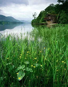
Ullswater Boat House, Lake District J060232ULLSWATER BOAT HOUSE, Lake District, Cumbria. General view of the lake and boathouse
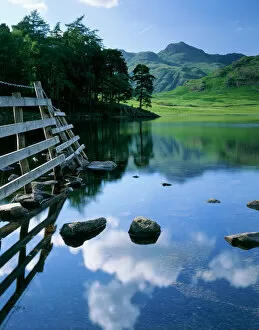
Blea Tarn, Lake District J060236BLEA TARN, Lake District, Cumbria. A view across Blea Tarn showing reflections of the clouds on the waters surface
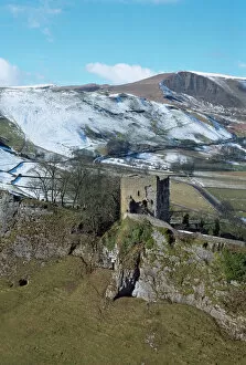
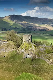
Peveril Castle K060036PEVERIL CASTLE, Castleton, Peak District, Derbyshire. A view from the South East looking across Cavedale towards the Keep with Mam Tor in the distance
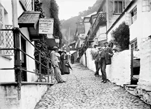
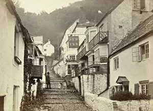
Clovelly BB73_07823High Street, Clovelly, Devon. Looking up the cobbled main street in Clovelly, showing the New Inn on the north side of the street, with people leaning against the walls of the buildings
Peveril Castle DP175579Peveril Castle, Market Place, Castleton, Derbyshire. Keep and Cavedale with Iron Age hillfort, Mam Tor, beyond. View from east
Buttermere 28980_007Buttermere, Cockermouth, Lake District, Cumbria. A view of the lake from the North with snow on the ground
Clovelly, Devon OP04926CLOVELLY, Torridge, Devon. A view up the main cobbled street in Clovelly, with a donkey on the cobbles and a woman standing on the terrace of the New Inn talking to a man below
Peveril Castle N100487PEVERIL CASTLE, Derbyshire. Snow scene
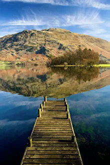
Ullswater, Lake District N100017ULLSWATER, Lake District, Cumbria. A landing stage jetty with reflection of Place Fell in the lake
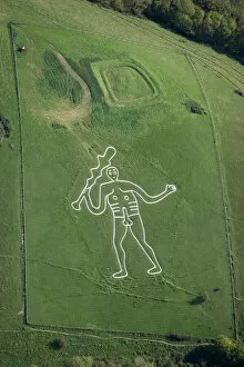
Cerne Abbas Giant 26127_047CERNE ABBAS GIANT, Dorset, in the care of the National Trust. Aerial view. The giants origin is uncertain, although one theory is that he was cut to represent " Englands Hercules"
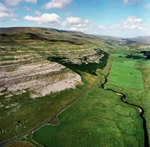
Yorkshire Dales EAW603550KELD HEAD SCAR, North Yorkshire. Aerial photograph of Kingsdale, near Thornton Force in the Yorkshire Dales. The cliffs reveal the Great Scar Limestone
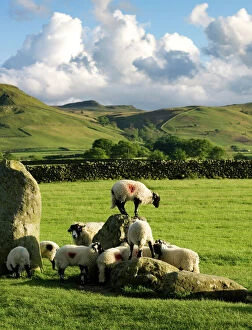
Castlerigg Stone Circle N071052CASTLERIGG STONE CIRCLE, Cumbria. Sheep climbing on the historic standing stones
Castlerigg Stone Circle N071051CASTLERIGG STONE CIRCLE, Cumbria. General view of the stones showing the fells in the distance
Peveril Castle K041035PEVERIL CASTLE, Castleton, Peak District Derbyshire. General view from the South East looking across Cavedale towards the Keep with Mam Tor in the distance
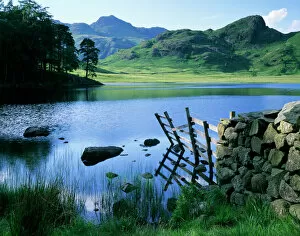
Side Pike, Lake District J060227SIDE PIKE, Lake District, Cumbria. View of Blea Tarn, Blea Moss and the Tilberthwaite Fells
Side Pike, Lake District J060230SIDE PIKE, Lake District, Cumbria. View from Side Pike showing Blea Tarn and Tilberthwaite fells in the background
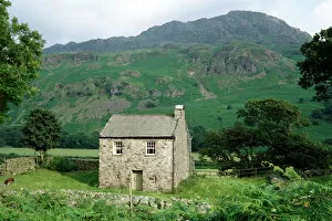
Cumbrian Fells K960908BIRD HOW, Eskdale, Cumbria. Farmhouse with the Cumbrian fells beyond
Blea Tarn, Lake District N061019BLEA TARN, Lake District National Park, Cumbria. The Langdale Pikes reflected in Blea Tarn
Blea Tarn, Lake District J060235BLEA TARN, Lake District, Cumbria. View of the tarn with the Langdale Pikes in the distance
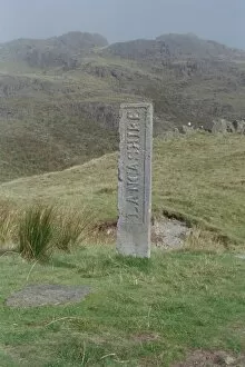
Boundary StoneDated 1816 and located on the site of the three shire stones, Cumbria. IoE 75841
Castlerigg Stone Circle N071056CASTLERIGG STONE CIRCLE, Cumbria. General view of the stone circle showing the fells in the background
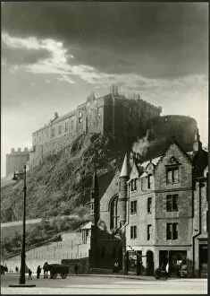
Edinburgh Castle DIX02_01_164EDINBURGH CASTLE, EDINBURGH, SCOTLAND. Edinburgh Castle viewed from the Grassmarket
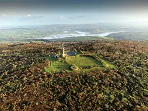
Kit Hill Folly DP348625Kit Hill, Folly, Stokeclimsland, Cornwall. Oblique aerial view from the south, taken using a drone, showing the Folly at Kit Hill
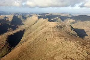
Cumbrian fells 28690_075Yoke, Ill Bell, Low Mere Greave and High Mere Greave, Cumbria, 2015. NY4305