mail_outline sales@mediastorehouse.com
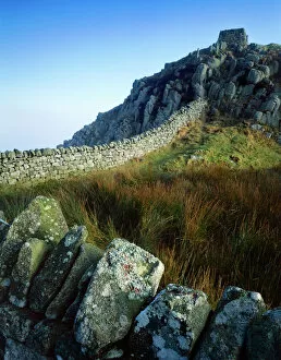
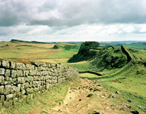
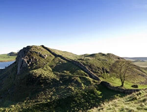
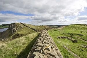
Hadrians Wall J080005HADRIANs WALL, Northumberland. Cuddys Crags, near turret 37A. The morning light illuminates the wall with Broomlee Lough in the distance. hadrian
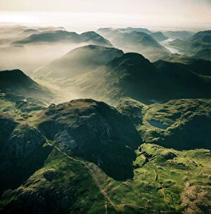
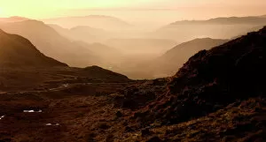
Scafell Pikes AFL03_aerofilms_ac587428SCAFELL, Cumbria. Aerial photograph showing Scafell Pikes and the Lake District. Aerofilms Collection (see Links)
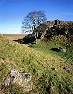
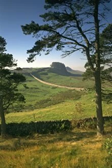
Hadrians Wall: Sycamore Gap J080007HADRIANs WALL, Northumberland. Steel Rigg, by Milecastle 39. The wall winds past a mature Sycamore tree, close to a well, with large foreground rock and blue sky. hadrian
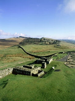
Hadrians Wall K890059HADRIANs WALL: HOUSESTEADS FORT, Northumberland. View of the North East quadrant from the West. hadrian
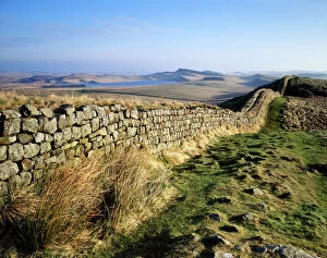
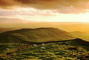
Hadrians Wall N070307HADRIANs WALL, Northumberland. View looking west from Shield on the Wall. Sheep grazing at sunset. hadrian
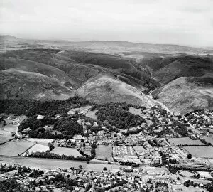
Church Stretton EAW017336The Long Mynd and the town, Church Stretton, Shropshire, from the south-east. Photographed by Aerofilms Ltd in July 1948
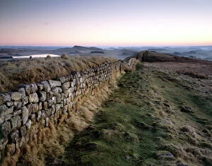
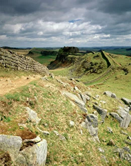
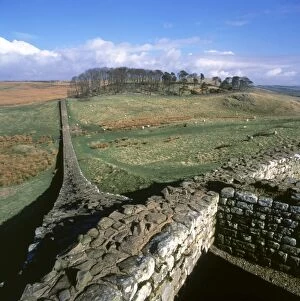
Hadrians Wall : Cuddys Crags J080003HADRIANs WALL, Northumberland. Cuddys Crags, near turret 37A. The morning sun breaks through to illuminate the lichens and grass around the crag. hadrian
Hardknott Roman Fort EAW589036HARDKNOTT, Cumbria. Aerial photograph showing the well-placed Roman fort on a promontory overlooking the Lake District (NGR: NY218015). Aerofilms Collection (see Links)
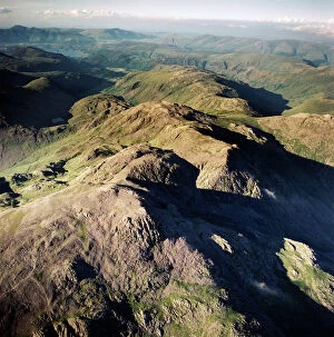
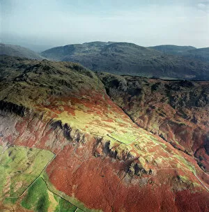
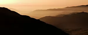
Scafell EAW587429SCAFELL, Cumbria. Aerial view of Great End, 910 metres (2984 ft), the most northerly mountain in the Scafell chain, in the Lake District National Park. Aerofilms Collection (see Links)
Hadrians Wall J910099HADRIANs WALL, Northumberland. View from Cuddys Crag looking east. hadrian
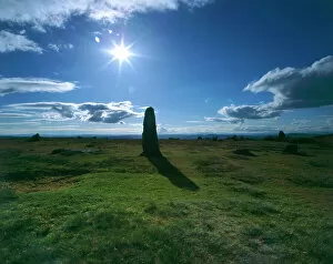
Mitchells Fold Stone Circle K040517MITCHELLs FOLD STONE CIRCLE, Shropshire. View looking into the sun with stone silhouetted against the sky
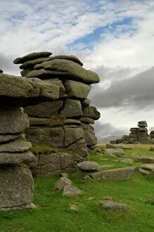
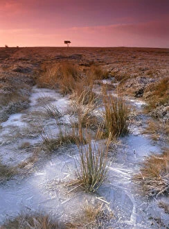
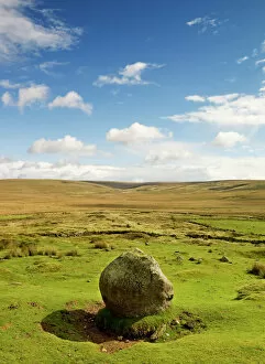
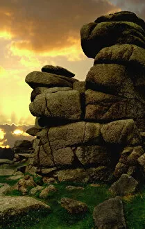
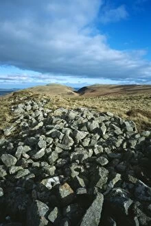
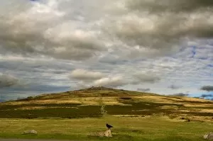
Dartmoor N040025DARTMOOR, Devon. Great Staple Tor and clitterfield
Hadrians Wall N060719HADRIANs WALL, Northumberland. A view along the wall at Sycamore Gap near Steel Rigg. hadrian
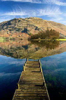
Ullswater, Lake District N100017ULLSWATER, Lake District, Cumbria. A landing stage jetty with reflection of Place Fell in the lake
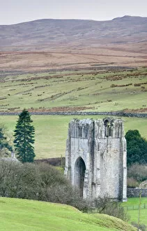
Shap Abbey N090047SHAP ABBEY, Cumbria. View of the West Tower and surrounding moorland
Hadrians Wall, Hotbank Crags J080009HADRIANs WALL, Northumberland. The path along Hotbank Crags at dawn, with Greenlee Lough in the distance. hadrian
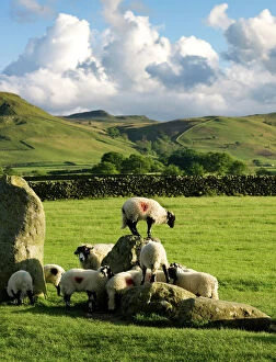
Castlerigg Stone Circle N071052CASTLERIGG STONE CIRCLE, Cumbria. Sheep climbing on the historic standing stones
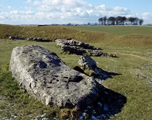
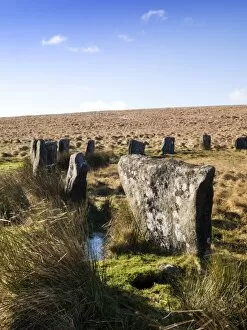
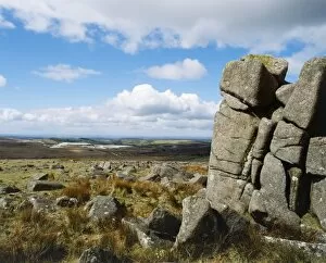
Peters Stone, Derbyshire K031244PETERs STONE, Peak District, Derbyshire. View of the large limestone outcrop and surrounding countryside, Cressbrook Dale
Hardknott Pass, Cumbria N081058HARDKNOTT PASS, Cumbria. General view of landscape from summit of Hardknott Pass, with Hardknott Roman Fort
Hardknott Pass, Cumbria N081057HARDKNOTT PASS, Lake District, Cumbria. Landscape views with Roman fort in far distance
Egton Moor K100005EGTON MOOR, North Yorkshire. View of the moor between Goathland and Egton Bridge. Ice forms on an expanse of water with tree on the horizon
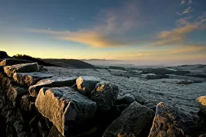
Cleveland Hills N100021CLEVELAND HILLS, North York Moors National Park. Early morning view from Great Ayton Moor over a drystone wall, looking across frost-covered fields and moorland
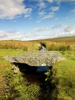
Stone bridge, Dartmoor N071837DARTMOOR, Devon. General view of leat and stone bridge
Merrivale Prehistoric Settlement N071133MERRIVALE PREHISTORIC SETTLEMENT, Dartmoor, Devon. General view of stone row avenue against an overcast sky
Dartmoor N071130DARTMOOR, Devon. General view of the landscape near Whiteworks Tin Mine
Arbor Low Stone Circle K060169ARBOR LOW STONE CIRCLE, Derbyshire. Detailed view of the neolithic monument showing the Derbyshire Dales in the background
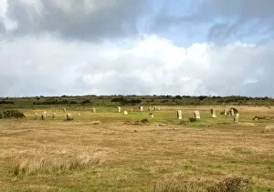
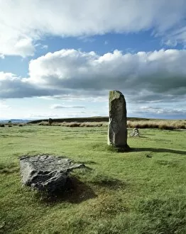
Mitchells Fold Stone Circle K040514MITCHELLs FOLD STONE CIRCLE, Stapeley Hill, Shropshire. View of part of the Bronze Age stone circle
Dartmoor N040031DARTMOOR, Devon. Sun setting behind clouds at Great Staple Tor
Hadrians Wall J910098HADRIANs WALL, Northumberland. The view from Cuddys Crag looking east. hadrian
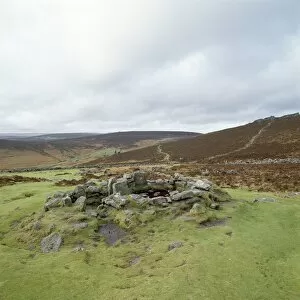
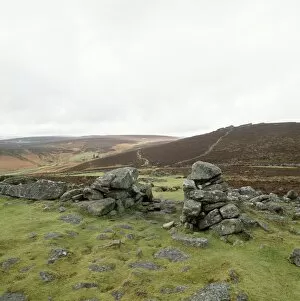
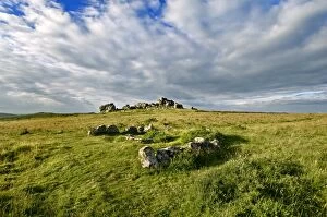
Grimspound K930029GRIMSPOUND, Dartmoor, Devon. General view of the remains of a Bronze Age settlement
Grimspound K930028GRIMSPOUND, Dartmoor, Devon. General view of the remains of a Bronze Age settlement
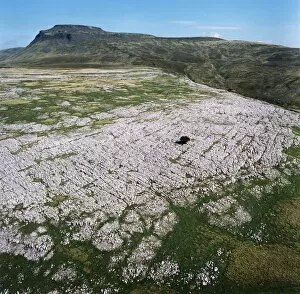
Ingleborough Common EAW603463Ingleborough Common, Yorkshire Dales. Aerial view of a limestone pavement - a natural karst landform consisting of a flat incised surface of exposed limestone. Aerofilms Collection (see Links)
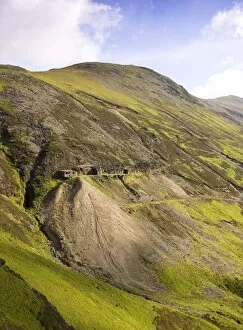
Force Crag Mine DP054906FORCE CRAG MINE, Coledale Valley, Braithwaite, Keswick, Cumbria. Hillside location of High Force Cross Cut, viewed from the south. Lake District landscape
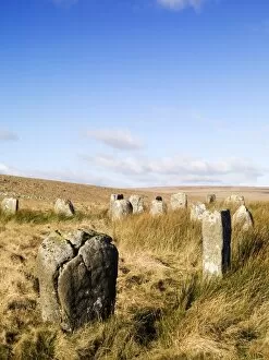
Grey Wethers Stone Circles N081130GREY WETHERS STONE CIRCLES, Dartmoor, Devon. View of the stones
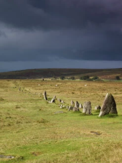
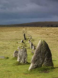
Hurlers Stone Circles N061067HURLERS STONE CIRCLES, Cornwall. General view of the late Neolithic or early Bronze Age stone circles. Reputed to be the remains of men petrified for playing hurling on a Sunday
Cumbrian landscape N080905KIRKSTONE SLATE QUARRY, Lake District, Cumbria. View of an isolated tree found close to the quarry
Hound Tor, Cist and Cairn Circle N090115HOUND TOR, Devon. View towards Hound Tor showing the Cist and Cairn Circle
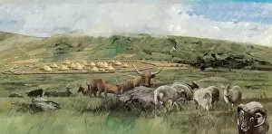
Grimspound J940467GRIMSPOUND, Dartmoor, Devon. Reconstruction drawing of the village and surrounding countryside by Ivan Lapper. The best known of many Dartmoor prehistoric settlements
Grey Wethers Stone Circles N080727GREY WETHERS STONE CIRCLES, Dartmoor, Devon. View of the stones
Hadrians Wall N060989HADRIANs WALL, Northumberland. General view of wall at Steel Rigg. hadrian
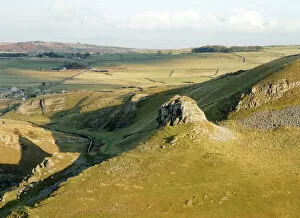
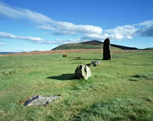
Monday Cleugh K040921MONDAY CLEUGH, Akeld, Northumberland. View from the West of the ramparts of the Iron Age hillfort
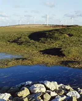
St Breock Wind Farm K050257ST BREOCK WIND FARM, St Breock Downs, Cornwall. View looking towards the wind turbines with pond and rocks in the foreground
View from Little Trowlesworthy Tor K041102LITTLE TROWLESWORTHY TOR, Shaugh Prior, Devon. View looking towards quarry
Merrivale Prehistoric Settlement N071132MERRIVALE PREHISTORIC SETTLEMENT, Dartmoor, Devon. General view of stone row avenue against an overcast sky
Hadrians Wall K890052HADRIANs WALL: HOUSESTEADS ROMAN FORT (VERCOVICIUM), Northumberland. North east view of the forts corner and wall. hadrian
Mitchells Fold Stone Circle K040516MITCHELLs FOLD STONE CIRCLE, Shropshire. View of part of the Bronze Age stone circle
Dartmoor N040023DARTMOOR, Devon. Great Staple Tor and surrounding clitterfields
Hadrians Wall K940730HADRIANs WALL, Northumberland. View towards Housesteads Roman Fort. hadrian