mail_outline sales@mediastorehouse.com
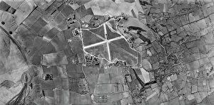
Wroughton, Wiltshire US_7PH_GP_LOC209_V_5004WROUGHTON, Wiltshire. This vertical photograph (taken in 1944 by the US Army Air Force) shows Barbury Castle hillfort, RAF Wroughton (centre), and the village of Wroughton
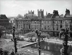
Bomb damage, Exeter BB42_00712Exeter, Devon. A view looking towards the remains of the terrace of houses comprising numbers 25-36 Southernhay West showing bomb damage
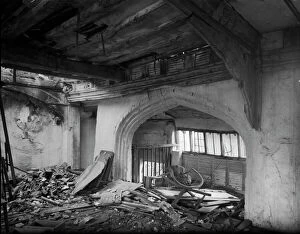
The Great Hall Norwich, 1942 a42_03739The Great Hall, Oak Street, Norwich, Norfolk. The interior of a first floor room in The Great Hall at Flowerpot Yard showing bomb damage
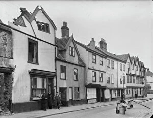
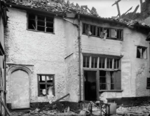
Oak Street Norwich, 1942 a42_03736Oak Street, Norwich, Norfolk. The houses at 110 to 98 Oak Street showing bomb damage
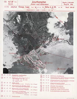
Luftwaffe targets in Southampton LFT01_01_01Southampton Docks, City Of Southampton. This Luftwaffe index sheet dates between 1938 and March 1939. It is marked Geheim ( secret)
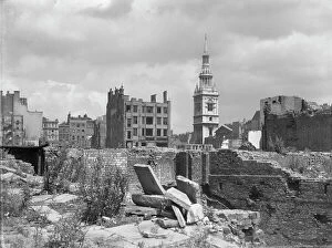
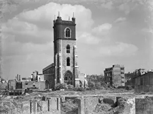
St Mary-le-Bow CXP01_01_082St Mary-le-Bow Church, Cheapside, City of London. A view looking north-east across a bomb damaged landscape towards St Mary-le-Bow Church
The Great Hall Norwich, 1942 a42_03738The Great Hall, Oak Street, Norwich, Norfolk. The south elevation of The Great Hall at Flowerpot Yard showing bomb damage
Horsefair Birmingham, 1941 a42_00440Colonial Buildings, 7 Horsefair, Ladywood, Birmingham. The premises of the Birmingham Tube and Fittings Company Limited on the corner of Horsefair and Windmill Street
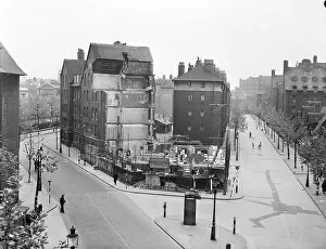
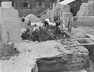
Repairing Milbank Estate P_H00261_004Millbank Estate, Ruskin House, Herrick Street, Millbank, City of Westminster, Greater London. View from the north of Ruskin House on the Millbank Estate
Repairing Milbank Estate P_H00261_001Millbank Estate, Ruskin House, Herrick Street, Millbank, City of Westminster, Greater London. An elevated view of Ruskin House on the Millbank Estate
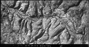
Teign Valley US_7PH_GP_LOC118_V_5046Teign Valley, Devon, photographed by an aircraft of the United States Eighth Air Force's 7th Photographic Reconnaissance Group on 22 December 1943
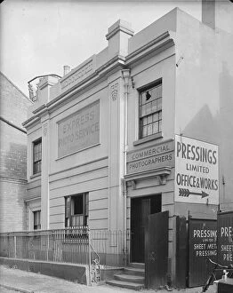
Cow Lane Coventry, 1941 a42_00357Baker Billing and Crows Charity School, Cow Lane, Coventry. The front elevation of Baker, Billing and Crows Charity School on Cow Lane showing the entrance to Pressings Limited Cow Lane Works
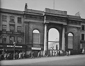
Market Hall, Birmingham, 1941 a42 / 00726The High Street elevation of Market Hall showing damage caused by an incendiary attack. Bull Ring, Birmingham. Photographed by G B Mason for the National Buildings Record, 1941
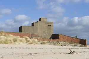
Blyth blockhouse DP087767Former military structure, Links Road, Blyth, Northumberland. Concrete blockhouse and observation post at the harbour entrance
Mulberry Harbour 24688_027Two blocks of Mulberry Harbour, Portland Harbour, Dorset. This modular design enabled two complete prefabricated harbours to be towed across the channel
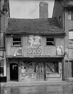
Coventry 1941 a42_00337The bomb damaged front elevation of 4 Gosford Street, Coventry. Photographed by G B Mason, 1941. Oxo poster advertisement
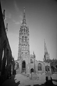
Coventry Cathedral UXC01_01_01_0007_07Ruined Cathedral Church of St Michael, Bailey Lane, Coventry, Coventry, Coventry. A view of the spire of the ruined St Michaels Cathedral Church, seen from inside the ruins
Prefabricated hospital med01_01_0643Mount Vernon Hospital, Rickmansworth Road, Hillingdon, Greater London. Ministry of Health new hutted hospitals. A view of the ends of the new hutted hospital being built at Mount Vernon
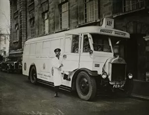
Mobile first aid post MED01_01_0220A bus which has been converted into an A.R.P. mobile first aid post. Converted buses were first used in September 1939. Some could still be used as ordinary buses
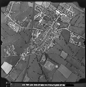
Moreton-in-Marsh US_7GR_LOC349_RP_3041Moreton-in-Marsh, Gloucesterhsire. Photographed by the USaF early in 1944, prior to D-Day, with barracks, truck parks and Sherman tanks parked in the main street
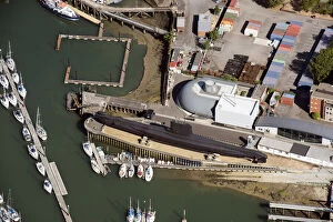
HMS Alliance 33563_041Royal Navy Submarine Museum, Gosport, Hampshire, 2018. HMS Alliance, a Second World War submarine. SZ6299
St Giles Cripplegate CXP01_01_080St Giles Cripplegate, Fore Street, City of London. A view looking south-east across a bomb damaged landscape towards St Giles Cripplegate Church
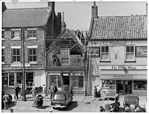
High Street Sutton Coldfield, 1942 a42_03367High Street, Sutton Coldfield, Birmingham. The front elevation of 20-24 High Street, including the premises of Boots the Chemists
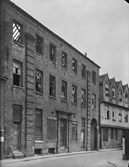
Norfolk Iron Works Norwich, 1942 a42_03733Norfolk Iron Works, Coslany Street, Norwich. The front elevation of 24 Coslany Street showing bomb damage, with number 22 visible in the background
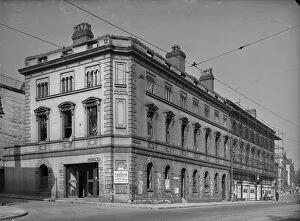
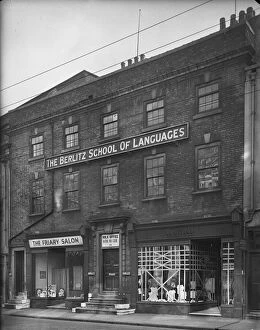
Friar Gate Derby, 1941 a42_00903115A - 117A Friar Gate, Derby. The exterior of 115A-117A Friar Gate, premises of Wendy (115A), The Berlitz School of Languages (116) and The Friary Salon (117)
Market Hall Birmingham, 1941 a42_00727Market Hall, Worcester Street, Bull Ring, Birmingham. Construction workers beside a traction engine inside the bombed out shell of the Market Hall. The former Market Hall dated from the 1830s
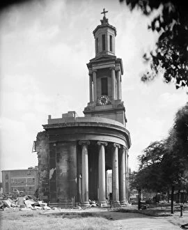
St Thomas Church Birminghma, 1941 a42_00588St Thomass Church, Bath Row, Lee Bank, Birmingham. The tower and portico of St Thomass Church viewed from the north showing bomb damage
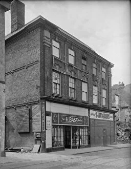
Fleet Street Coventry, 1941 a42_005335 - 5A Fleet Street, Coventry. The exterior of 5 and 5A Fleet Street, premises of H E Bass, Furrier and Simmons, Drapers. Evidence of damage caused by air raids can be seen to adjacent buildings
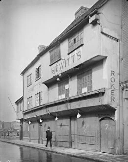
Much Park Street Coventry, 1941 a42_003628 - 10 Much Park Street, Coventry. Exterior view showing a policeman walking past the front elevation of 8-10 Much Park Street, premises of C. G. Hewitt
Little Park Street Coventry, 1941 a42_00356Court 20, Little Park Street, Coventry. The exterior of numbers 5 and 6, Court 20, accessed between 92 and 93 Little Park Street, showing the roof covered by tarpaulin
Little Park Street Coventry, 1941 a42_00353Court 16, Little Park Street, Coventry. The houses of Court 16 at the east side of Little Park Street showing damage caused by air raids
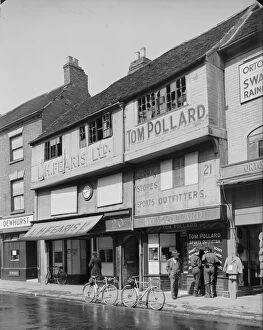
Jordan Well Coventry, 1941 a42_0033920 - 21 Jordan Well, Coventry. The exterior of 20 and 21 Jordan Well, premises of L H Fearis Ltd. and Tom Pollard, showing damage to the upper storey windows
New Street Coventry, 1941 a42_00327New Street, Coventry. The exterior of 30 New Street with a woman standing in the doorway of the house holding a baby and the windows boarded as a result of bomb damage
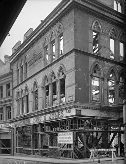
Union Street Ladywood Birmingham, 1941 a42_00461Midland House, 27 - 30 Union Street, Ladywood, Birmingham. Midland House, the premises of Chamberlain King & Jones Limited, at 27-30 Union Street and 12 Union Passage, showing bomb damage
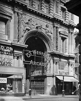
Great Western Arcade Birmingham, 1941 a42_00436GREAT WESTERN ARCADE, TEMPLE ROW, BIRMINGHAM. The entrance to the Great Western Arcade from Temple Row with two signs for ARP Shelters visible on lamp posts in the foreground
St Annes Convent Deritend a42_00473St Annes Convent, Lowe Street, Deritend, Digbeth, Birmingham. The exterior of St Annes Convent viewed from the east showing the pre Victorian building
Gloucester Lodge Battery 28948_001Gloucester Lodge Heavy Anti-Aircraft Battery, Northumberland, 2017
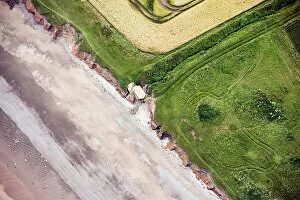
Front line 34109_050Second World War lozenge pillbox falling into the sea as a result of coastal erosion, near Holmpton, East Riding of Yorkshire, 2019
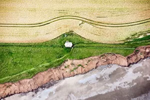
Front line 34109_047Second World War pillbox at risk from coastal erosion, near Holmpton, East Riding of Yorkshire, 2019
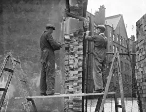
Repairing Wedmore Estate P_H00258_001Wedmore Estate, Wessex Buildings, Wedmore Street, Holloway, Islington, Greater London. Builders working on the repair of war damaged London Council Council flats, at the Wedmore Estate
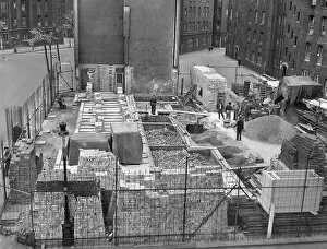
Repairing bomb damage P_H00252_004Millbank Estate, Erasmus Street, Millbank, City of Westminster, Greater London. Two workmen repairing bomb damage to London Council Council (LCC) flats on the Millbank Estate
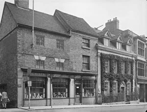
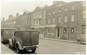
Wartime Newark OP35553Castle Gate, Newark, Newark and Sherwood, Nottinghamshire. The exterior of 25 Castle Gate viewed looking across the street from the west with the Ram Hotel
Rebuilding Lambeth OP35458St Johns Church, Waterloo Road, Lambeth, Greater London. Exterior view from the north-west of St Johns Church, showing the building surrounded by scaffolding during rebuilding following bomb damage
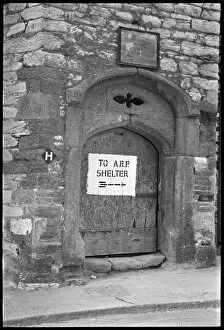
Directions to air raid shelter NBR_LEICA_VI_17_08PRYSTEN HOUSE, FINEWELL STREET, PLYMOUTH, DEVON. The main entrance to Prysten House bearing a sign to the nearest air raid shelter
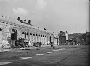
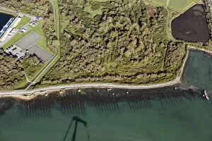
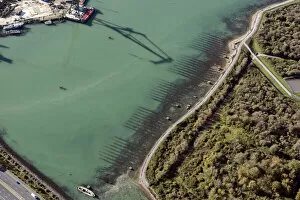
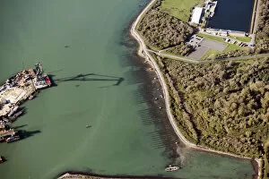
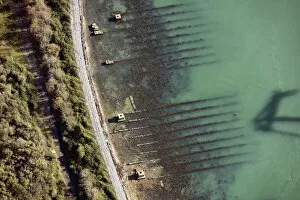
Horsea Island slipways 33943_022Second World War D Day landing craft slipways at Horsea Island, Portsmouth, Hampshire, 2020
Horsea Island slipways 33943_018Second World War D Day landing craft slipways at Horsea Island, Portsmouth, Hampshire, 2020
Horsea Island slipways 33943_016Second World War D Day landing craft slipways at Horsea Island, Portsmouth, Hampshire, 2020
Horsea Island slipways 33943_006Second World War D Day landing craft slipways at Horsea Island, Portsmouth, Hampshire, 2020