mail_outline sales@mediastorehouse.com
238 Photo Mugs
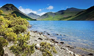
Wast Water, Lake District N061018WAST WATER, Lake District National Park, Cumbria. Shoreline of the lake with gorse bushes and mountains in the distance. View towards Scafell
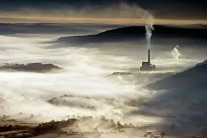
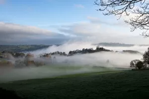
Castleton shrouded in mist N050057CASTLETON, Peak District, Derbyshire. Early morning view from Mam Tor looking down onto Castleton showing the valley shrouded in mist as a factory chimney adds smoke to the air
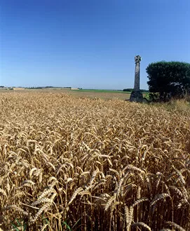
Towton Battlefield K940712TOWTON BATTLEFIELD, North Yorkshire. Site of battle of 1461. Stone cross and wheat field. Cereal grain
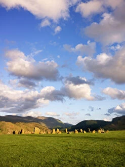
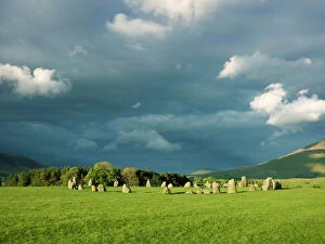
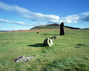
Castlerigg Stone Circle N071056CASTLERIGG STONE CIRCLE, Cumbria. General view of the stone circle showing the fells in the background
Castlerigg Stone Circle N071054CASTLERIGG STONE CIRCLE, Cumbria. Storm clouds loom over the stone circle
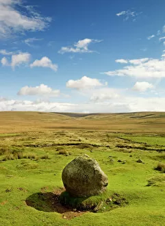
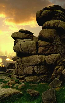
Dartmoor N071130DARTMOOR, Devon. General view of the landscape near Whiteworks Tin Mine
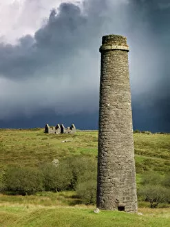
Powder Mills, Dartmoor N071127DARTMOOR, Devon. Remains of the Powder Mills at Postbridge, with chimney in the foreground, against an overcast sky
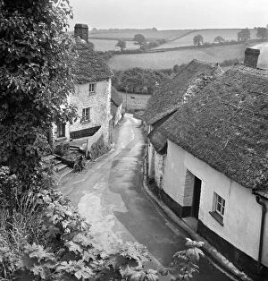
English village a079532A view from an elevated position over an unidentified village lane, showing small whitewashed and thatched cottages either side of the road and a rural landscape of fields beyond
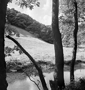
Wooded riverbank a074158A view from a wooded riverbank with tree trunks in the foreground, looking over a calm stretch of river to a field and hillside woodland
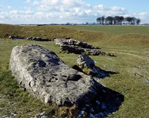
Arbor Low Stone Circle K060169ARBOR LOW STONE CIRCLE, Derbyshire. Detailed view of the neolithic monument showing the Derbyshire Dales in the background
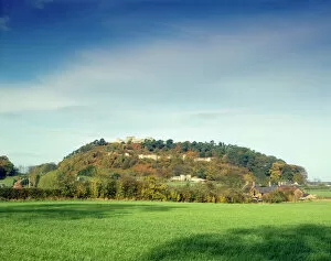
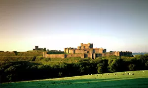
Beeston Castle J860369BEESTON CASTLE, Cheshire. View of the castle from the south
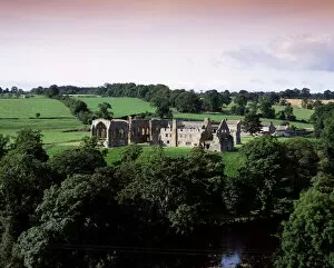
Egglestone Abbey K021397EGGLESTONE ABBEY, Durham. View from the North East showing the monastery and the River Tees
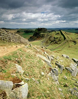
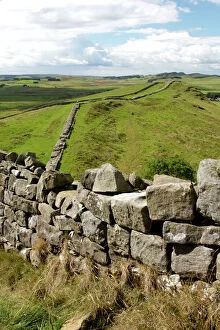
Hadrians Wall J910098HADRIANs WALL, Northumberland. The view from Cuddys Crag looking east. hadrian
Mitchells Fold Stone Circle K040514MITCHELLs FOLD STONE CIRCLE, Stapeley Hill, Shropshire. View of part of the Bronze Age stone circle
Dartmoor N040031DARTMOOR, Devon. Sun setting behind clouds at Great Staple Tor
Dover Castle J960158DOVER CASTLE, Kent. View from the North East
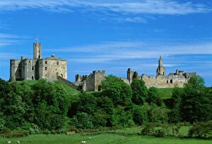
Warkworth Castle K021167WARKWORTH CASTLE, Northumberland. General view of the castle
Hadrians Wall N060591HADRIANs WALL, Northumberland. General view of the wall. hadrian
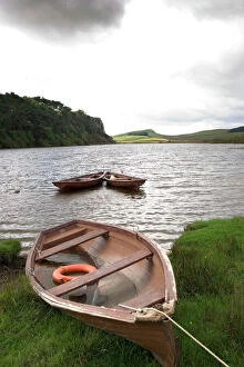
Crag Lough N060764CRAG LOUGH, Hadrians Wall, Northumberland. General view of Crag Lough with boat. hadrian
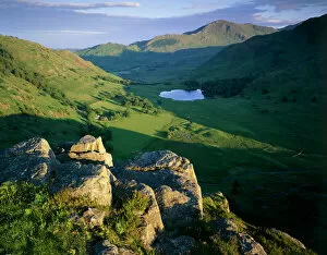
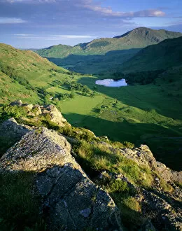
Side Pike, Lake District J060227SIDE PIKE, Lake District, Cumbria. View of Blea Tarn, Blea Moss and the Tilberthwaite Fells
Side Pike, Lake District J060230SIDE PIKE, Lake District, Cumbria. View from Side Pike showing Blea Tarn and Tilberthwaite fells in the background
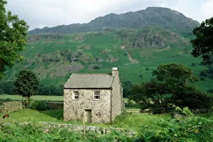
Cumbrian Fells K960908BIRD HOW, Eskdale, Cumbria. Farmhouse with the Cumbrian fells beyond
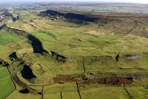
West Witton Moor 35143_024View looking south east over West Witton Moor, North Yorkshire, 2022
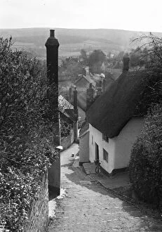
Church Steps a48_05560MINEHEAD, WEST SOMERSET. View of Church Steps leading down towards Vicarage Road, and overlooking parts of Minehead. View of Church Steps from the top, overlooking parts of Minehead
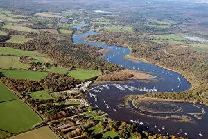
Bucklers Hard 33947_053Looking north along the Beaulieu River at Bucklers Hard, Hampshire, 2020
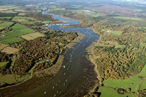
Beaulieu River 33947_024Looking north along the Beaulieu River near Exbury Gardens, Hampshire, 2020
Brede Level 33243_009Brede Level, East Sussex, 2016. The level valley floor fo teh River Brede bounded on either side by the Udimore and Icklesham ridges
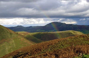
Rainbows end DP140717Long Mynd, Church Stretton, Shropshire. Landscape view looking across the hills of the Long Mynd, with one end of a rainbow in the foreground
Malham 34123_028Malham, North Yorkshire, 2019. View from the south, over the village of Malham towards Malham Cove and Malham Tarn. SD9063
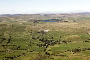
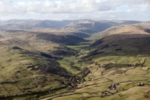
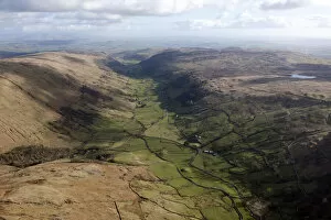
Longsleddale 28690_005Longsleddale from the north, Cumbria, 2015. NY4905
Longsleddale 28690_001Longsleddale from the south, Cumbria, 2015
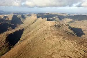
Cumbrian fells 28690_075Yoke, Ill Bell, Low Mere Greave and High Mere Greave, Cumbria, 2015. NY4305
Longsleddale 28690_010Longsleddale from the north, Cumbria, 2015. NY4805
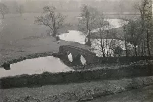
Dorothy Vernons bridge ALB93_08_078DOROTHY VERNONs BRIDGE, HADDON HALL, NETHER HADDON, DERBYSHIRE DALES, DERBYSHIRE. A view from Haddon Hall, looking down towards Dorothy Vernons bridge over the River Wye
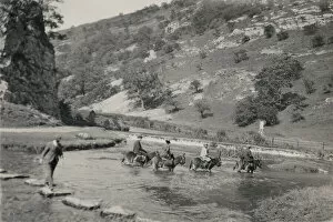
Dove Dale alb93_08_057DOVEDALE, DERBYSHIRE DALES, DERBYSHIRE. People on horseback wading across the River Dove by the stepping stones at Dovedale. Photographed between 1950 and 1964
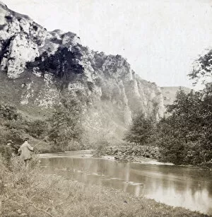
Tissington Spires CTP02_01_34TISSINGTON SPIRES, DOVEDALE, TISSINGTON AND LEA HALL, DERBYSHIRE DALES. Two anglers on the east bank of the River Dove, with Tissington Spires beyond. Photographed in the 1860s or 1870s
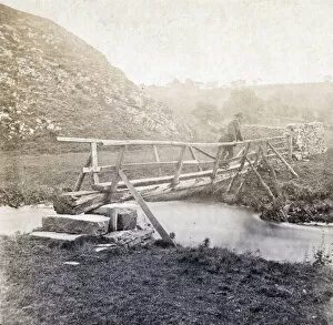
Dove Dale CTP02_01_20Dove Dale, Ilam, Staffordshire Moorlands. A man standing on a wooden footbridge over the River Dove, with Thorpe Cloud beyond, at the southern entrance to Dove Dale. Photographed in the 1860s or 1870s
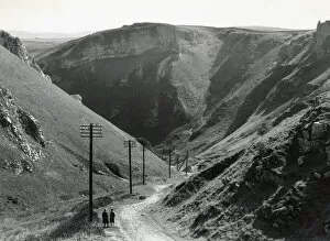
Winnats Pass DIX02_01_029WINNATS PASS, CASTLETON, HIGH PEAK, DERBYSHIRE. A couple standing at the head of Winnats Pass. In the early 1930s Winnats Pass was the site of a rally, attended by 10, 000 people
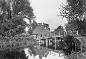
Flatford Bridge DIX02_01_026Flatford Bridge, Flatford Mill, East Bergholt, Babergh, Suffolk. Flatford Bridge and Bridge Cottage viewed from the south bank of the River Stour in the 1930s
Morning mist DP195806Snodhill Castle, Snodhill, Peterchurch, Herefordshire. Early dawn, view of castle site with mist, view from south
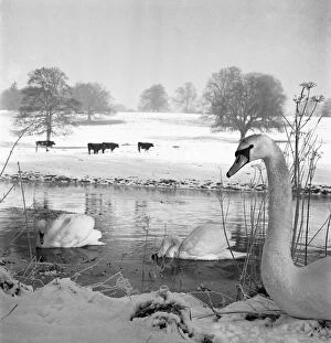
Swans a076252Swans on a river, with cattle in a snow covered field beyond. Possibly near Gaddesden. Hertfordshire. Photographed by John Gay in the 1950s or 1960s
Byall Fen DP219044Byall Fen, Manea, Fenland, Cambridgeshire. The landscape at Welches Dam, looking towards the river Delph from the north-east, September 2017
Billingham DP143513Billingham, Stockton on Tees. Industrial landscape with farmland in the foreground. Aldous Huxley was inspired to write Brave New World after visiting Billingham
Elephant grass in snow N100016Snowfall covers a biocrop in Somerset. Elephant grass is used for biofuel and thatching
Offas Dyke, Herefordshire N090410OFFAs DYKE, Llanfair Hill, Herefordshire. General view, with sheep
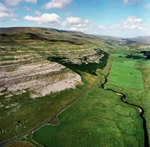
Yorkshire Dales EAW603550KELD HEAD SCAR, North Yorkshire. Aerial photograph of Kingsdale, near Thornton Force in the Yorkshire Dales. The cliffs reveal the Great Scar Limestone
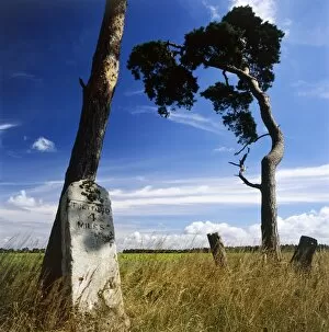
Milestone K022126LANDSCAPE NEAR THETFORD, Norfolk. View of milestone inscribed " Thetford 4 Miles" and tree
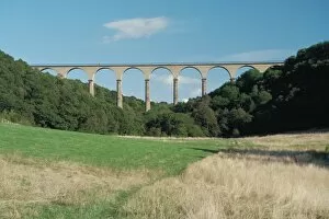
Hownes Gill Viaduct IoE 350551Railway viaduct, now part of Waskerley Walk, County Durham. IoE 350551