mail_outline sales@mediastorehouse.com
Choose a picture from our Rural Landscapes Collection for your Wall Art and Photo Gifts
238 items
River valleys Collection46 items
Yorkshire Dales Collection16 items
The Lake District Collection53 items
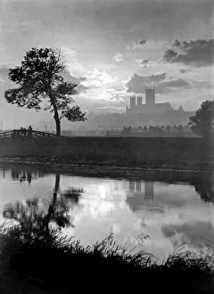
Lincoln Cathedral BB49_02570LINCOLN CATHEDRAL, Lincolnshire. A misty view with Lincoln Cathedral in the distance taken from the Swanpool. The Cathedral dates back to 1092 with later additions and remodelling
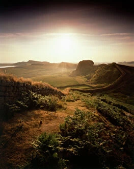
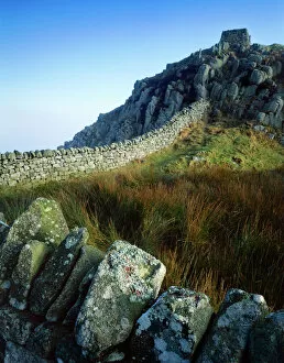
Hadrians Wall J060262HADRIANs WALL, Northumberland. View into bright sun, looking east along the Wall, half a mile west of Housesteads
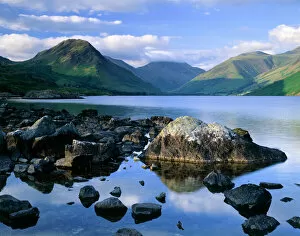
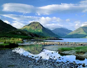
Wast Water, Lake District J060228WAST WATER, Lake District, Cumbria. Showing the fell of Yew Barrow in the distance
Wast Water, Lake District J060226WAST WATER, Lake District, Cumbria. A view over Wast Water showing the fell of Yew Barrow in the distance
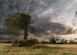
The Royal Oak and Boscobel House N090358BOSCOBEL HOUSE, Brewood, Staffordshire. The Royal Oak and Boscobel House with dramatic sky
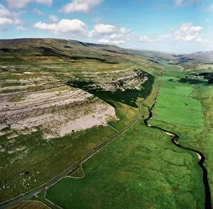
Yorkshire Dales EAW603550KELD HEAD SCAR, North Yorkshire. Aerial photograph of Kingsdale, near Thornton Force in the Yorkshire Dales. The cliffs reveal the Great Scar Limestone
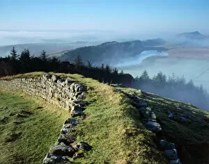
Hadrians Wall : Cuddys Crags J080003HADRIANs WALL, Northumberland. Cuddys Crags, near turret 37A. The morning sun breaks through to illuminate the lichens and grass around the crag. hadrian
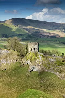
Peveril Castle DP175579Peveril Castle, Market Place, Castleton, Derbyshire. Keep and Cavedale with Iron Age hillfort, Mam Tor, beyond. View from east
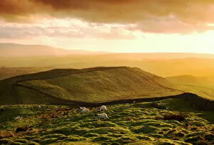
Hadrians Wall N070307HADRIANs WALL, Northumberland. View looking west from Shield on the Wall. Sheep grazing at sunset. hadrian
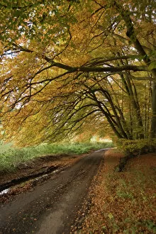
Country lane N080937Autumn leaves cover a rural road in Oxfordshire
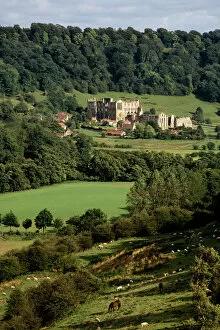
Rievaulx Abbey N050068RIEVAULX ABBEY, North Yorkshire. General view of the abbey showing its picturesque countryside landscape
Hardknott Roman Fort EAW589036HARDKNOTT, Cumbria. Aerial photograph showing the well-placed Roman fort on a promontory overlooking the Lake District (NGR: NY218015). Aerofilms Collection (see Links)
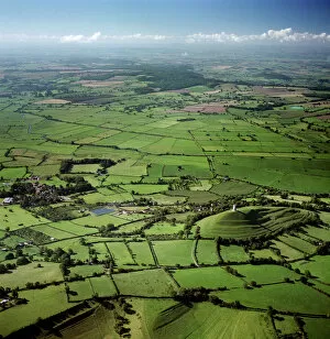
Glastonbury Tor and surrounding countryside 23697_05GLASTONBURY TOR, Somerset. Aerial view of the tor and surrounding countryside, reputedly the Isle of Avalon
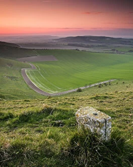
South Downs waymarker N071744SOUTH DOWNS, East Sussex. Waymarker along downland path
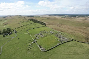
Housesteads Roman Fort and surrounding countryside N061001HADRIANs WALL: HOUSESTEADS FORT, Northumberland. Aerial view of the fort with the wall heading off into the distance. hadrian
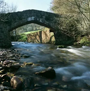
Packhorse bridge, Exmoor K020606EXMOOR, Somerset. Packhorse bridge over river near Horner, south west of Porlock
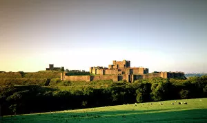
Dover Castle J960158DOVER CASTLE, Kent. View from the North East
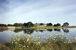
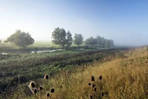
Byall Fen DP219045Byall Fen, Manea, Fenland, Cambridgeshire. The landscape at Welches Dam, looking south-west towards the river Delph from the embankment track, September 2017
Coalhouse Fort DP182466Coalhouse Fort, East Tilbury, Thurrock, Essex. The fort, looking north-west from the far bank of the water-filled ditch on its east side. Photographed in July 2016
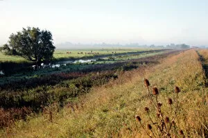
Byall Fen DP219044Byall Fen, Manea, Fenland, Cambridgeshire. The landscape at Welches Dam, looking towards the river Delph from the north-east, September 2017
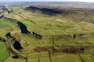
West Witton Moor 35143_024View looking south east over West Witton Moor, North Yorkshire, 2022
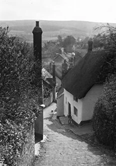
Church Steps a48_05560MINEHEAD, WEST SOMERSET. View of Church Steps leading down towards Vicarage Road, and overlooking parts of Minehead. View of Church Steps from the top, overlooking parts of Minehead
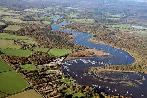
Bucklers Hard 33947_053Looking north along the Beaulieu River at Bucklers Hard, Hampshire, 2020
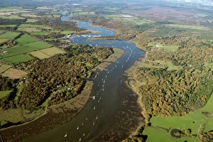
Beaulieu River 33947_024Looking north along the Beaulieu River near Exbury Gardens, Hampshire, 2020
Brede Level 33243_009Brede Level, East Sussex, 2016. The level valley floor fo teh River Brede bounded on either side by the Udimore and Icklesham ridges
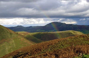
Rainbows end DP140717Long Mynd, Church Stretton, Shropshire. Landscape view looking across the hills of the Long Mynd, with one end of a rainbow in the foreground
Malham 34123_028Malham, North Yorkshire, 2019. View from the south, over the village of Malham towards Malham Cove and Malham Tarn. SD9063
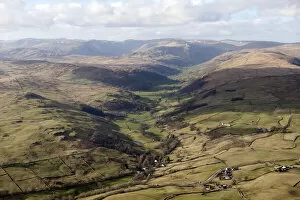
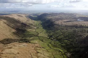
Longsleddale 28690_005Longsleddale from the north, Cumbria, 2015. NY4905
Longsleddale 28690_001Longsleddale from the south, Cumbria, 2015
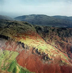
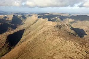
Cumbrian fells 28690_075Yoke, Ill Bell, Low Mere Greave and High Mere Greave, Cumbria, 2015. NY4305
Longsleddale 28690_010Longsleddale from the north, Cumbria, 2015. NY4805
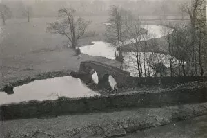
Dorothy Vernons bridge ALB93_08_078DOROTHY VERNONs BRIDGE, HADDON HALL, NETHER HADDON, DERBYSHIRE DALES, DERBYSHIRE. A view from Haddon Hall, looking down towards Dorothy Vernons bridge over the River Wye
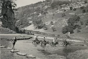
Dove Dale alb93_08_057DOVEDALE, DERBYSHIRE DALES, DERBYSHIRE. People on horseback wading across the River Dove by the stepping stones at Dovedale. Photographed between 1950 and 1964
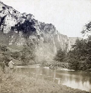
Tissington Spires CTP02_01_34TISSINGTON SPIRES, DOVEDALE, TISSINGTON AND LEA HALL, DERBYSHIRE DALES. Two anglers on the east bank of the River Dove, with Tissington Spires beyond. Photographed in the 1860s or 1870s
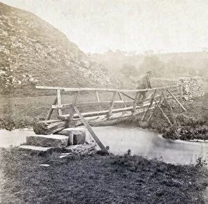
Dove Dale CTP02_01_20Dove Dale, Ilam, Staffordshire Moorlands. A man standing on a wooden footbridge over the River Dove, with Thorpe Cloud beyond, at the southern entrance to Dove Dale. Photographed in the 1860s or 1870s
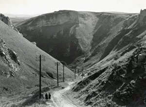
Winnats Pass DIX02_01_029WINNATS PASS, CASTLETON, HIGH PEAK, DERBYSHIRE. A couple standing at the head of Winnats Pass. In the early 1930s Winnats Pass was the site of a rally, attended by 10, 000 people
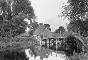
Flatford Bridge DIX02_01_026Flatford Bridge, Flatford Mill, East Bergholt, Babergh, Suffolk. Flatford Bridge and Bridge Cottage viewed from the south bank of the River Stour in the 1930s
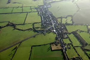
Watling Street 27371_006Hockliffe, Bedfordshire. The Roman road of Watling Street provides the principle axis, with roads to Woburn (to the left) and Leighton Buzzard (to the right)
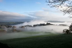
Morning mist DP195806Snodhill Castle, Snodhill, Peterchurch, Herefordshire. Early dawn, view of castle site with mist, view from south
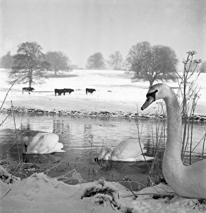
Swans a076252Swans on a river, with cattle in a snow covered field beyond. Possibly near Gaddesden. Hertfordshire. Photographed by John Gay in the 1950s or 1960s
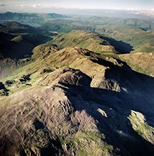
Scafell Pikes AFL03_aerofilms_ac587428SCAFELL, Cumbria. Aerial photograph showing Scafell Pikes and the Lake District. Aerofilms Collection (see Links)
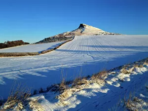
Roseberry Topping K011542ROSEBERRY TOPPING, North Yorkshire. Snow view of hill on North Yorkshire moors
Hadrians Wall J080008HADRIANs WALL, Northumberland. Hotbank Crags, near turret 37B. View from atop the wall out across the mist enshrouded Crag Lough beneath Highshields Crags. hadrian
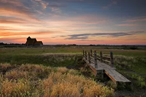
Fairfield Church, Romney Marsh N060981FAIRFIELD CHURCH, Romney Marsh, Kent. View of the footbridge looking across the meadow towards Fairfield Church at sunset
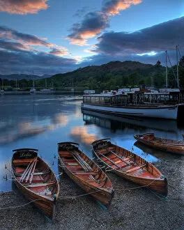
Rowing boats at Ambleside N060978LAKE WINDERMERE, Lake District National Park, Ambleside, Cumbria. Rowing boats at sunset