mail_outline sales@mediastorehouse.com
Choose a picture from our Flooding Collection for your Wall Art and Photo Gifts
48 items
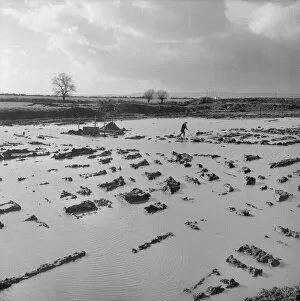
High water table JLP01_08_048996BERKELEY POWER STATION, BERKELEY, HAM AND STONE, STROUD, GLOUCESTERSHIRE. A view across a flooded area of the Berkeley Nuclear Power Station construction site
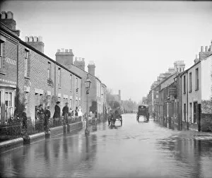
Flooded street CC73_00433Lake Street, New Hinksey, Oxford, Oxfordshire. Looking down the street during a flood with people standing outside their houses and two carts making their way down the road
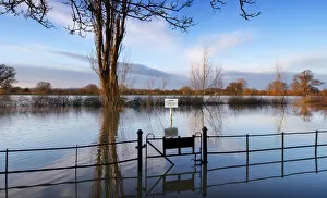
Flooded car park DP181271Oddas Chapel, Deerhurst, Gloucestershire. Car park to Oddas Chapel submerged by flooding. January 2016
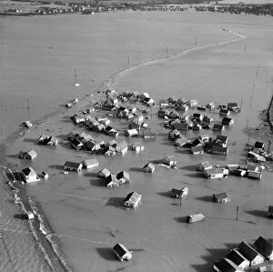
Coastal flooding 1953 EAW048271JAYWICK SANDS, Essex. Aerial photograph taken on 2nd February 1953 showing flooded housing following the great East Coast storm surge which hit the coast overnight on 31st January
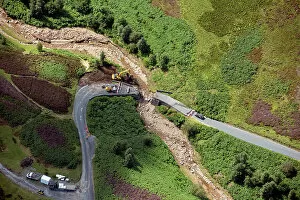
Bridge repairs 34110_035Repairs to bridge that collapsed during floods of July 2019, near Grinton Moor, North Yorkshire, 2019
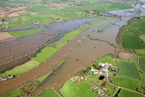
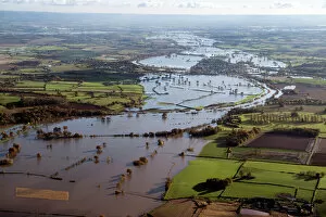
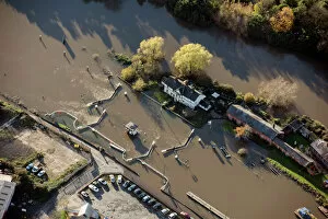
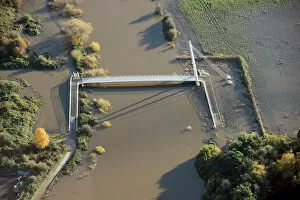
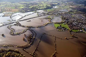
River Severn flooding 33611_023Flooding of River Severn at Deerhurst, Gloucestershire, 2018
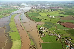
River Severn flooding 33611_047Flooding of River Severn at Deerhurst, Gloucestershire, 2018
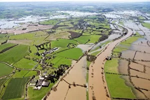
River Severn flooding 33611_043Flooding of River Severn at Deerhurst, Gloucestershire, 2018
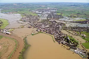
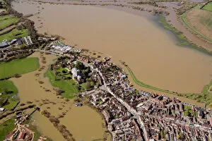
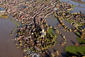
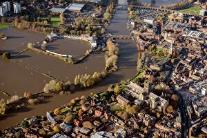
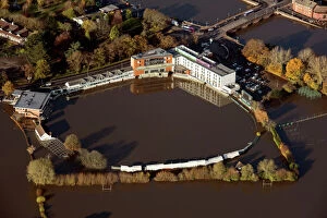
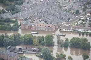
Tewkesbury flooded 33611_012The town surrounded by floodwater from the River Severn and River Avon, Tewkesbury, Gloucestershire, 2021
Tewkesbury flooded 33611_004The town and abbey surrounded by floodwater from the River Avon and RIver Severn, Tewkesbury, Gloucestershire, 2018
Tewkesbury flooded 33610_024Flooding of River Severn and RIver Avon, Tewkesbury, Gloucestershire, 2018
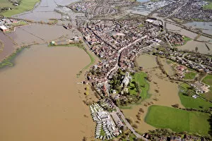
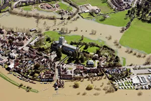
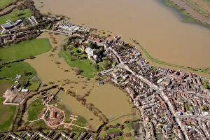
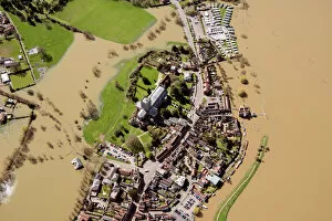
Tewkesbury flooded 33611_001Tewkesbury Abbey surrounded by floodwater from the River Avon, Tewkesbury, Gloucestershire, 2018
Tewkesbury flooded 33609_061Tewkesbury Abbey surrounded by floodwater from the River Avon, Tewkesbury, Gloucestershire, 2018
Tewkesbury flooded 33609_060Tewkesbury Abbey surrounded by floodwater from the River Avon, Tewkesbury, Gloucestershire, 2018
Tewkesbury flooded 33609_020Tewkesbury Abbey surrounded by floodwater from the River Avon, Tewkesbury, Gloucestershire, 2018
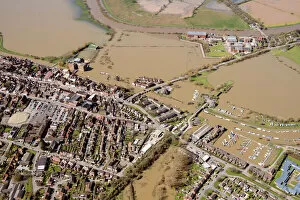
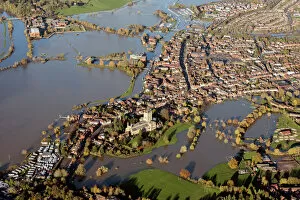
Tewkesbury underwater 33872_016Tewkesbury Abbey surrounded by floodwater, Tewkesbury, Gloucestershire, 2019. Flooding from River Avon and River Swilgate
Tewkesbury underwater 33872_014Tewkesbury Abbey surrounded by floodwater, Tewkesbury, Gloucestershire, 2019. Flooding from River Avon and River Swilgate
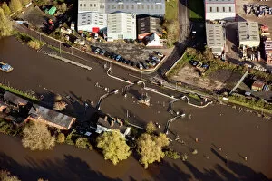
Flooding at Diglis 33871_021Flooding of River Severn at Diglis Lock near Worcester, Worcestershire, 2019
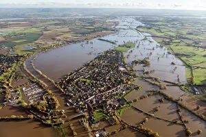
Upton upon Severn 33871_042Flooding of River Severn at Upton upon Severn, Worcestershire, 2019
Upton upon Severn 33871_024Flooding of River Severn at Upton upon Severn, Worcestershire, 2019
Flooding at Diglis 33871_017Flooding of River Severn at Diglis Lock near Worcester, Worcestershire, 2019
Flooding at Diglis 33871_019Flooding of River Severn at Diglis Bridge near Worcester, Worcestershire, 2019
Worcester underwater 33871_007Worcester County Cricket Club under flood from the River Severn with Christ and St Marys Cathedral in the foreground, Worcester, Worcestershire, 2019
Flooding of Severn and Teme 33871_016Flooding of River Severn and River Teme at Lower Wick near Worcester, Worcestershire, 2019
Worcester under water 33871_005Worcester County Cricket Club under flood water from the River Severn, Worcester, Worcestershire, 2019
Flooding 28846_001St Andrews College and moat, North yorkshire, 2016. SE5741
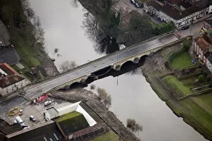
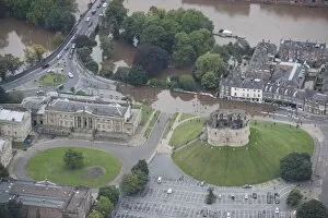
Wharfe Bridge 28846_023Tadcaster, North Yorkshire, 2016. The flood-damaged Wharfe Bridge. The central arch is showing considerable structural damage and the road is closed and blocked at both ends. SE4843
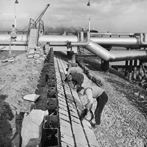
Coryton Refinery flood defences JLP01_08_020888CORYTON OIL REFINERY, THURROCK, ESSEX. Workers constructing a protective wall of precast concrete blocks at Coryton Oil Refinery, as part of extensive flood prevention work at the site
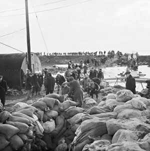
Coryton flood response 1953 JLP01_08_008092CORYTON OIL REFINERY, THURROCK, ESSEX. A chain of Laing workers carrying sandbags to breaches in the river wall after flooding on the construction site of Coryton Oil Refinery
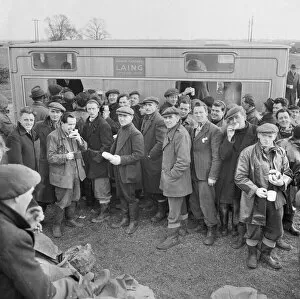
Mobile canteen at Coryton Refinery JLP01_08_008088aCORYTON OIL REFINERY, THURROCK, ESSEX. A large group of Laing workers using a mobile canteen following severe flooding on the construction site of Coryton Oil Refinery
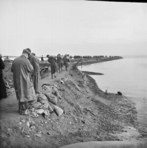
Coryton flood response 1953 JLP01_08_008085CORYTON OIL REFINERY, THURROCK, ESSEX. Laing workers collecting and transporting sandbags to repair breaches in the river wall after flooding on the construction site of Coryton Oil Refinery
Coryton flood response 1953 JLP01_08_008084CORYTON OIL REFINERY, THURROCK, ESSEX. A chain of Laing workers carrying sandbags to breaches in the river wall after flooding on the construction site of Coryton Oil Refinery
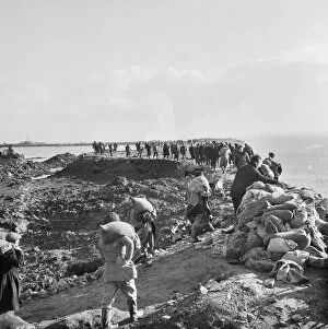
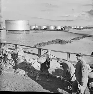
Coryton flood response 1953 JLP01_08_008073CORYTON OIL REFINERY, THURROCK, ESSEX. Flooding on the construction site of Coryton Oil Refinery, showing flood water in the tank farm area and workmen transporting sandbags in the foreground
Flooding, York 28341_050York, 27th September 2012. River flood levels peaked in York at mid-day. This photograph was taken at at half past one
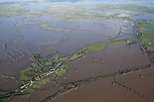
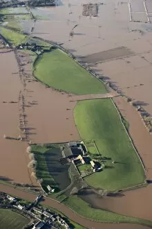
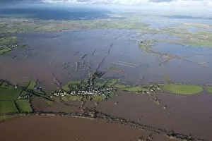
East Lyng flooding 27897_016East Lyng, Somerset. At the end of the 9th century AD King Alfred the Great established a burh, or fortified settlement, at the eastern end of the Lyng ridge
East Lyng flooding 27896_037East Lyng, Somerset Levels. Aerial view of extensive flooding, January 2014
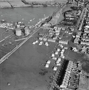
Flooding in Felixstowe EAW048298Flooding around Langer Road, Felixstowe, Suffolk. Photographed by Aerofilms Ltd in February 1953
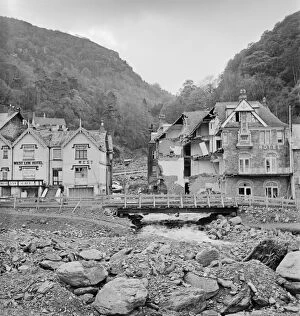
After the flood a53_10717Lyn Valley Hotel, Lynmouth, Devon. A view of the hotel after the disastrous flood of 15/16 August 1952. This is one of a series of views of Lynmouth taken by James Nelson both before
River defences JEH_22047_27Phipps Bridge, North Somerset. Flood alleviation defences alongside the Congresbury Yeo River. Photographed during M5 construction work, November 1970. Jim Hancock Collection
Flooding, York 28341_052Cliffords Tower, York, 27th September 2012. River flood levels peaked in York at mid-day. This photograph was taken at at half past one
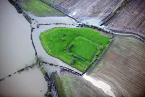
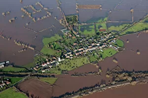
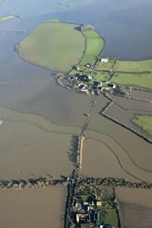
Muchelney flooding 27898_008Muchelney Abbey, Somerset Levels. Aerial view of flooding in January 2014. ST4224/44
Muchelney flooding 27898_021Muchelney Abbey, Somerset Levels. Aerial view of flooding in January 2014. ST4223/4
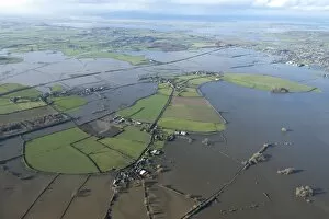
Athelney flooding 27897_022Athelney Hill, Somerset Levels. Aerial view of flooding in January 2014. ST3429/11
East Lyng flooding 27897_018East Lyng, Somerset Levels. Aerial view of extensive flooding, January 2014. ST3329/20
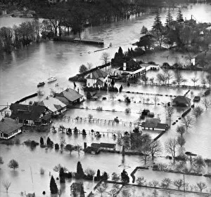
Thames floods 1947 EAW003697Boats are the best way of getting around by river, road or garden. Aerial view. Thames flooding in the Windsor area - probably Sunnymeads (SU997 749). 1947. Aerofilms Collection (see Links)
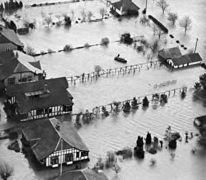
Thames floods 1947 EAW003696People in Boats. Aerial view. A boat in the flooded riverside garden. Thames flooding in the Windsor area - probably Sunnymeads (SU997 749). 1947. Aerofilms Collection (see Links)
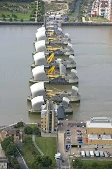
Thames Barrier, London 24455_021THAMES BARRIER, Woolwich Reach, London. Aerial view. A flood control structure built between 1974 and 1984 to help protect London from flooding
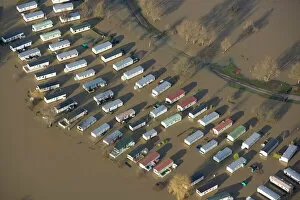
Flooding 2008 N071920Cosgrove Lodge Caravan Park, near Milton Keynes. Aerial view. After heavy rain, the fishing lakes at Cosgrove Lodge Leisure Park must have flooded