mail_outline sales@mediastorehouse.com
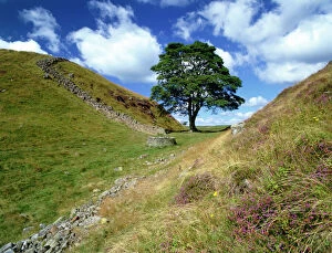
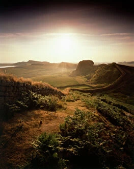
Hadrians Wall: Sycamore Gap K060462Hadrians Wall, Northumberland. View of Sycamore Gap near Steel Rigg. Used as a film set for Robin Hood Prince of Thieves
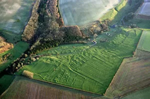
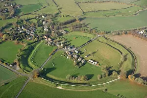
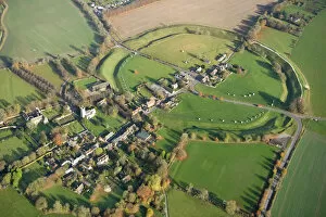
Wharram Percy Medieval Village N070612WHARRAM PERCY MEDIEVAL VILLAGE, North Yorkshire. Aerial view of the deserted medieval village. First settled in prehistoric times, Wharram flourished as a village between the 12th and 14th centuries
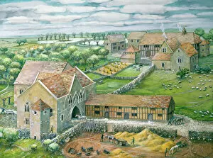
Thornholme Priory J890422THORNHOLME PRIORY, Humberside. Gatehouse and west precinct as it may have been in mid-14th century by Judith Dobie (English Heritage Graphics Team)
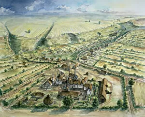
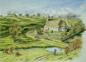
Wharram Percy Medieval Village J890256WHARRAM PERCY MEDIEVAL VILLAGE, North Yorkshire. Reconstruction drawing of the North Manor & peasant houses, tofts and crofts in the late 12th century, by Peter Dunn (English Heritage Graphics Team)
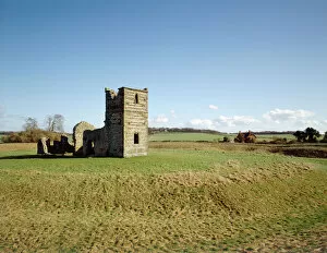
Knowlton Church and Earthworks J940538KNOWLTON CHURCH AND EARTHWORKS, Dorset. General view of the site from the West. The siting of this ruined medieval church at the centre of a Neolithic ritual henge earthwork symbolises the transition
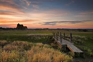
Fairfield Church, Romney Marsh N060981FAIRFIELD CHURCH, Romney Marsh, Kent. View of the footbridge looking across the meadow towards Fairfield Church at sunset
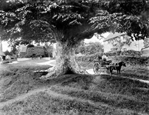
Denton village CC73_01156DENTON, Oxfordshire. A picturesque village scene, showing a pony trap with riders underneath a large old tree. There are cottages in the background. Photographed by Henry Taunt (active 1860 - 1922)
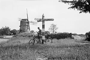
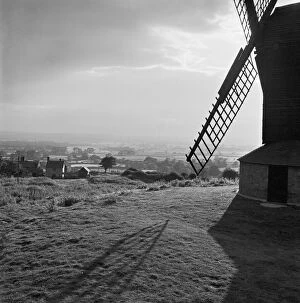
Mill Green, Broxted, Essex a81_00922MILL GREEN, Broxted, Essex. A cyclist rests his tandem against the finger post / sign post at Mill Green in Broxted. A windmill stands in the background
Hadrians Wall J080008HADRIANs WALL, Northumberland. Hotbank Crags, near turret 37B. View from atop the wall out across the mist enshrouded Crag Lough beneath Highshields Crags. hadrian
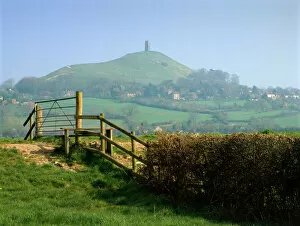
Glastonbury Tor K020561GLASTONBURY TOR, Somerset. Looking north from east across stile towards distant tor
Hadrians Wall J080005HADRIANs WALL, Northumberland. Cuddys Crags, near turret 37A. The morning light illuminates the wall with Broomlee Lough in the distance. hadrian
Meeting at a country gate CC73_01502MICKLETON, Gloucestershire. A couple posing by a gate with the spire of St Lawrences Church and surrounding countryside in the background. Photographed by Henry Taunt (active 1860-1922)
The Royal Oak and Boscobel House N090358BOSCOBEL HOUSE, Brewood, Staffordshire. The Royal Oak and Boscobel House with dramatic sky
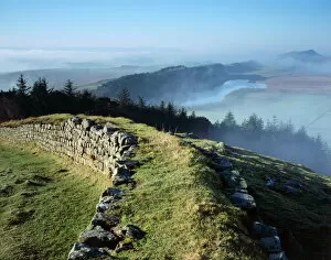
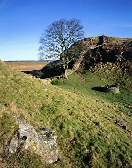
Hadrians Wall J060262HADRIANs WALL, Northumberland. View into bright sun, looking east along the Wall, half a mile west of Housesteads
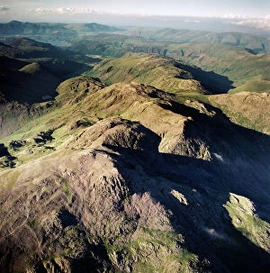
Scafell Pikes AFL03_aerofilms_ac587428SCAFELL, Cumbria. Aerial photograph showing Scafell Pikes and the Lake District. Aerofilms Collection (see Links)
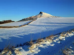
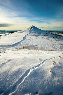
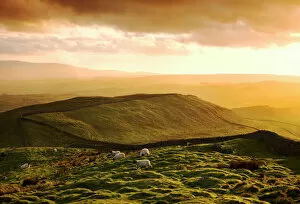
Roseberry Topping K011542ROSEBERRY TOPPING, North Yorkshire. Snow view of hill on North Yorkshire moors
Wharram Percy Medieval Village J890258WHARRAM PERCY MEDIEVAL VILLAGE, North Yorkshire. Reconstruction drawing by Peter Dunn (English Heritage Graphics Team) of the Norman church and semicircular apse & vicarage to the south
Avebury Stone Circle N071124AVEBURY STONE CIRCLE, Wiltshire. Aerial view
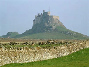
Lindisfarne Castle K011703LINDISFARNE CASTLE, Holy Island, Northumberland. View of the castle with fields in the foreground
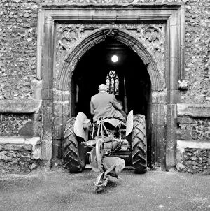
St Etheldredas Church, Hatfield a054112ST ETHELDREDAs CHURCH, Hatfield, Hertfordshire. View showing a tractor being driven through the 15th century west tower doorway of the church during preparations for the harvest festival in 1960
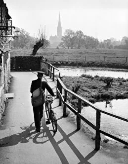
Postman, Harnham, Salisbury OP04500HARNHAM, Salisbury, Wiltshire. View from the Old Mill at Harnham, looking across the water meadows towards Salisbury Cathedral with a postman pushing his bicycle along the Town Path in
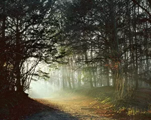
Woodland path J070052ANDREWS WOOD, Polhill, Kent. Morning light illuminates a woodland path. Rays of sunlight
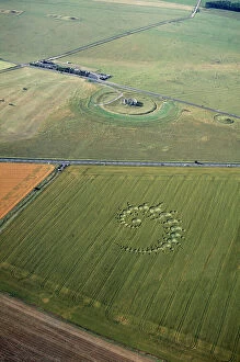
Stonehenge and crop circle N960002STONEHENGE, Wiltshire. Aerial view of Stonehenge with crop circle in the foreground
Down House Sandwalk K000185DOWN HOUSE, Kent. View of The Sandwalk looking towards the greenhouses
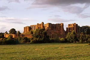
Kenilworth Castle K981291KENILWORTH CASTLE, Warwickshire. General view from the South West at sunset
Silbury Hill N060151SILBURY HILL, Avebury, Wiltshire. View from the east looking towards the snow covered mound. Part of the Avebury World Heritage Site
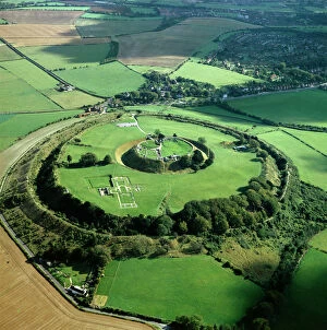
Old Sarum K000139OLD SARUM, Wiltshire. Aerial view
Hadrians Wall: Sycamore Gap J080007HADRIANs WALL, Northumberland. Steel Rigg, by Milecastle 39. The wall winds past a mature Sycamore tree, close to a well, with large foreground rock and blue sky. hadrian
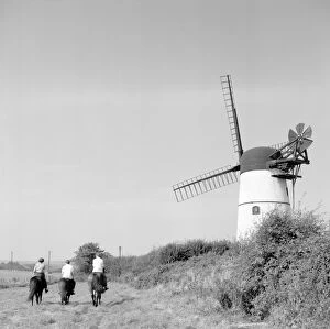
Patcham Windmill a98_05267PATCHAM, East Sussex. Three horsemen ride past Patcham tower mill on the Downs behind Brighton. Photographed by Eric de Mare (active 1945-80)
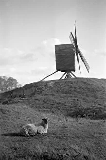
Brill Windmill, Buckinghamshire a81_02141BRILL WINDMILL, Brill, Buckinghamshire. This post mill dates to 1668, making it one of the oldest in the country. The last remaining of three mills that were once positioned on this hill
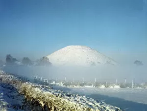
Roseberry Topping N100024ROSEBERRY TOPPING, North Yorkshire. Snow view of hill on North Yorkshire moors with animal tracks
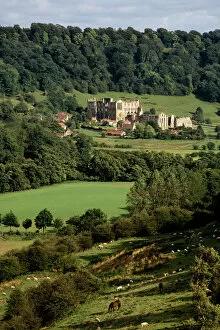
Rievaulx Abbey N050068RIEVAULX ABBEY, North Yorkshire. General view of the abbey showing its picturesque countryside landscape
Brill Windmill a081475BRILL WINDMILL, Windmill Street, Brill, Buckinghamshire. Brill Windmill overlooking a farmstead and Aylesbury Vale landscape
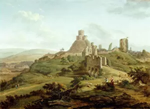
De Cort - Launceston Castle K010763LAUNCESTON CASTLE, Cornwall. " View of Launceston Castle from the South" c1770 by Hendrik Frans De Cort (1742-1810)
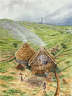
Brean Down J890031BREAN DOWN, Somerset. Reconstruction drawing of Bronze Age huts, by Peter Dunn (English Heritage Graphics Team)
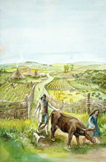
Rural landscape J910032Reconstruction drawing of imaginary rural landscape, 2000 BC by Judith Dobie, English Heritage Graphics Team. Farming
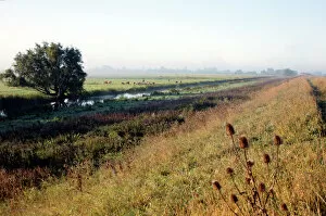
Byall Fen DP219045Byall Fen, Manea, Fenland, Cambridgeshire. The landscape at Welches Dam, looking south-west towards the river Delph from the embankment track, September 2017
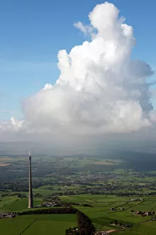
Emley Moor 28824_047Emley Moor, Kirklees. Aerial oblique view showing the Arqiva Tower transmission mast. Completed in 1971 the tower broadcasts UHF TV signals to most of Yorkshire
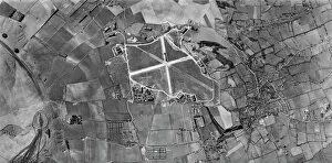
Wroughton, Wiltshire US_7PH_GP_LOC209_V_5004WROUGHTON, Wiltshire. This vertical photograph (taken in 1944 by the US Army Air Force) shows Barbury Castle hillfort, RAF Wroughton (centre), and the village of Wroughton
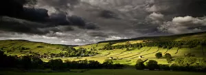
North Yorkshire landscape N100504KETTLEWELL, North Yorkshire. Panoramic view of field barns in the landscape
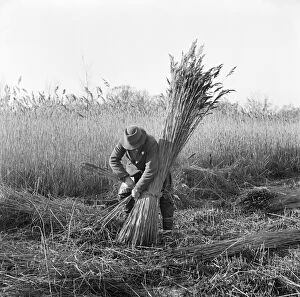
Reed cutting, Norfolk a98_07731Horning Ferry, Norfolk. Reed cutter bundling reeds on Woodbastwick Marshes. Photographed by Hallam Ashley in February 1949
Avebury Stone Circle N071125AVEBURY STONE CIRCLE, Wiltshire. Aerial view
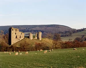
Clun Castle K060184CLUN CASTLE, near Ludlow, Shropshire. General view of the castle showing its picturesque surroundings and extensive earthworks
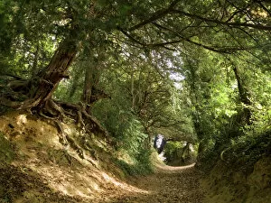
Country lane N070968GREEN LANE, Dog Hill Wood, near Ledbury, Herefordshire. A general view of the woodland landscape looking up the lane with dappled sunlight shining through the trees
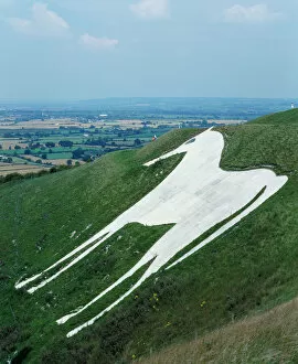
Westbury White Horse K022100BRATTON CAMP & WHITE HORSE, Westbury Hill, Wiltshire. View of the Westbury White Horse from the south west. Cut into the hillside in 1778, this replaced an older horse
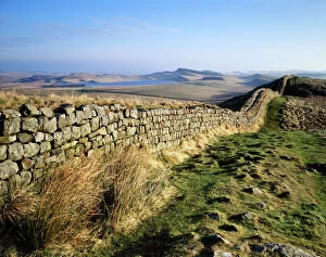
Hadrians Wall N070307HADRIANs WALL, Northumberland. View looking west from Shield on the Wall. Sheep grazing at sunset. hadrian
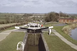
Foxton LocksStaircase flight of 10 locks on the Grand Union Canal. Foxton, Leicestershire. IoE 191334
Malvern Hills EPW005389MALVERN HILLS, Herefordshire and Worcestershire. Aerial view looking south at Upper Colwall. Jubillee Drive winds through a plantation along the western side of the ridge. Photographed in 1921