mail_outline sales@mediastorehouse.com
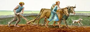
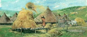
Ploughing J910038Reconstruction drawing of family ploughing during the Iron Age by Judith Dobie, English Heritage Graphics Team. Farming
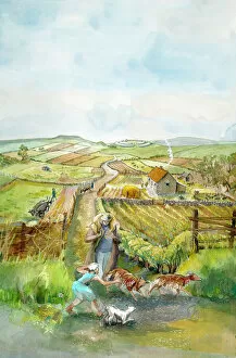
Rural landscape J910033Reconstruction drawing of imaginary rural landscape, AD 200 Romano-British by Judith Dobie, English Heritage Graphics Team. Farming
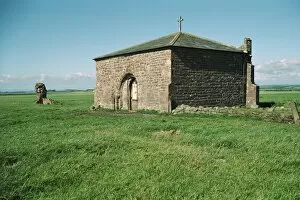
Cockersand Abbey, LancashireGrade I listed chapter house of Cockersand Abbey near Lancaster. IoE 182270
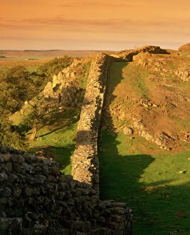
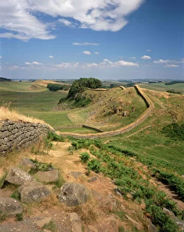
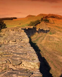
Hadrians Wall, Walltown Crags K961329HADRIANs WALL: WALLTOWN CRAGS, Northumberland. View along the wall. hadrian
Hadrians Wall J060253HADRIANs WALL, Northumberland. View along the wall looking east located half a mile west of Housesteads. hadrian
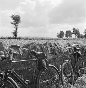
Bicycles a082787Two bicycles propped against a stone wall in Somerset. Photographed by John Gay during the 1950s
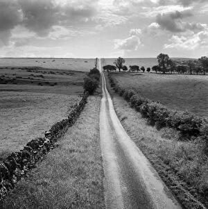
Country road a081285A long straight country road near Stamfordham, Northumberland. Photographed by John Gay during the 1950s
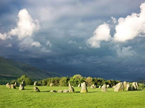
Castlerigg Stone Circle N071049CASTLERIGG STONE CIRCLE, Cumbria. Dark storm clouds loom over the stones
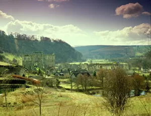
Rievaulx Abbey J870076RIEVAULX ABBEY, North Yorkshire. Winter view from the hillside
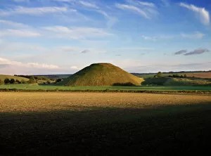
Silbury Hill N070124SILBURY HILL, Avebury, Wiltshire. View taken from the information board to the west
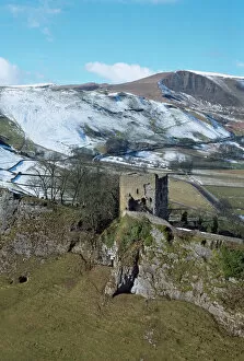
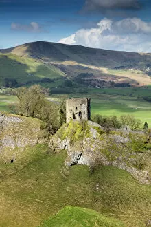
Peveril Castle K060036PEVERIL CASTLE, Castleton, Peak District, Derbyshire. A view from the South East looking across Cavedale towards the Keep with Mam Tor in the distance
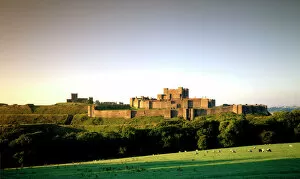
Dover Castle J960158DOVER CASTLE, Kent. View from the North East
Hadrians Wall K961267HADRIANs WALL: CAWFIELDS, Northumberland. A sunlit view along the wall. hadrian
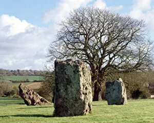
Stanton Drew Circles and Cove K971814STANTON DREW CIRCLES AND COVE, Bath & NE Somerset. View of the standing stones. Also the site of Britains largest prehistoric timber circle discovered September 1997
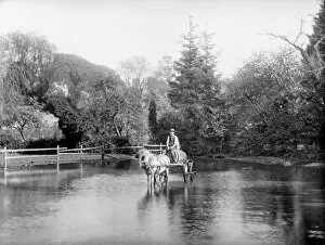
Crossing the pond CC73_01138EWELME, Oxfordshire. A young man with a horse and cart, laden with a barrel, crossing the village pond. Probably the water carrier. Photographed by Henry Taunt sometime between 1860 and 1922
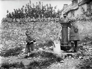
Two children collecting water at a water pump MCF01_02_0182Two children collecting water at a water pump in Cheddar, Somerset. Photographed by Katherine J. Macfee, 11th May 1907
Peveril Castle DP175579Peveril Castle, Market Place, Castleton, Derbyshire. Keep and Cavedale with Iron Age hillfort, Mam Tor, beyond. View from east
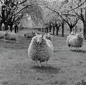
Sheep a079979Mob of sheep and an orchard in blossom. Headcorn, Kent. April 1964. Photographed by John Gay
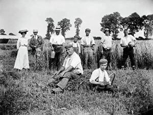
Harvest time, Lower Cadsden, Buckinghamshire a97_05316LOWER CADSDEN, Princes Risborough, Buckinghamshire. View of people in a field, including farm workers taking a break from harvesting, with a smart lady and gentleman
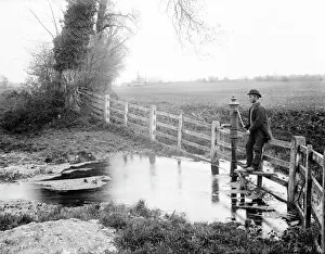
Thames Head CC73_00534THAMES HEAD, Coates, Gloucestershire. View at the source of the River Thames in the Cotswolds at Thames Head. Showing the fourth spring and man beside the pump. Photographed by Henry Taunt in 1890
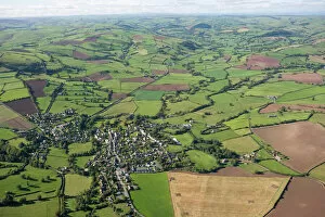
Clun 24753_041CLUN, Shropshire. Aerial view of the countryside. A small town nestling in the Shropshire Hills Area of Outstanding Natural Beauty. The remains of Clun Castle can be made out to the right of the town
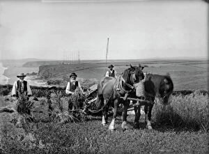
Harvesting at Trenance BB98_06122Mr Richard Harvey and workers harvesting at Trenance, Mullion, Cornwall, 1900-'1. Alfred Newton & Son. Silver gelatin glass plate negative
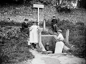
At the village water pump a97_05320BARTON HARTSHORN, Buckinghamshire. General view showing people collecting water from the village water pump. A woman is helped by a young girl while two well dressed ladies look
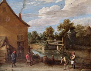
Teniers - Peasants playing Bowls N070543APSLEY HOUSE, London. " Peasants playing Bowls in front of an Inn by a River" by David TENIERS the younger (1610-90). Spanish Royal Collection. Captured at Vitoria, 1813. WM 1579-1948
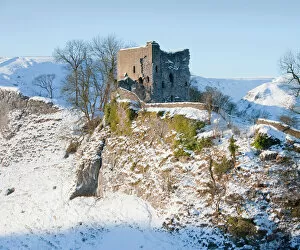
Peveril Castle N100487PEVERIL CASTLE, Derbyshire. Snow scene
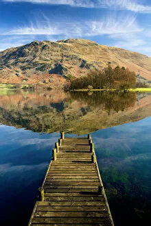
Ullswater, Lake District N100017ULLSWATER, Lake District, Cumbria. A landing stage jetty with reflection of Place Fell in the lake
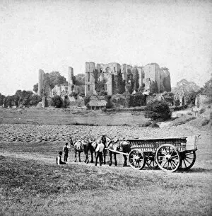
Hay cart and Kenilworth Castle BB81_02414KENILWORTH CASTLE, Warwickshire. A Victorian hay cart at rest in front of the ivy-clad remains of Kenilworth Castle. A view resonant of Turner paintings
Farm wagons, Norfolk a98_15161Freethorpe, Norfolk. These two traditional horse-drawn farm wagons would still have been in regular use when this photograph was taken. Behind, a portable elevator was used to build the haystacks
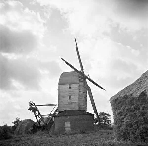
Windmill, Suffolk a98_07336Thornham Magna, Suffolk. The timber-clad post mill at Thornham Magna, with its sails, fantail and roundhouse, appears to be falling into ruin. Photographed by Hallam Ashley, November 1950
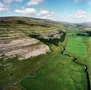
Yorkshire Dales EAW603550KELD HEAD SCAR, North Yorkshire. Aerial photograph of Kingsdale, near Thornton Force in the Yorkshire Dales. The cliffs reveal the Great Scar Limestone
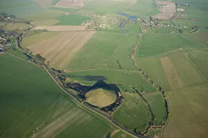
Silbury Hill and Avebury N071892SILBURY HILL, AVEBURY, Wiltshire. Aerial view with the henge and stone circle at Avebury top right
Grimspound J940464GRIMSPOUND, Dartmoor, Devon. Reconstruction drawing by Ivan Lapper showing village life. The best known of many Dartmoor prehistoric settlements, Grimspound dates from the late Bronze Age
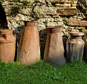
Milk churns DP068967Milk churns
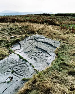
Cup and ring marked rock N030028DODDINGTON, near Berwick Upon Tweed, Northumberland. View of a cup and ring marked rock. Their purpose is a mystery, which archeologists usually describe as ritual
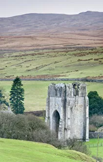
Shap Abbey N090047SHAP ABBEY, Cumbria. View of the West Tower and surrounding moorland
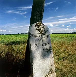
Milestone K022125LANDSCAPE NEAR THETFORD, Norfolk. Detail of milestone inscribed " Thetford 4 Miles"
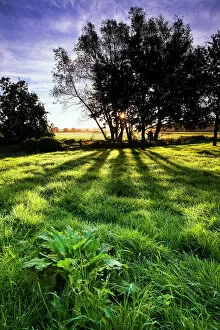
Backlit tree and meadow at sunrise N061020English countryside. Backlit trees and meadow at sunrise
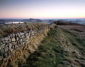
Hadrians Wall, Hotbank Crags J080009HADRIANs WALL, Northumberland. The path along Hotbank Crags at dawn, with Greenlee Lough in the distance. hadrian
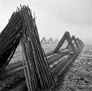
Hop poles a079959Hop poles, stacked in tent shapes, arranged in lines. Taken in Kent. Photographed by John Gay during the 1950s
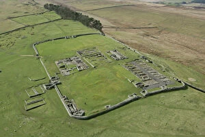
Housesteads Roman Fort N061000HADRIANs WALL: HOUSESTEADS FORT, Northumberland. Aerial view of the fort. hadrian
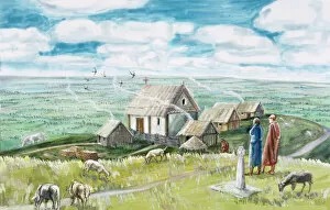
Monastic settlement, Glastonbury Tor J920411GLASTONBURY TOR, Somerset. Anglo-Saxon monastic settlement. Reconstruction drawing by Judith Dobie (English Heritage Graphics Team). Anglo Saxon
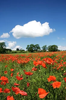
Poppy field N071385NORTHUMBERLAND COUNTRYSIDE. View of poppies in field with white cloud in the sky
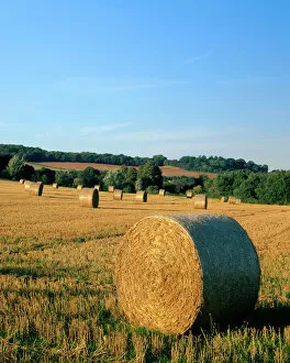
Haywheels J070054KENT COUNTRYSIDE, View of hay bails / haywheels in a field near Farningham
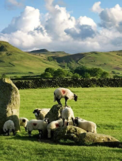
Castlerigg Stone Circle N071052CASTLERIGG STONE CIRCLE, Cumbria. Sheep climbing on the historic standing stones
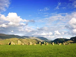
Castlerigg Stone Circle N071051CASTLERIGG STONE CIRCLE, Cumbria. General view of the stones showing the fells in the distance
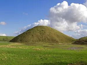
Silbury Hill N071113SILBURY HILL, Avebury, Wiltshire. General view of Silbury Hill
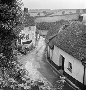
English village a079532A view from an elevated position over an unidentified village lane, showing small whitewashed and thatched cottages either side of the road and a rural landscape of fields beyond
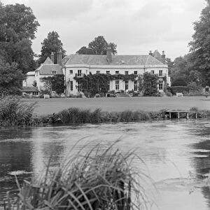
Longparish House, Hampshire a067267LONGPARISH HOUSE, Longparish, Hampshire. A view looking across the River Test towards the country house. Photographed 1980 by John Gay