mail_outline sales@mediastorehouse.com
Choose a picture from our Maritime Collection for your Wall Art and Photo Gifts
14 items
Wrecks Collection17 items
Lighthouses Collection35 items
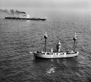
Mersey Bar Lightship EAW008656The Alarm (Mersey Bar Lightship) and SS Collegian, Liverpool Bay, Wirral
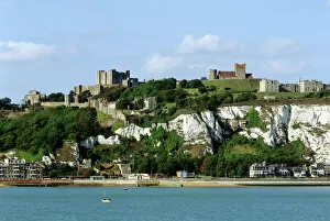
Dover Castle K970010DOVER CASTLE, Kent. View of the cliff, castle, lighthouse and church from the sea
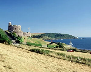
St Mawes Castle J870402ST MAWES CASTLE, Cornwall. View of the castle with the lighthouse of St. Anthonys Head in the distance
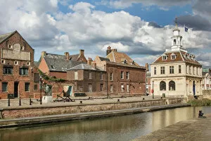
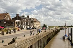
Purfleet Quay Kings Lynn DP217310Kings Lynn, Norfolk. Custon House and Purfleet Quay from south west
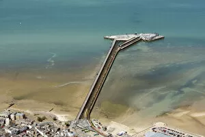
Ryde Pier 33888_044Ryde Pier, Isle of Wight, 2020
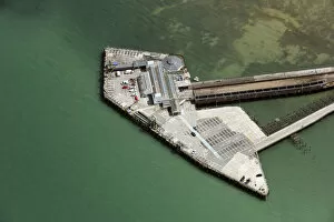
Ryde Pier Head 33888_017Ryde Pier Head railway station and ferry terminal, Isle of Wight, 2020
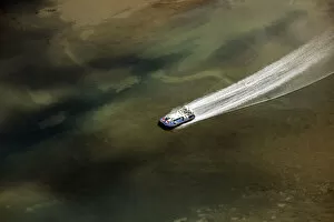
Hovercraft 33888_015Ryde Hovercraft at sea, Isle of Wight, 2020
Shipwreck 28909_001A shipwreck outside Blyth harbour, Northumberland, 2016. NZ3280
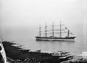
The Preussen DAR_P01The German schooner The Preussen, run aground in St Margarets Bay, Kent. The Preussen was the largest sailing vessel in the world at the time of her loss in November 1910
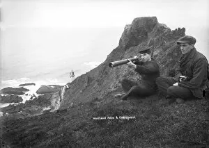
Coastguard BB98_10715A coastguard, with telescope, keeping watch near Hartland Point lighthouse, Devon. Alfred Newton and Son 1896-1920
South Quay Kings Lynn DP217307Kings Lynn, Norfolk. South Quay from north west
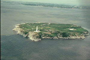
Flat Holm JEH_22025_09Flat Holm, Bristol Channel. The small island of Flat Holm lies five miles off Weston-super-Mare in the centre of the Bristol Channel